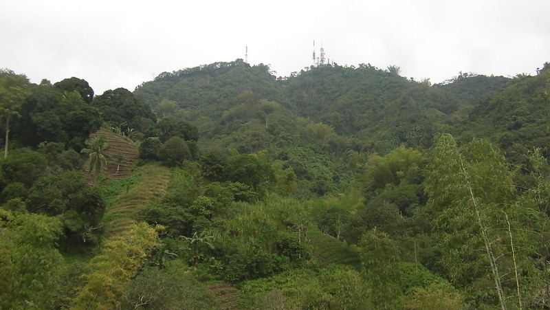
If you approach Cebu by boat, if you cross the first Mactan-Mandaue Bridge, or if you stand on the Mactan island coastline facing mainland Cebu, you will probably notice a long mountain range that seems to protect the cityscape before it. This mountain range, which is around 25 kilometers long, is called Babag Range. And on Babag Range, the most conspicuous feature is the array of communication towers that stand on its highest point. That point is called Mt. Babag.
Mt. Babag is one of the most popular yet challenging hiking destinations in Cebu. The backyard of a prestigious bushcrafting group called Camp Red, it is easily accessible from either Sitio Napo at the lowlands of Baranggay Guadalupe or at Veteran’s Drive high up in Upper Busay. Most mountaineers choose the ascent to Mt. Babag from Napo due to the ease of accessibility, low fare, and challenge of the climb.
Mt. Babag’s extreme steepness makes it an ideal mountain for practice climbs to prepare for major climbs. Nestled under her care are Cebu’s secrets; rocky rivers, pristine waterfalls, and dense forests that are carefully tucked away from view. Sharing these natural wonders are small communities of humans who are involved in farming and logging. Sweetie and her friends have long planned an adventure for their climbing team’s anniversary. That day, January 27, 2013, we were supposed to climb Mt. Kapayas in Catmon. However, uncontrollable circumstances led us to cancel the Mt. Kapayas climb. Instead, we decided to climb the knee-breaking, bone-crunching, body fluid-draining 752 MASL Mt. Babag.
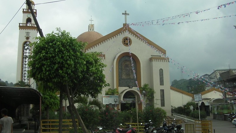
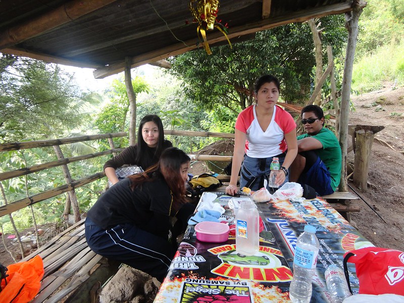
We met around 8AM at the magnificent Guadalupe Church. The solemn sound of mass that blends together with the chatter of people outside selling candles and other wares is extremely soothing to the ear and makes you happy on an overcast Sunday morning.
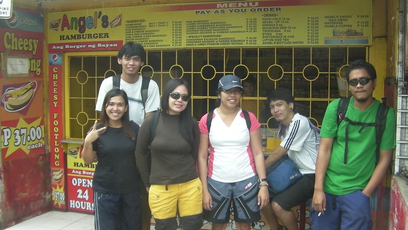
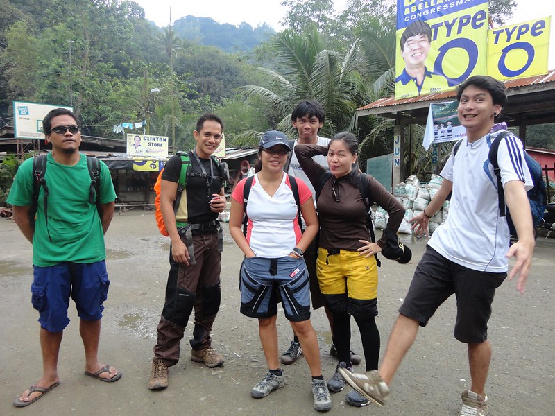
Here’s the group at Angel’s Burger, all ready and packed for a great adventure. Earlier during the week, we told them of a nice waterfall in Guadalupe, which we plan to visit on our way to Mt. Babag’s summit.
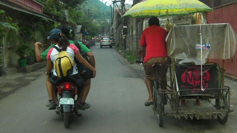
Right beside the Guadalupe church are a group of habal-habal drivers who are ready to take you to Napo. Mt. Babag is simply so popular that you don’t have to say anything where you want to go! When drivers see you in mountaineering attire, they already know you’re going to Sitio Napo.
After 15 minutes on a habal-habal, we arrived at Sitio Napo, our jump-off point, which, we believe is Tomas Osmeña territory. Hehe! We bought a few provisions here.
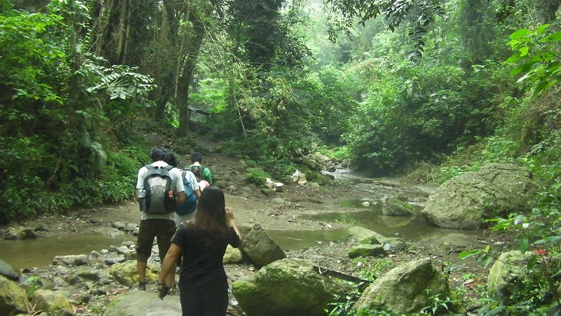
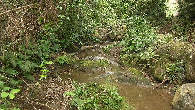
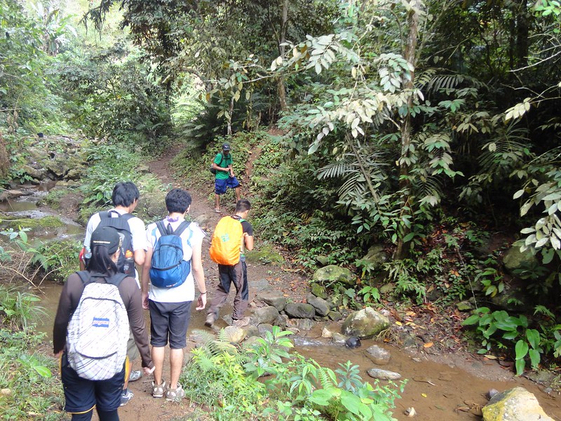
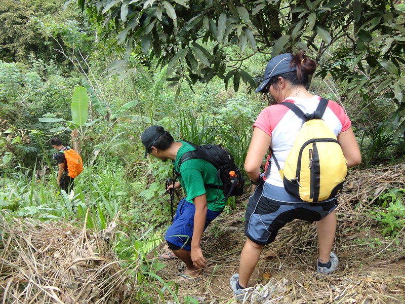
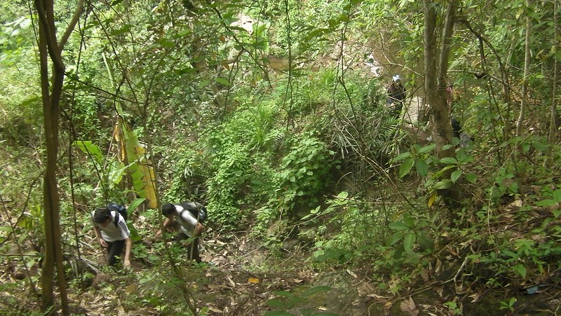
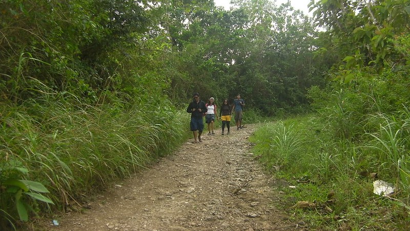
After a short prayer, we started the trek. Crossing this shallow river, called Sapangdaku, is the first hurdle.
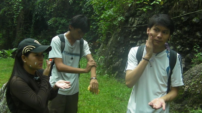
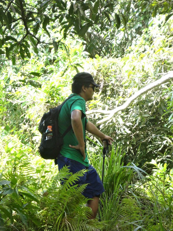
And they applied makeup. Of course, not! That’s sunscreen. You don’t want your face to be burned to a crisp, do you? Sun protection is important when you’re up in the mountains. That’s because you often won’t feel the sun burning your skin as much as when you’re in the city due to the high altitude, cool air, and cozy canopy.
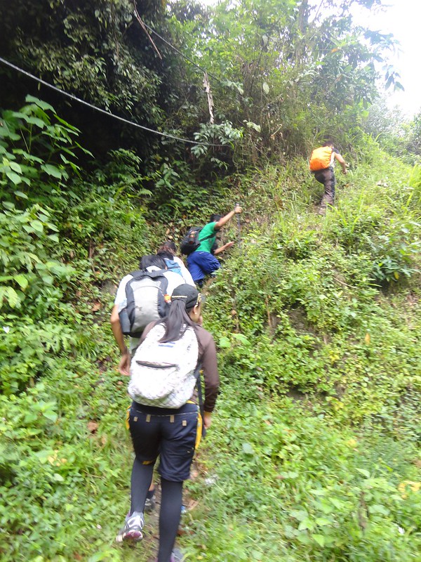
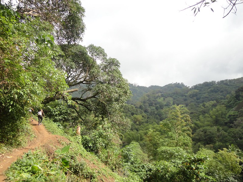
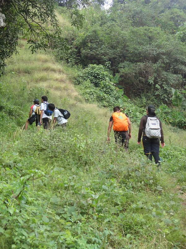
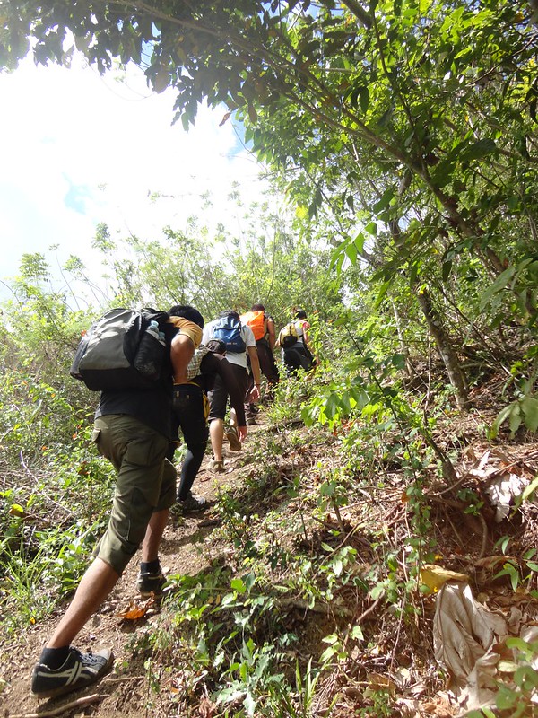
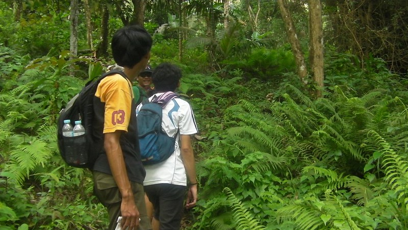
After putting on sunscreen, the team started to make their way up. The entrance immediately punches you in the face with a steep climb.
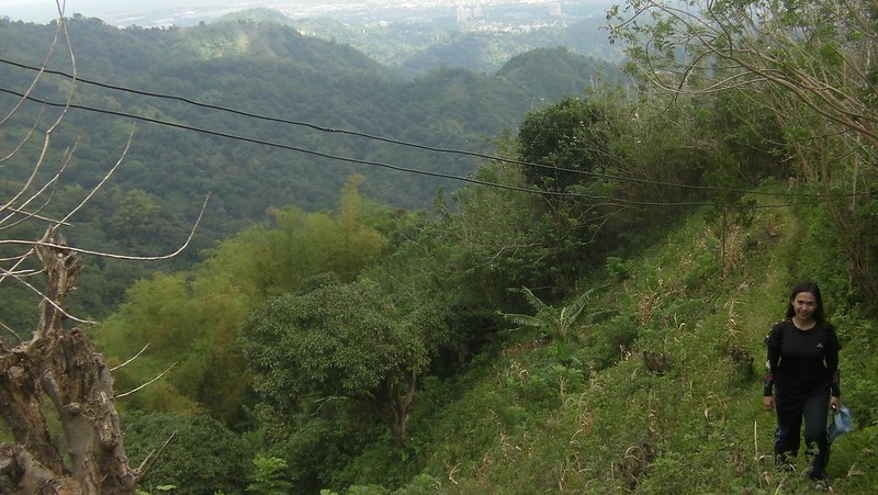
The Napo main trail follows rolling terrain, mostly gentle ascents like this, by the edge of a mountain.
The Sapangdaku River flows below the main trail. During rainy season when the water is high, kids usually prowl the river and hunt for various fauna such as crabs, shrimps, and catfish.
Verdant wooded areas that conceal signs of human habitation dot the area. It’s actually refreshing to know that places like these still exist.
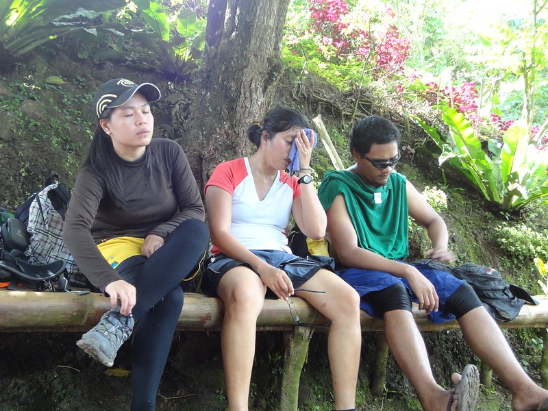
Whew! What a sweet rest spot. The sun broke suddenly through the clouds, which means, the temperature began to rise. And being almost at the bottom of Babag Range and sheltered from cool winds on both sides, the temperature becomes uncomfortably hot.
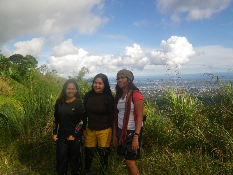
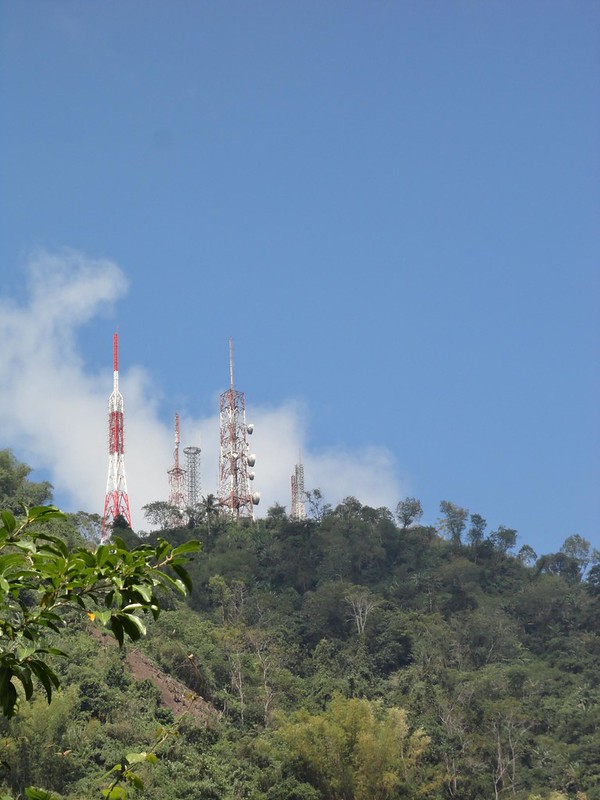
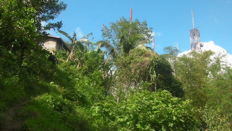
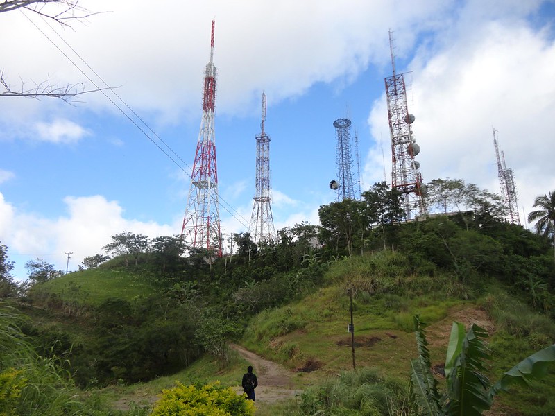
Do you see those communication towers? That’s the summit of Mt. Babag, our destination. It looks so near…
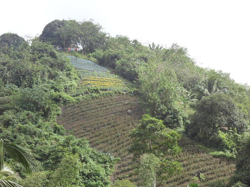
The cool weather and the fertile soil make Babag Range an ideal place for planting flowers. Here’s a flower farm up the slope.
After an hour of walking, we reached Lower Kahugan Spring. Here, the trail splits into two. The left one is the Kahugan Trail, the main route used by farmers to bring their produce to Guadalupe. The right one is Busan Trail, which leads right up to the summit.
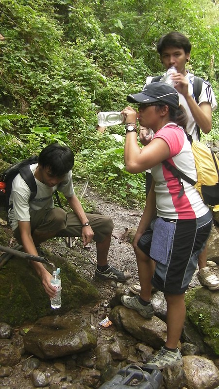
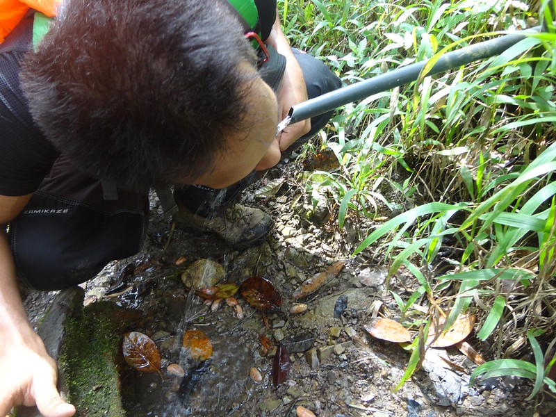
That’s the Lower Kahugan Spring which is always trickling with fresh, clear water. Following this river takes you to the lowest tier of the secret Busay Lut-od, the waterfalls I was talking about earlier.
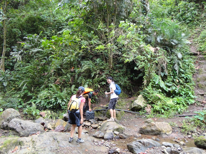
Locals managed to rig a pipe to bring fresh spring water here. This also serves as our water source. Refreshing spring water tastes better than bottled water. It is also full of mineral salts that are beneficial for the body.
After filling up our water bottles, we decided to visit Busay Lut-od waterfalls first. To go its third tier, we followed the wider, longer, and easier Kahugan trail, which is actually a gentle but grueling ascent all the way.
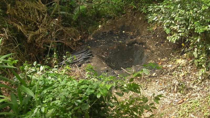
That’s a charcoal pit. Dried wood is placed inside the pit, lit, and covered with soil. Small openings allow oxygen to go inside the covered pit. Sometime later, the pit is dug, and the resulting charcoal is gathered.
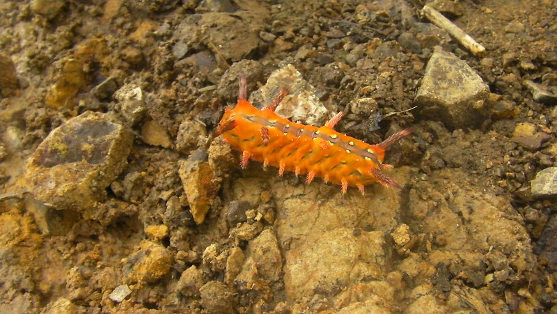
Along the way, we found this zazzy little guy trudging across the trail.
We found the secretive trail that leads to the third tier of Busay Lut-od. Descending here needs extra care because the ground is made up of loose soil. Translation? It’s slippery and you might lose your footing. Consequences? You may fall face down, or you may fall to the side of a deep ravine.
Struggling to stabilize footing becomes a challenge.
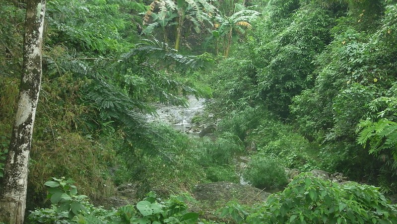
However, don’t worry. The reward at the end of the 5-minute descent is worthwhile. Behold the third tier of the secret Busay Lut-od waterfalls. It didn’t rain for the past few weeks, so the waterfall was relatively “dry.” On rainy days however, this becomes a powerful monster.
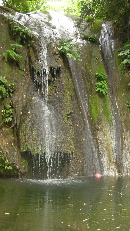
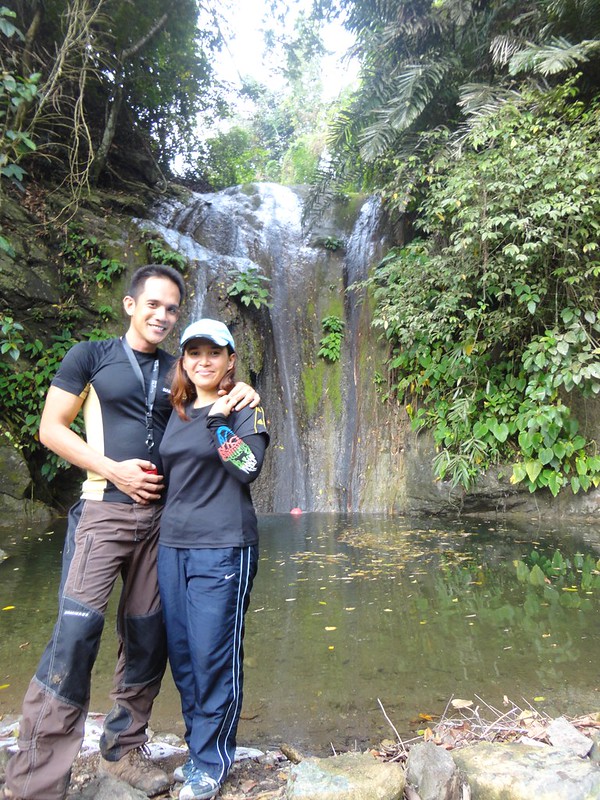
Adrenaline Romance sweeties take a customary pose. Yes, you can swim in that lagoon.
After taking a few photos, it’s time to go back to Kahugan Trail. Going up is a whole lot easier than descending.
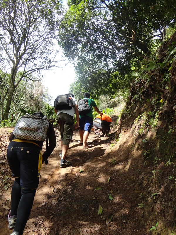
Going back to Lower Kahugan Spring took around half an hour. After resting and refilling our water bottles, it’s time for the endless assault to Mt. Babag’s summit using the Busan Trail. It’s torture time!
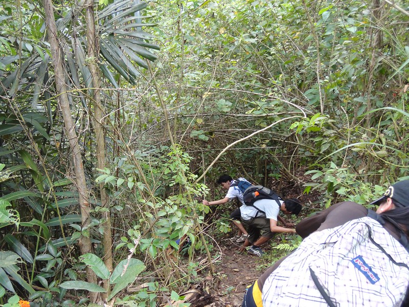
Busan Trail almost does not offer any relaxing descents or level trails. Even though the mountain is only at 752 MASL, the steepness of this trail can definitely make any climb challenging.
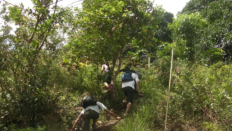
I’ve climbed this mountain a lot of times, but it’s sheer steepness never fails to literally take my breath away and squeeze the sweat out of me. This photo poignantly shows a mountaineer’s dilemma when climbing this powerful mountain.
That’s Wendell, our cool, camera-shy guide.
Is it still far? No, it’s not. Just 2 more hours of merciless ascent.
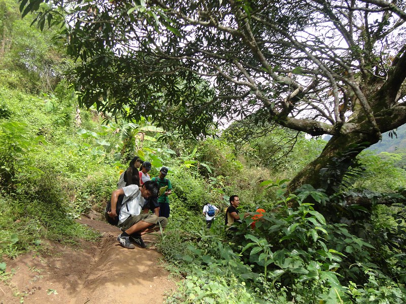
Along the way, we passed by small mountain communities such as these. We admire the strength and perseverance of these people. We climb mountains for recreational purposes, but these people do it every day to make a living.
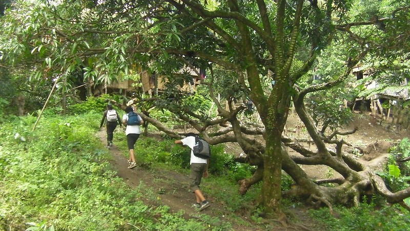
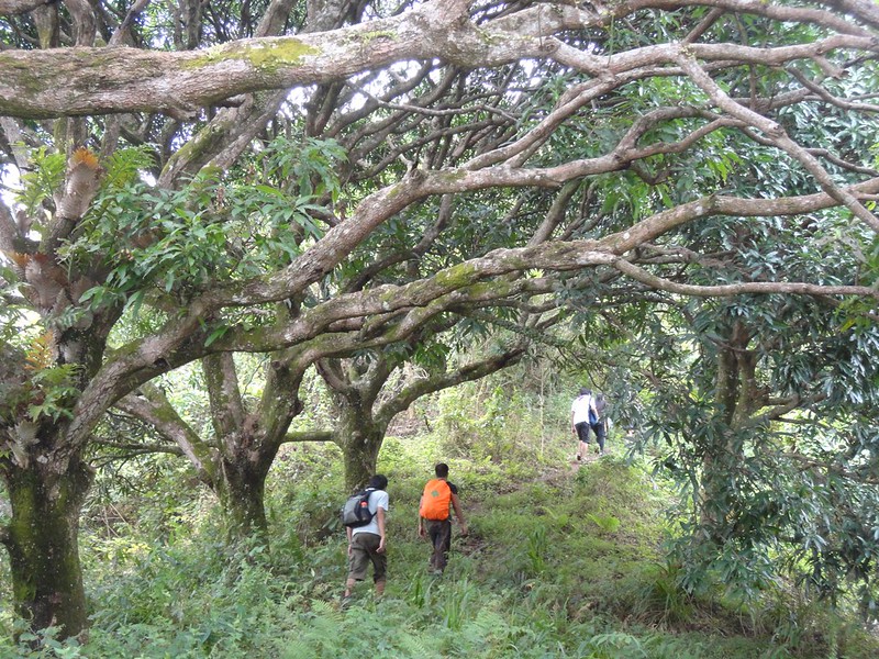
These LOTR trees make it seem that we’re trekking in Pandora, the fictional world featured in the movie Avatar.
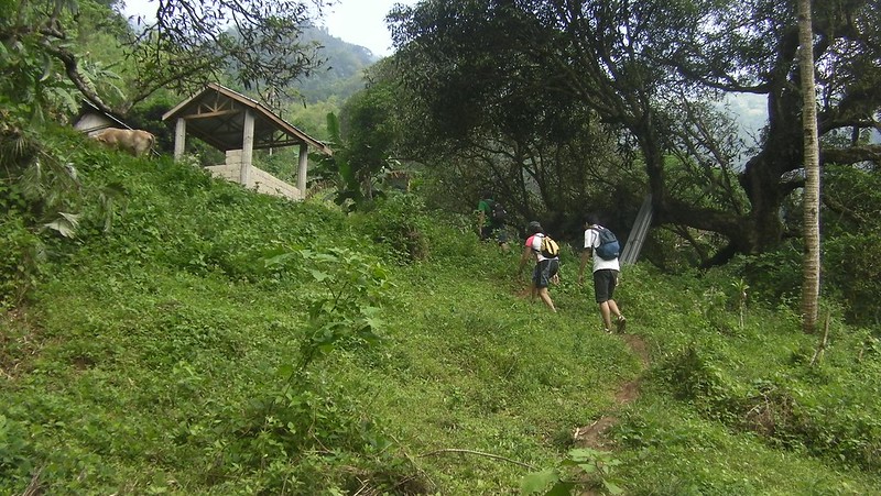
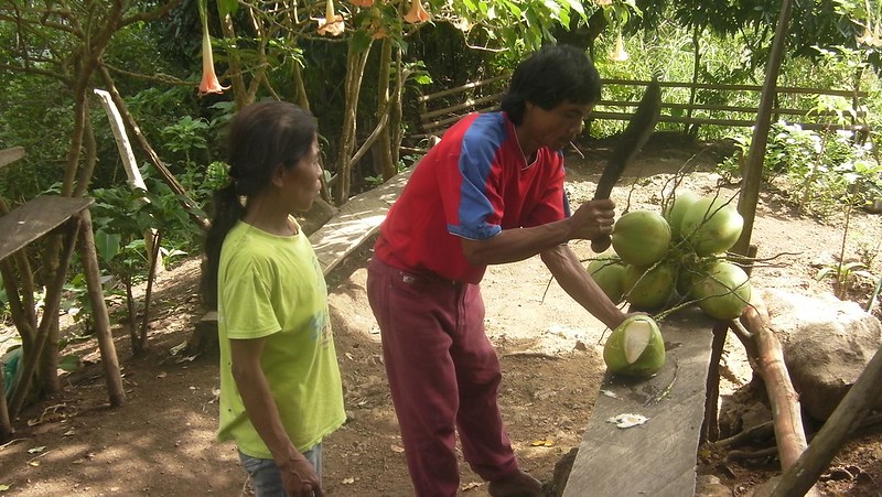
Around 12 noon, we stopped by the Roble homestead, a rest stop and a mountaineering landmark in Mt. Babag. This is where mountaineers usually take their lunch and rest before continuing the assault.
The Robles have erected this cool shed for mountaineers and bushcrafters who regularly ply this area. This is where adventurers take their lunch.
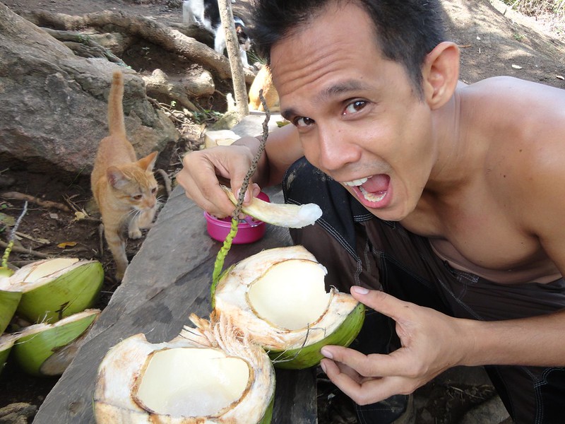
One of the must-trys when climbing Mt. Babag is the sweet taste of young coconuts. They have the best coconuts in the world with really sweet water and very soft, almost gelatin-like meat. You can ask the Robles to get coconuts for you at a reasonable price.
Coconuts are full, nutritious meals in themselves. The meat is packed with proteins, and the water is chock full of ions and electrolytes. We call coconuts Mother Nature’s Gatorade. Oh, never mind the cat.
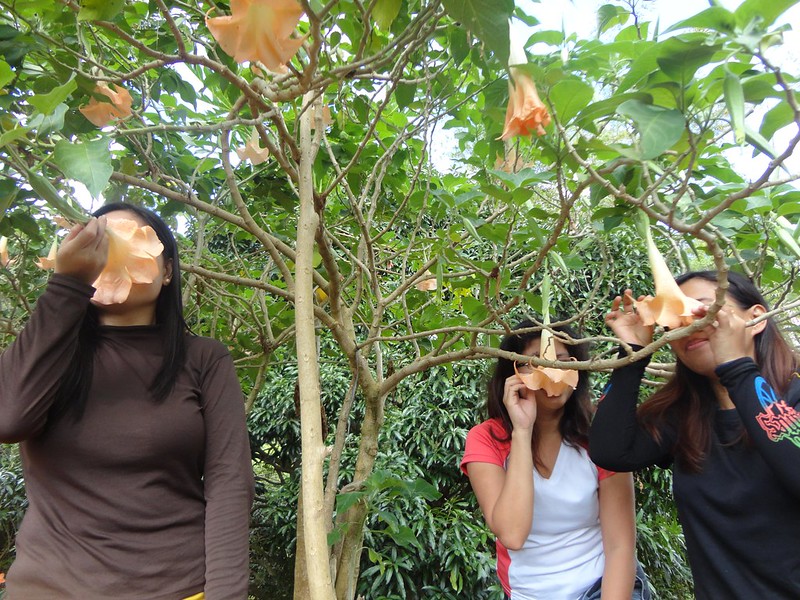
I guess this is a girl thing…smelling upside-down flowers.
That’s the summit as seen from the Roble homestead. Yes, it looks deceptively near.
After a half an hour of rest, we said goodbye and thanked the Robles before proceeding up the trail. Now, this was an extremely uncomfortable ascent because the sun was bombarding us with its full power, and there was no shade.
Another highlight of Mt. Babag is traversing this narrow trail. One step to the left will send a mountaineer careening down a sloping ravine.
Hikers feel relieved and refreshed when they enter this section of the mountain where the forest is thick and shady.
Tucked deep inside this forest is this pipe which continuously channels water. This is the trail’s second water source.
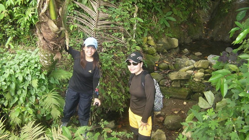
Check out that pond behind Sweetie and Faye. That’s the source of the water.
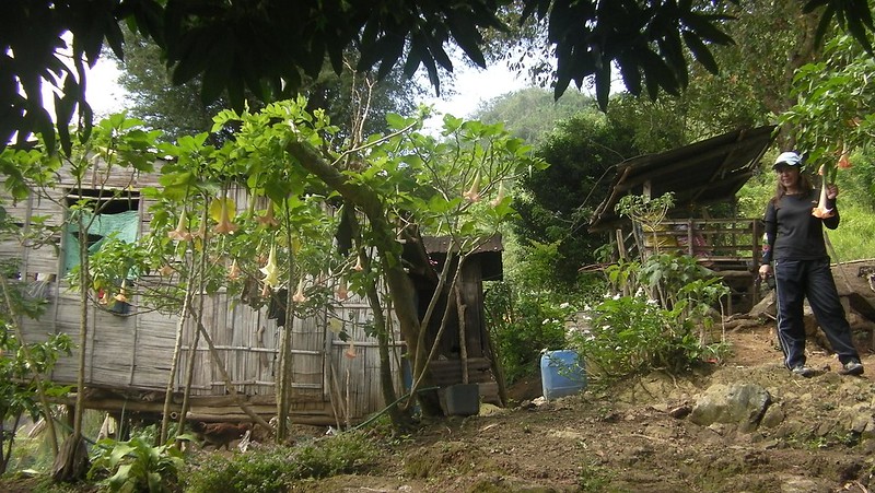
We’re almost there, after almost three hours of grueling ascent with little shade. If you see that house, it means your ordeal is almost over.
And when mountaineers reach this house, they can finally forget about the world. All they want to do is just to lie down, curl up, take off the shoes, and mercifully slip into a long moment of rest. This photo says it all.
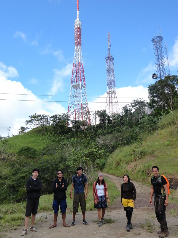
After resting for half an hour, it was time to visit the peak. The true peak of Mt. Babag rests inside that tower array. Unfortunately, that is private property, which means, no trespassers allowed. Thus, mountaineers usually settle at a small ledge just beside the tower array.
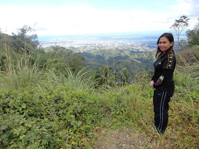
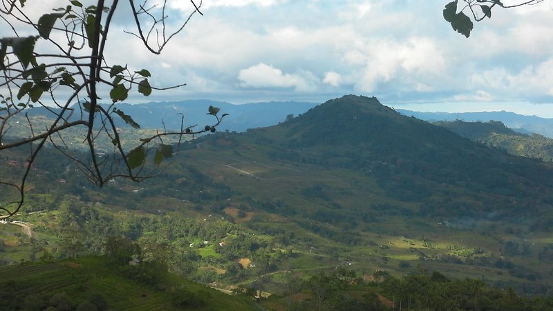
There’s the viewing ledge which offers a breathtaking view of magnificent and progressive Cebu City.
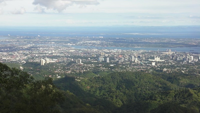
That’s the Queen City of the South in all her elegance. Mactan Island, Olanggo Island, and the blue mountains of Bohol are clearly visible. From this viewpoint, you can’t help but feel proud that you are a Cebuano.
After enjoying the view and engaging in the usual photo-taking session, it’s time to descend down the mountain and back to civilization. Going down Mt. Babag is easy because there’s actually a road that leads straight to Veterans’ Drive and Mountain View Resort.
Along the way, we saw this hill. This is coined Manwel’s Peak (named after Manwel Roble) or One-Bamboo Hill by the bushcrafters of Camp Red. This serves as a campsite. It offers commanding views of the green hills and valleys of Central Cebu.
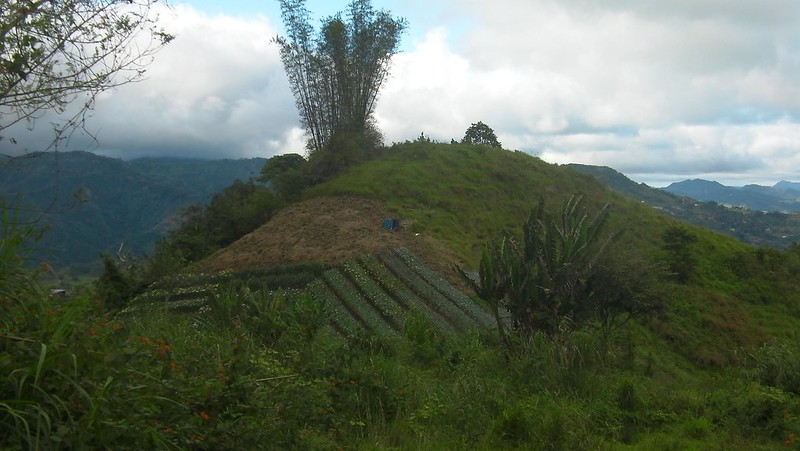
From here, one can also see the imposing Mt. Kan-Irag.
Congratulations for summiting the mighty Mt. Babag!
* Technical info courtesy of Sir Jing Lavilles de Egurrola of Camp Red and Warrior Pilgrimage.
Suggested Itinerary for Day Trek
7:00 AM – Assemble at Guadalupe church, breakfast, buy provisions
8:00 AM – ETD bound for Sitio Napo (ride a habal-habal)
8:15 AM – ETA Napo, start trek
9:00 AM – ETA Lower Kahugan Spring, rest and refill from water source
9:15 AM – ETD Lower Kahugan Spring to visit Busay Lut-od Waterfalls
10:00 AM – ETA Busay Lut-od Waterfalls
10:30 AM – ETD Busay Lut-od Waterfalls and back to Lower Kahugan Spring
11:00 AM – ETA Lower Kahugan Spring, rest and refill from water source
11:10 AM – Start assault, head to Roble Homestead
12:3O PM – arrival at Roble Homestead, lunch
1:30 PM – ETD Roble Homestead and continue assault to Mt. Babag via East Ridge Pass
2:30 PM – ETA Summit, rest and rehydrate, take photos
3:15 PM – ETD Summit to Veterans Drive and Mountain View Resort
4:15 PM – ETA Veterans Drive, hire habal-habal
5:00 PM – ETA JY Square
Budget
- P10 – habal-habal ride from Guadalupe Church to Napo
- P40 – habal habal ride from Mountain View Resort to JY Square
- TBN (to be negotiated) – guide fee
Tips
1. Most Cebu mountaineers know the trails of Mt. Babag. However, we recommend contacting Sir Jing Lavilles de Egurrola (a.k.a. PinoyApache) of Camp Red, the only bushcrafting organization in Cebu. Mt.Babag is Camp Red’s backyard and Sir Jing can definitely show you the secrets of the place.
- Mobile Number: 0933-391-1627
- Email: pinoyapache@yahoo.com
- Website: Pinoy Apache
- Facebook Account: Jing Lavilles de Egurrola
2. The best time to climb Mt. Babag for day hikes is early morning when the sun is still gentle.
3. Don on good trekking shoes with an aggressive tread. You will need the shoes for traction due to the loose soil that characterizes Babag Ridge.
4. Wear arm guards and leg guards since the plants are vicious.
5. Take salt tablets or beverages that are filled with ions (e.g. Gatorade, coconut water, etc) besides water. The hot sun and the brutally steep ascent can squeeze the fluids off you. When you lose enough ions and salts through your sweat, cramps will occur.
6. Bring energy-rich trail food such as nuts, crackers, bread, and bananas.
7. Note that Mt. Babag is extremely steep, with 45-degree inclines on some places. Keep a steady stride, and match the rhythm of your breathing to your pace. Don’t hesitate to ask your guide to stop; even the strongest mountaineers’ stamina gets drained here.
8. Pack light but be sure to bring along (for day hike):
- water (at least 1 liters)
- extra dry clothes
- swimwear (if you wish to dip at the falls)
- trekking shoes/boots
- raincoat, rain jacket, or poncho
- hat, scarf, and sunglasses (to protect yourself from the sun)
- first aid kit
- snacks and packed meals
- hydration salts, table salt, or Gatorade (to avoid and relieve cramps)
- toiletries and sunblock
- headlamp or flashlight
- whistle
- cellphone
- extra money
9. You can camp at Manwel’s Peak, which is 150 meters away from the summit, if you want. The camp ground can hold around 9 to 12 tents and offer you a great view of Cebu. Alternatively, you can camp at the Chalet, which can accommodate around 20 to 40 tents. Chalet is about a mile away from the summit.

Mt. Babag is the best place to start for newbies and it is a 4-star base training ground for those who want to prepare for major climbs outside Cebu. People are so used to our kind of activities that they don’t get alarmed of climbers passing by in the middle of the night.
Basically, the trails to Babag Ridge are safe. I have done solo walks – day or night – and conduct night navigation training once in a while if ever I am requested. It is about 20 kilometers in length and about four kilometers at is widest and you could explore any possibilities of its trails from all sides.
Warrior Pilgrimage,
Thank you for the insight, Sir Jing, and thank you too for letting me use your info.
Sir, let me schedule another climb so you can take us to more places in Babag Range.
OMG! I can’t be so sure if I could survive this kind of trek. I’m outdoorsy and I must say that this one is more than just fun.Perhaps, I would need some warm-up weeks before doing something like this. I like how you guys brave this journey.Wonderful.
PostScript: You guys continue doing what you’re doing. Trolls and people with social issues are inevitable. They’re everywhere and pulling us down is the best they can do, but they just can’t. They send catapults of malicious attacks hitting our passions. Passions that forge our unique identities. Sadly, their passion is to destroy and provoke trouble, while ours create a powerhouse that makes us living and thinking individuals. From the immortal words of Edith Wharton, “After all, one knows one’s weak points so well that it’s rather bewildering to have the critics overlook them and invent others.”
J.J. Solon,
Oh, you can. The trail is steep, yes, but you can definitely ascend it as what Sir Jing pointed out. We can just have a lot of rest stops, actually. The first time I climbed Mt. Babag, I had to rest every 5 minutes of climbing!
And about the troll that’s been attacking us, well, what can you expect from a jealous ignoramus who thinks he’s the best there is?
ill be climbing mt. babag this saturday, march 16, 2013. anyone wanna hop in?
Cedric,
Hi! Thanks for dropping by. However, we can’t join you on that day due to prior appointments.
Rest assured that we will join you in one of your future climbs. After all, we’re adventure junkies!
Have fun on your climb!
wow! thanks for this blog. I was able to get some idea. My team will climb there on Sept 2014.. It makes me feel more excited now!.. 😉
Hi Jo,
Thank you very much for visiting our blog. Trekking up Busay Lut-od waterfalls and Mt. Babag is a great experience. Hopefully, your team will meet master bushcrafter Sir Jing of Camp Red. Mt. Babag and the surrounding areas is collectively his playground.
try Mt. Kitanglad it is more exciting
Hello Paul,
Sorry, but as mountaineers and adventurers, we never compare one place to another. Each has its own charm, challenge, and characteristic.
Also, were supposed to climb Mt. Kitangland and Mt. Dulandulang this month. But we cancelled our climb due to security reasons in the mountain. Our contact informed us of a military operation which fell squarely on the dates of our climb.
Sorry for the comparison if you feel that I compared between the two mountains. Yes it is true each place has a unique charm. It is just a sort of suggestion. I have gone to Mt. Kitanglad several times without any signs of danger. I have climbed also Mt. Amuyao in Mountain Province.
A KD2/D2K climb has always been in our mountain checklist. We will surely climb those two beautiful mountains.
Since we are from Cebu and not from Bukidnon, we have no first-hand info on KD@’s status. Like many of our climbs, we rely on the information of our contact/guide there. He suggested to abort the climb due to the mil-op in the area. We complied since he’s a local there, and he knows the area/situation best.
Well, he might be right or wrong; the threat may even be perceived. But for us, it’s always better to err on the side of safety.
Mt. Amuyao—hmmm. We should put that on our checklist too. 🙂 Do you have contact details, itinerary, budget, and tips for a climb there? Would very much appreciate it.
Climb on! Adventure on!
Thank you sir for this blog. Me and my friends are just newbies in mountain climbing and we’re planning to visit mt. babag next month hopefully… however we don’t have any guide. Is it possible to ask the locals which way to go in reaching the peak?
Hi Kyra,
Thank you for the compliment. Yes, it’s possible. However, since locals give conflicting instructions, we suggest you let a guide accompany you. Visit these FB pages and ask for someone who can accompany you:
* Enthusiast of Cebu Outdoors
* Visayan Trekkers Forum
thank you for this sir… 🙂
hey .. adrenaline,, please post. not just about yourself hiking. but about the Attraction..
What attraction do you mean? Our blog posts are about our adventures, and hiking is one of them. If you are just looking for attractions, you may find it somewhere else. And by the way, this is Sheila and Gian, not adrenaline.
hahahahaha I don’t get the point of Weldon Labang… It is very visible in the pictures the views of Mt. Babag and the trail going there…
I’ve done night trek from RCPI tower to Mt. View yesterday (june 28), I want to try night trek from Guada to RCPI to Mt view. Who can guide me/us? Easiest way possible as there my be newbies that will join.
Hi Cebu Nite Walker,
Mr. Jing Lavilles de Egurrola and the rest of Camp Red would be the best people who can guide you there. Although many hikers know the trail, Mt. Babag and the surrounding areas is Camp Red’s playground.
You can find Sir Jing in FB (just search his full name above). You can also search for Camp Red in FB as well.
Hope this helps. Thanks.
how much will be the total expenses if it is to be estimated per person?
Is there any payment if we were to ask for a tour guide?
during camping can the guide stay with the team too?
Daghang Salamat from Las Piñas
Sent from Yahoo Mail on Android
Hi Faye,
Budget, contact details, and other information you need in climbing Mt. Babag is in the blog post.
You can negotiate the payment and terms of service with the guide.
Thanks! 🙂
HI Sir AdrenalineRomance,
here again reading your blogs and may I know how much is the range of the guide fee (I’ve read it is negotiable) but maybe you have idea how much is the range of fees? coz upon seeing the itenirary it took you almost 6hours trekking… So I could arrange budget for Mt.Babag Adventure… Thanks
Hi Che Ryll,
Thank you for reading! Actually, a climb up Mt. Babag usually takes only 3 to 4 hours. We had 6 hours because we walked really slow, took photos, and rested for long minutes. Hehehe!
For the guide fee, honestly, we really have no idea. However, a benchmark of around 500 would be good. I would suggest you ask or contact Sir Jing for the rates. He would know better as Mt. Babag is his playground. 🙂