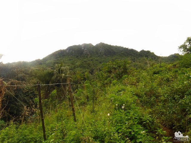
Mountains have their own immortal tales. While many of these stories fade in the mists of obscurity, some leave identifying marks—everlasting scars in time—in their lofty slopes. The saga may be one of triumph, inspiration, mystery, or tragedy. An example of such story surrounds Mt. Manunggal in Balamban for it has a great significance in Philippine history.
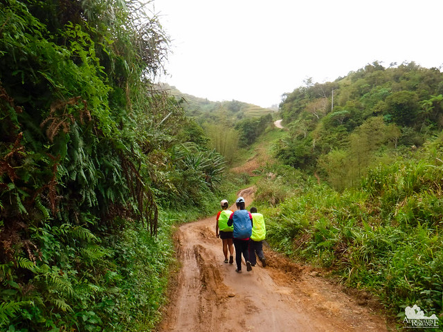
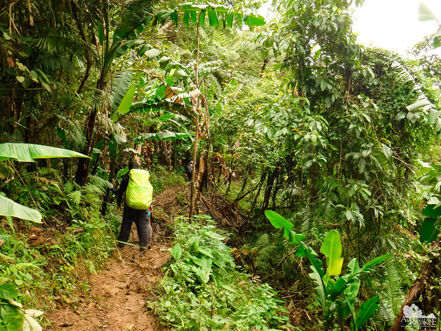
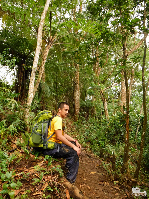
We got down from Mt. Mauyog and walked towards Mt. Manunggal. The hike was quite easy, somewhat like a cool-down from the day’s adventure. It involved walking on a road that is cemented in some parts but muddy and rocky in others.
On each side of the rolling terrain are farms, waiting sheds, abandoned structures, and small houses. These are merely blips in the province’s economic and social radar.
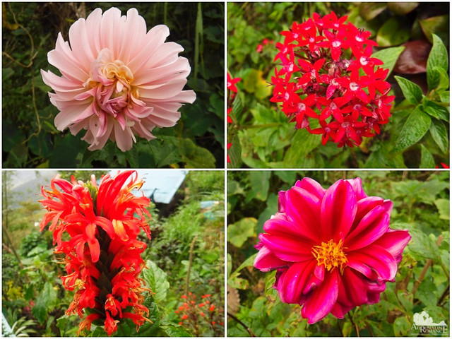
One of the nicest things about hiking in the mountains is that we get to see beautiful and colorful wild flowers such as these. Flowers like these strive in high altitudes, cool climates, and moist soil. That’s why a lot of wild flowers cannot survive in the lowlands where the conditions for their growth are poor and harsh.
After more than an hour of walking on rolling terrain, we arrived at the Gaas-Sunog crossroads. The road on the left leads to Barangay Gaas and beyond that, the Transcentral Highway. The Gaas route is the “executive” trail for those who want to climb Mt. Manunggal.
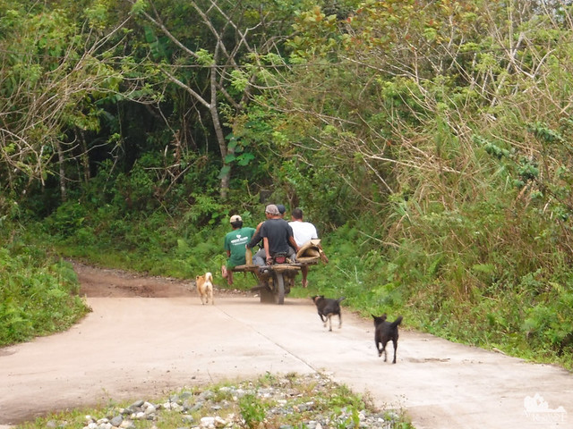
We were surprised when we saw a fully-loaded “skylab” cruise past us and towards Barangay Sunog. A skylab is a modified motorcycle with metal or wooden outriggers fastened to the sides. The outriggers carry farm produce, goods, animals, and often, people! A great amount of skill and effort is exerted to keep the skylab balanced.
This one amused us because the driver had to accelerate after being chased by some stray dogs that got startled with the engine’s noise.
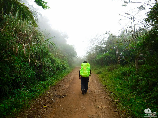
Many times in your life, the road you walk may be lonely. You might doubt yourself if you’re on the right path. You may have apprehensions whether you made the right direction considering no one is walking alongside with you.
However, you have to remember that all roads lead somewhere. In time—and with confidence, faith, and persistence—you will arrive at your goal.
Low-altitude clouds covered the landscape around us, giving birth to a misty, mysterious realm. In such a brief moment, we were engulfed in another dimension that is absent of people. It felt as if we stepped back into an empty past where all events as we know it have left.
The fresh, cool air became laden with moisture, which signified the coming of a thunderstorm.
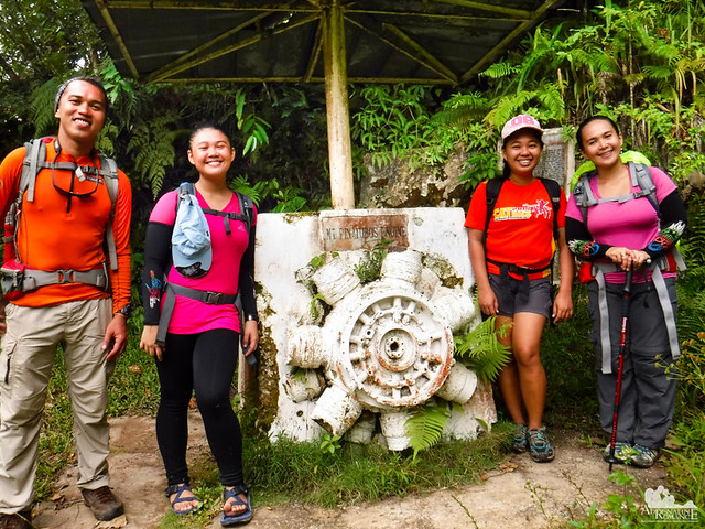
From the parking area, we walked down a dirt trail that led to the Mt. Pinatubo Engine Memorial. Comprising of a Douglas C-47 Skytrain cylinder block, this is the last remnant of President Magsaysay’s plane Mt. Pinatubo, which crashed on this very spot on March 15, 1957. The crash took the lives of the President, 17 presidential staff, and several news correspondents.
Within the quiet forest, we could almost feel the spirits of those perished in the mountain and the past echoes of frantic rescuers and locals trying to save the victims in vain.
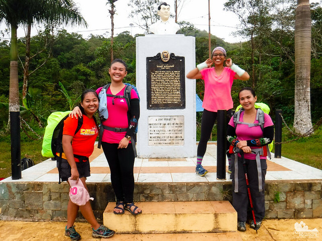
Finally, we arrived at our last stop for the day, the monument of President Ramon Magsaysay, the 7th President of the Republic of the Philippines. The son of a blacksmith and a school teacher, he became an automotive mechanic before he delved into the world of politics. He was also a guerilla captain during the Japanese occupation of the Philippines.
President Magsaysay’s administration and presidency was dubbed the Philippines’s Golden Years as it was virtually corruption-free. He was also known for his landmark agrarian reforms and his firm stand against communism. His humility and superb statesmanship earned him the moniker “The People’s President.”
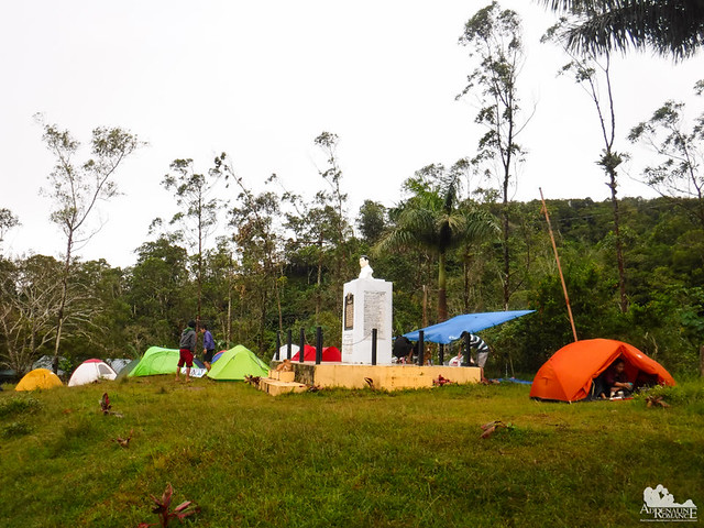
The sky was not so kind on us late that day. We had a gloomy afternoon, and for a few hours during the night, heavy rain poured not in rivulets but in buckets. We simply ate our dinner then went to sleep. Since we don’t drink alcohol, we didn’t join the rest of the Bukal Outdoors Club during their socials in one of the houses that dot the campsite.
We woke up a little past sunrise (I had a really sound sleep due to the cool weather) and started cooking breakfast.
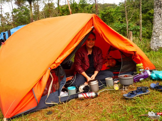
What’s the matter, Sweetie? Why are you not smiling? Well, when it rained during the night, our trusty Luxe tent finally gave up. After many years of usage, the waterproof film and the seam tape wore off, allowing water to permeate through the fly sheet. Small pools of water got inside the tub floor. The wet conditions made the interior more moist and clammy than it should be. I guess unlike Alexa and me, she did not have a restful sleep.
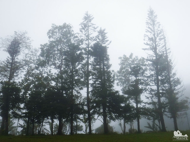
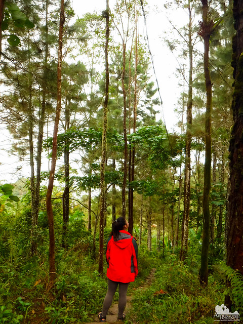
While Sweetie cooked our morning meal, I took Alexa to another part of Mt. Manunggal. This lovely pine grove is one of the most scenic pathways to the campsite. In the morning, the pines smell fragrant and wonderful.
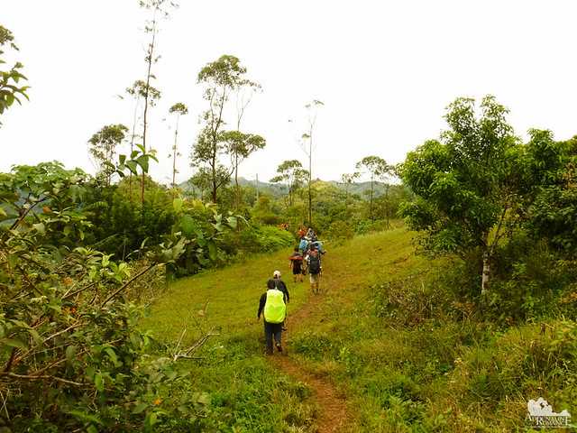
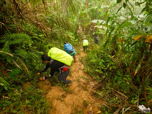
After a big, hot breakfast, we packed up and took a few photos of the group before heading to Mt. Manunggal’s summit. The first part of the trail was an easy trek on a grassy, relatively level hill.
But the heavy rain last night made the trail towards the summit extremely muddy. Thick, wet mud sucked on our shoes, threatening to rip them off our feet with each step.
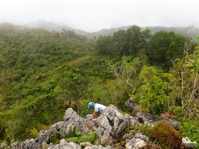
The muddy trail was only the beginning of the challenge. To get to the top of Mt. Manunggal, we had to climb these sharp rocks. While relatively easy during good weather, this was quite treacherous as the rocks were extremely slippery from last night’s rainfall.
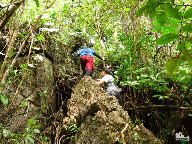
Slowly but surely, we made our way up. We also had to gingerly hold on to the branches of small trees to retain our balance over the rocks. Yes, gingerly because many of the trees here are rotten from the inside.
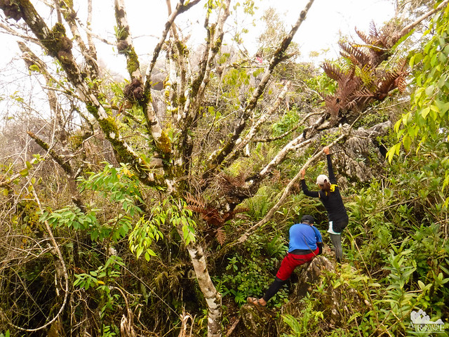
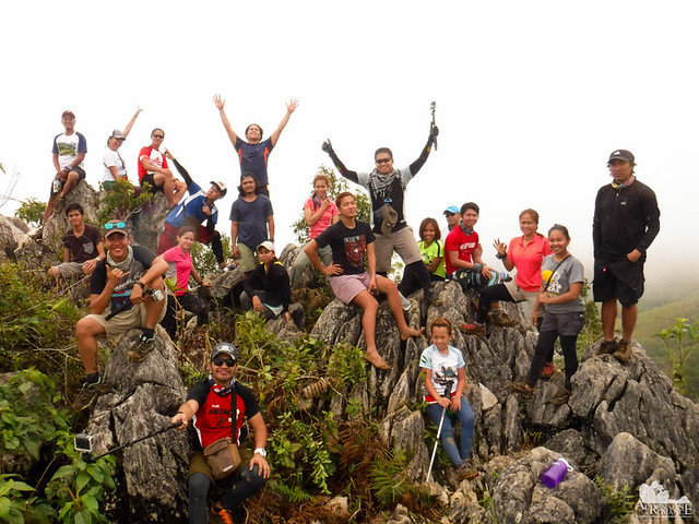
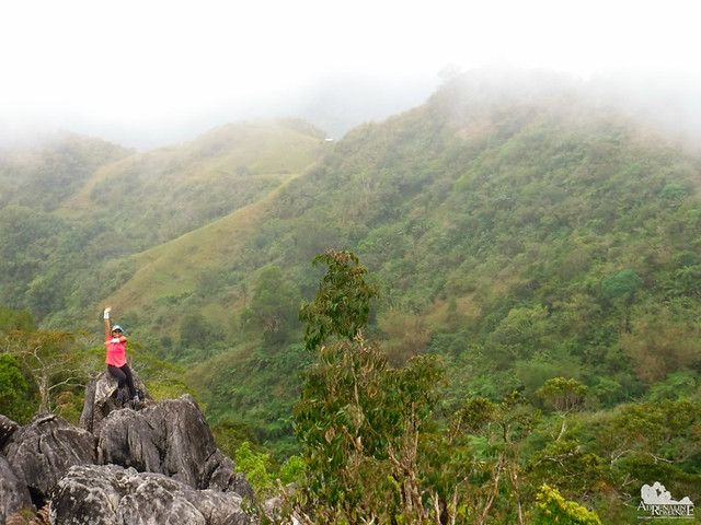
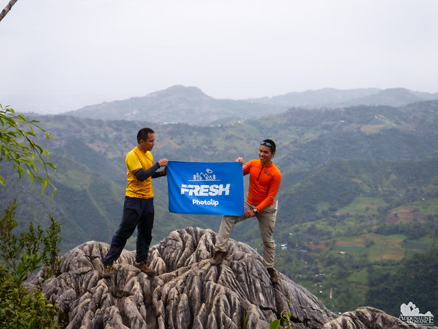
But with care, we finally reached the summit of the most historically important mountain in Cebu. Congratulations, everyone! What an awesome group!
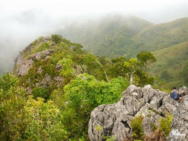
Let’s look around. Mt. Manunggal’s summit shares the same characteristics of Mt. Mauyog. The limestone promontory is jagged and filled with deep crevices. Ferns and shrubs grow from these dark cracks.

The island of Cebu has been deforested even before the Spaniards came. However, Mother Nature heals herself. Growing alongside the last remaining first-generation trees is a new forest cover made up of young trees. In time, if left undisturbed, this young forest will again cover this slope. In time, it will become home again to Cebu’s indigenous flora and fauna.
That’s simply picturesque, isn’t it? That is 1,097 meters of pure, majestic awesomeness right in the middle of Cebu!
Even though Mt. Manunggal is considered the highest mountain in Cebu, it does not have any significant topographical prominence. That’s because Mt. Manunggal is part of a long range of mountains that make up Cebu’s central spine, part of which is visible behind Apol.
While waiting for the others to get down, Sweetie and I hushed and listened to the song of the forest. The deep silence, the rustle of leaves, and the distant sounds of birds calling out to their mates were melodious.
As you can see in the photo below, we were at the edge of a first-generation forest. Mt. Manunggal is located within the Central Cebu National Park, which is protected by Republic Act 8475. The area also encompasses the Lusaran River below us.
The weather did not cooperate—again. As we went down the mountain, rain started pouring. Water saturated the downhill trail, making it extremely slippery and muddy. All of us had a hard time trying to maintain traction on the steep trail.
We had a short lunch break at a friendly farmer’s property midway down the mountain before proceeding to its foot. From afar, Mt. Manunggal looks at the lowlands like an everlasting guardian. Thank you, Mt. Manunggal and Mt. Mauyog for deeming us worthy to set foot on your summits.
Sometime in the middle of the afternoon, we arrived at the bank of Lusaran River. We were anxious to receive our reward, which was located a little bit upstream, for this fun-filled climb.
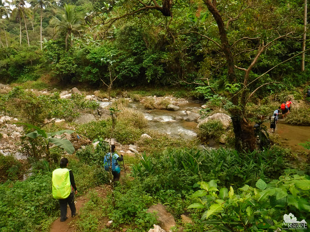
Our reward was a refreshing swim at Guining Falls at the northern end of Lusaran River. Although it’s not a spectacularly tall or large waterfall, it was a favorite spot for locals and visitors who want to cool off from a hot day. It is quite safe to swim here as the water is quite shallow. Simply sit or lie down on the riverbed and let the current caress you.
Water and wind erosion sculpted interesting rock formations on the rocky cliffs around the waterfall.
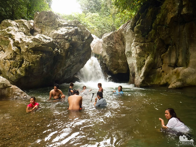
After spending more than an hour frolicking in the fresh, cool water of Guining Falls, we dressed up, packed up, and hiked downstream back towards Barangay Tabunan.
The Lusaran River is scenic in its own way. But more importantly, it is a precious waterway for the locals of the valley. The thick foliage around the river helps maintain its cleanliness.
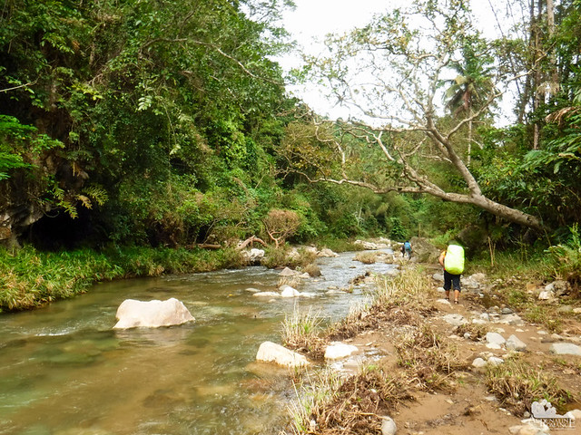
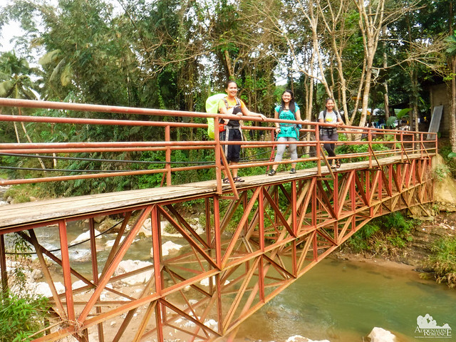
Twenty minutes later, we crossed an iron bridge that led us back to the Tabunan town center and marked the end of our weekend adventure.
Special Thanks
We would like to thank Bukal Outdoor Club for letting us join this weekend climb. These ladies and gentlemen are superb companions in the outdoors. We hope to climb again with you, guys.
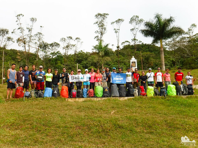
We would also like to personally thank Sir Tolits for letting us tag along during this sojourn. Sir Tolits is my colleague in PhotoUp, the best company in the world which offers fresh perspectives, ideas, and inspirations.
A national tragedy in 1957 shaped the story of this mountain. Forever it will be etched into the annals of Philippine history. The spirits of President Magsaysay and his compatriots eternally guard its slopes, valleys, forests, and trails. As such, Mt. Manunggal must be treated with reverence and respect even though its top barely touches the clouds.
(Update 3/27/2018 – Barangay Sunog/Gaas and the coop that takes care of Mt. Manunggal now requires an entrance fee of P 80 per person. Furthermore, if you camp there, you are required to pay P 50 per person.)
Budget*
Transportation-related
- P 150 to 200 per head – one-way fare for chartered jeepney (minimum of 15 pax, maximum of 20 pax) from JY Square Lahug to Barangay Tabunan
- P 200 to 250 per head – one way fare for habal-habal from JY Square Lahug to Barangay Tabunan
Climb-related**
- P 30 per head – registration fee
- P 300 per guide – Tabunan guide fee
- P 30 per head – registration fee
- P 200 per group – Mt. Mauyog guide fee
- P 50 per person – camp fee in Mt. Manunggal (effective March 27, 2018)
- P 80 per person – entrance fee in Barangay Sunog/Gaas (effective March 27, 2018)
* We did not include our expenses for snacks, tips, and other fees in this rate sheet as you may have different needs, preferences, itineraries, and sharing scheme from us. Note that all figures are subject to change without prior notice.
** Please read the section titled An Important Word About Tabunan’s and Sunog’s So-Called Fees in the previous post.
Itinerary
Day 1
6:00 AM – Assembly at JY Square
8:00 AM – Depart for Tabunan
9:30 AM – Arrival at Tabunan, registration, last-minute purchases
10:00 AM – Start trek to Mt. Mauyog
12:00 PM – Arrival at Barangay Sunog, lunch
1:00 PM – Start trek to Mt. Mauyog summit
2:30 PM – Arrival at Mt. Mauyog summit
3:30 PM – Descend from the summit, start trek to Mt. Manunggal
5:00 PM – arrival at Mt. Manunggal, set up camp, cook dinner
6:00 PM – dinner, socials
10:00 PM – lights out
Day 2
6:00 AM – wake up call, cook breakfast
7:00 AM – breakfast, break camp, pack up
10:00 AM – Start trek to Mt. Manunggal summit
11:00 AM – arrival at Mt. Manunggal summit
12:00 PM – Descent to Tabunan
1:00 PM – lunch
2:00 PM – start trek to Guining Falls
2:45 PM – Arrival at Guining Falls, swimming
4:00 PM – pack up, trek to Tabunan
4:30 PM – Arrival at Tabunan, ride jeep back to Cebu City
Tips
1. For guideship services other than local Tabunan guides, please contact Bukal Outdoor Club guides Tolits at 0917-797-4016 or Jethro at 0905-305-5953.
For jeepney rental, get in touch with Randell at 0935-293-7690.
2. Relatively speaking, a climb up Mt. Mauyog and Mt. Manunggal is among the most expensive outdoor adventures in Cebu mainly due to the costly fares and the possible overpricing of fees.
3. The trail to both mountains is moderately exposed. Thus, don’t forget to bring a wide-brimmed hat, scarf, or umbrella to protect yourself from the heat. Don’t hesitate to tell the guide to stop if you feel exhausted.
4. Water sources are aplenty on the trail. You can also buy water and resupply at the sari-sari stores in Barangay Sunog.
5. The campsite of Mt. Manunggal is equipped with facilities such as toilets, showers, and sinks. Abundant water is fed through a series of springs near the mountain. There are also a few sari-sari stores at the campsite where you can buy snacks and drinks. For a reasonable fee, you can ask the households in the campsite to cook meals for you.
6. Wear arm guards and trekking pants to protect your skin from the sun and prickly plants. Also, a dry-fit shirt or rash guard will help keep you cool.
7. Wear trekking shoes or sandals with an aggressive tread. You will need a lot of traction since you will be scrambling over loose soil and slippery rocks .
8. Bring salt tablets or ion-filled beverages such as Gatorade, coconut water, or fruit juice aside from water. The hot sun, multiple ascents, and exposed trails can make you sweat a lot. When you lose enough ions and salts via your sweat, cramps will occur. If cramps happen, rest for awhile, drink a lot of water or ionic drinks. This will replenish the ions in your system.
9. Bring energy-rich trail food such as nuts, crackers, bread, and bananas. Don’t underestimate the mountain.
10. Pack light but do bring the following:
- water (at least 2 liters)
- good-quality 3-season tent with fly sheet and ground sheet
- cookset (can be shared with the group)
- burner (can be shared with the group)
- cold weather gear (warmer, thermal underwear, fleece jacket, windbreaker or winter jacket)
- extra clothes (1 set for climbing, 1 set for sleeping, 1 set for returning home)
- swimwear (for swimming at Guining Falls)
- trekking shoes/boots
- light flip-flops (for walking around the campsite)
- raincoat, rain jacket, or poncho
- hat, scarf, and sunglasses (to protect yourself from the sun)
- first aid kit
- food for dinner, breakfast, and lunch
- hydration salts, table salt, or Gatorade (to avoid and relieve cramps)
- toiletries and sunblock
- toilet paper (for cleaning your cooking utensils)
- headlamp or flashlight
- whistle
- cellphone
- extra money
- trail snack
11. Don’t forget to waterproof your belongings. You can do this easily by wrapping your stuff inside dry sacks or plastic bags.
12. Please mind your trash; do not leave any of your garbage behind. Keep your voices low, and avoid unruly behavior. Remember that Mt. Manunggal is a historically and culturally important mountain, thus, it demands utmost respect.

Hello Gian & Sheila,
I’d like to ask… how many kilometers is the trek from start to peak? We’ve been planning to go there for sometime now. Salamat.
Hi Nancy! So sorry for the late reply. As usual, we had a temporary break due to COVID 19.
Regarding your question, it depends on where you start. If your jump-off point is at Barangay Tabunan way down at the bottom of the mountain, it would probably take you about 5 to 6 hours on a leisurely pace.
But if you start at Barangay Gaas at the Transcentral Highway, it would take you around 2 to 3 hours.
Hope this helps. 🙂 Thanks! Happy holidays and stay safe! 🙂
Thank you for this very helpful reminders.
Thank you for this very helpful reminders.
Hi Jan! You’re welcome. 🙂 Happy holidays and stay safe. We’ll be updating the blog soon with more adventures. 🙂