What does a mountain tell you? In this much quieter part of the land, you can hear its soft voice. A mountain may proudly share its treasures. It may weep in agony. It may teach you lessons in life. And it wordlessly tells you its poignant story. For this trip, we decided to listen to the silent tales of majestic Mt. Maculot, the jewel of the municipality of Cuenca in Batangas, Philippines.
For our last set of adventures this year and to celebrate Sweetie’s birthday, we decided to check out a few mountains around Batangas and Cavite. Our friends Loraine and her sister May decided to join us on this trip; however, their work schedules didn’t allow them to join us on this first adventure. Thus, rather than wasting our first day, we decided to climb up the 947-meter Mt. Maculot.
Normally, we would have taken a taxi (and spend hundreds of pesos considering how the taxi system in Manila works) to get to Buendia where we can board a bus to Cuenca, Batangas. A short walk towards NAIA’s exit changed all that. We were able to board a jeepney that took us to Roxas Boulevard, then another jeepney to take us to Buendia. See what a little bit of effort can do? That short walk saved us a lot of money!
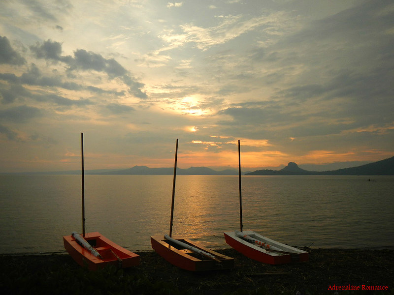
Shortly before midnight, we were relaxing on an air-conditioned bus bound for Cuenca, Batangas.

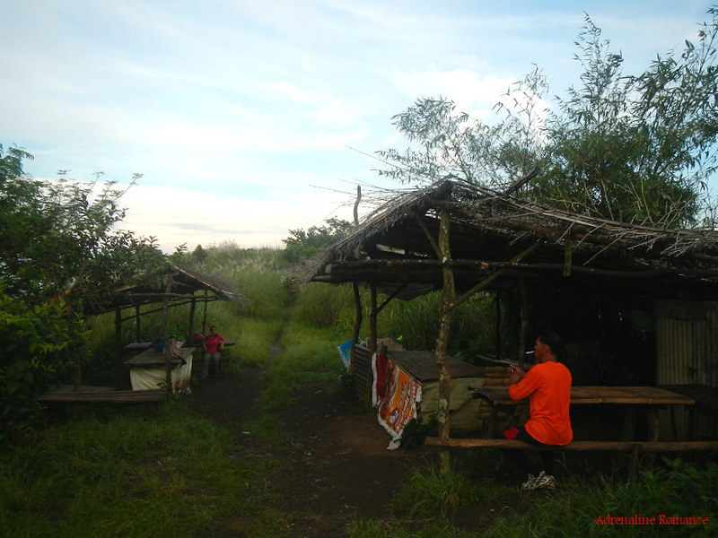
We disembarked at Cuenca and warmed up with a hot breakfast before heading to the barangay outpost where we will book for guides.
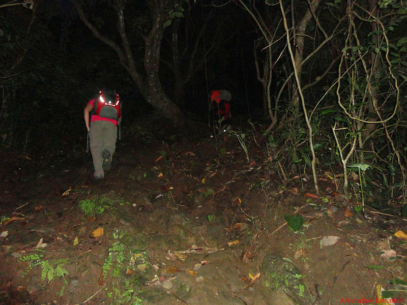
Based on our research, we know that the mountain is going to be really crowded with day trekkers, especially that it was a weekend. So, when we arrived at the jump-off at around 4:30AM, we immediately booked Sir Edwin, our guide, and started our climb up Mt. Maculot.
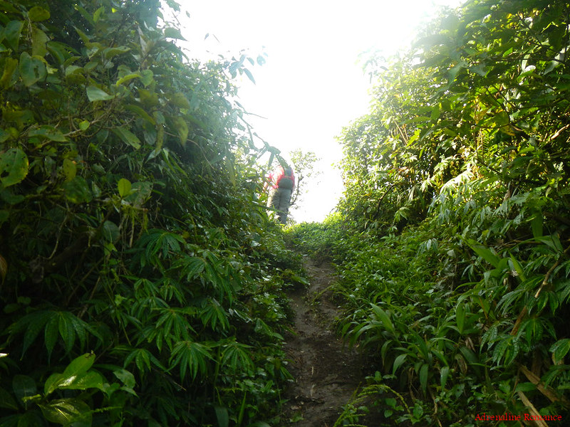
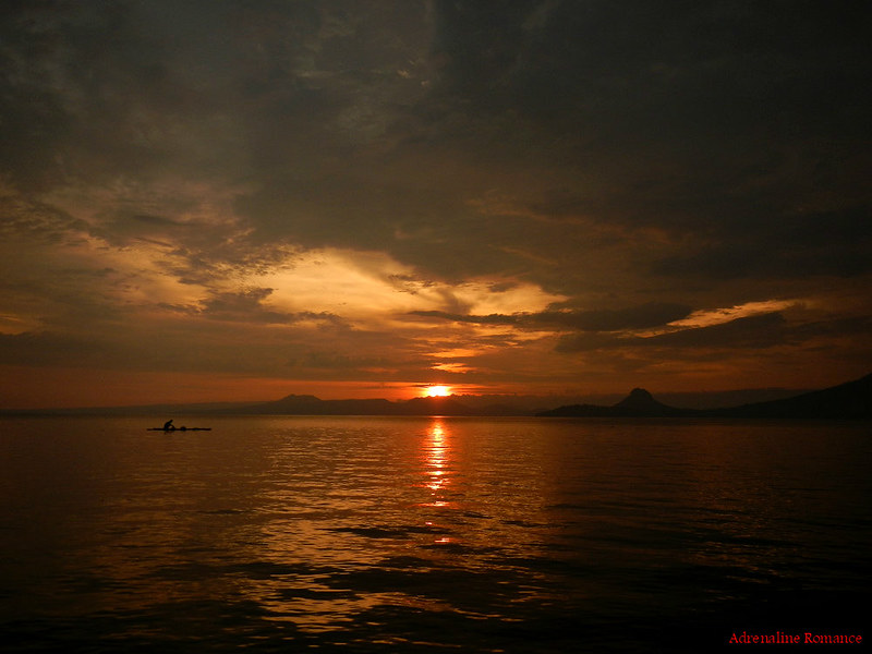
It was still pitch-black, and the town was still asleep when we started the climb. The pale moonlight and the sparkle of stars were the only other lights that peeped through the forest cover aside from the artificial illumination from our headlamps.
Soon, the real glow of dawn gradually and gently lit the land. For many people, each new day may feel trivial, but from up here on the slopes of Mt. Maculot, a sunrise feels like a revival of hope.

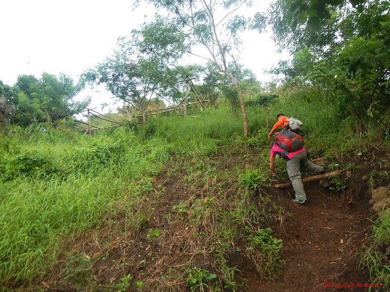
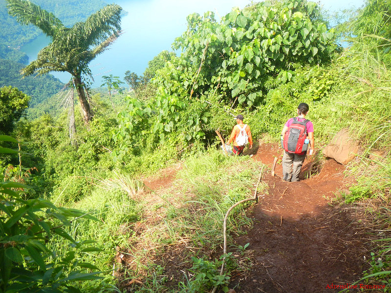
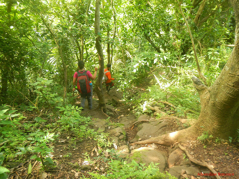
The ascent was moderately steep although the trail itself was quite easy. Still, we had to be careful as we have to trod on loose soil and slippery moss-covered rocks. The chilly dawn breeze and the naturally cool forest air made the trek quite relaxing and enjoyable.
In addition, there are several makeshift rest stations that are lined along the trail. Tired hikers can take a much-needed break on those rest stations.
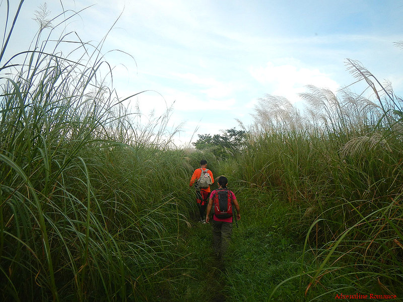
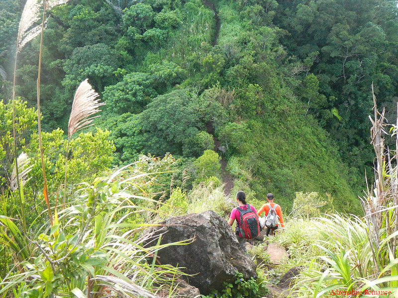
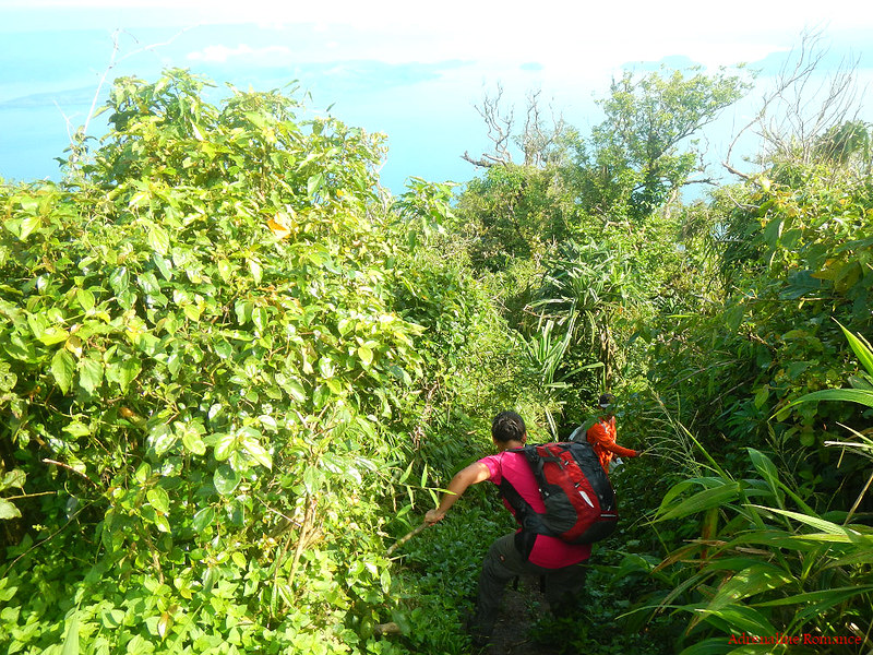
The light woods made way to thick fields of sword-sharp cogon grass that can really scratch your arms and legs. But the presence of cogon grass also meant that we were near the mountain’s shoulder.

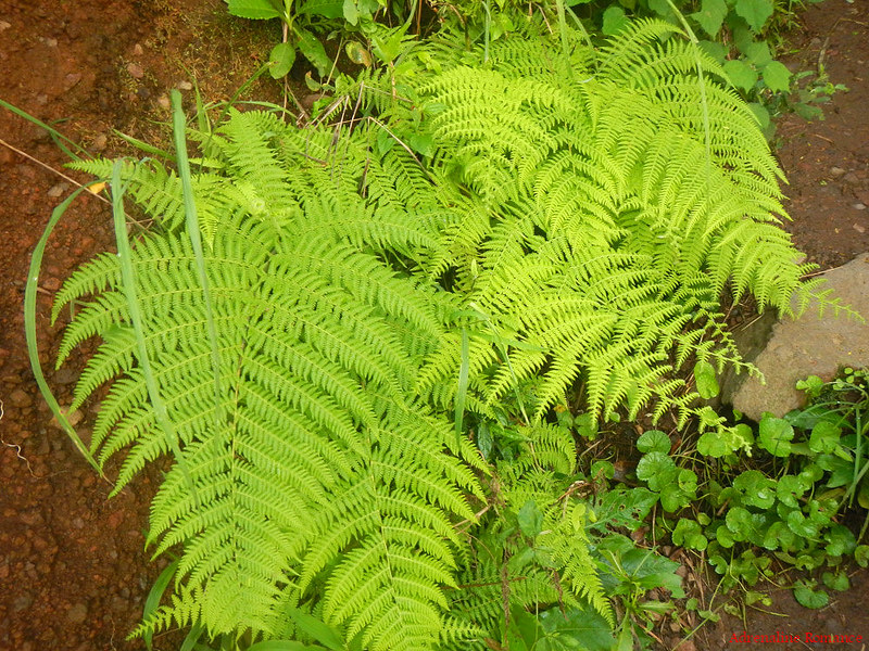
Large fans of ferns line up the trail along with cogon grass. According to Sir Edwin, these ferns have medicinal properties, but the process of preparing it is now lost in the sea of modernity.
At 5:30AM, we arrived at the last rest station that sits squarely at the fork that leads to the Rockies and Mt. Maculot’s summit. This rest station is colloquially called 7-11 after the popular chain store. You’ll see why in awhile.
The Rockies
After we had a refreshing 5-minute break, it was time to push through our first destination, the picturesque volcanic rock wall popularly called the Rockies. We turned left towards a sea of cogon grass with stalks that are taller than us!
Arm guards will really be handy here as they will protect you from those razor-sharp blades of grass.
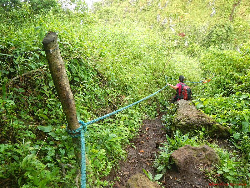
At the end of the field is a steep muddy trail. For safety and to assist a descent or ascent, fixed ropes are set here, acting as handholds.
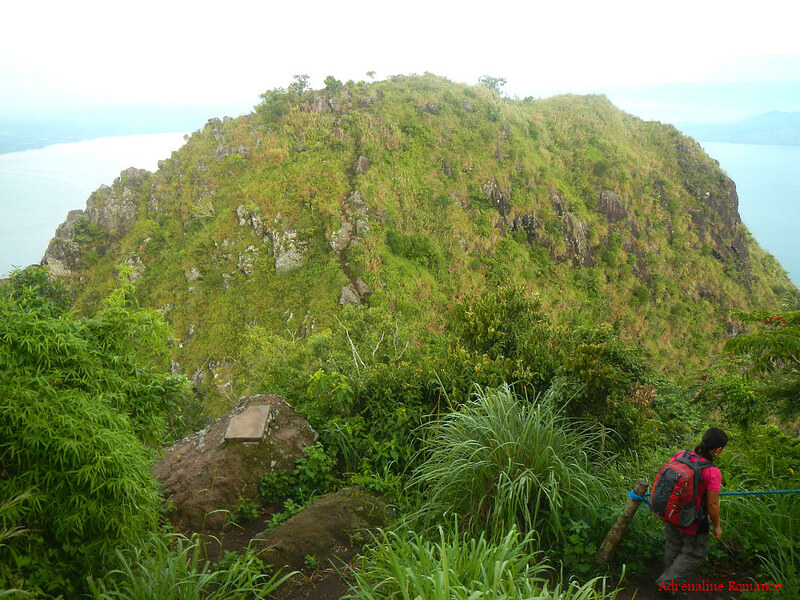
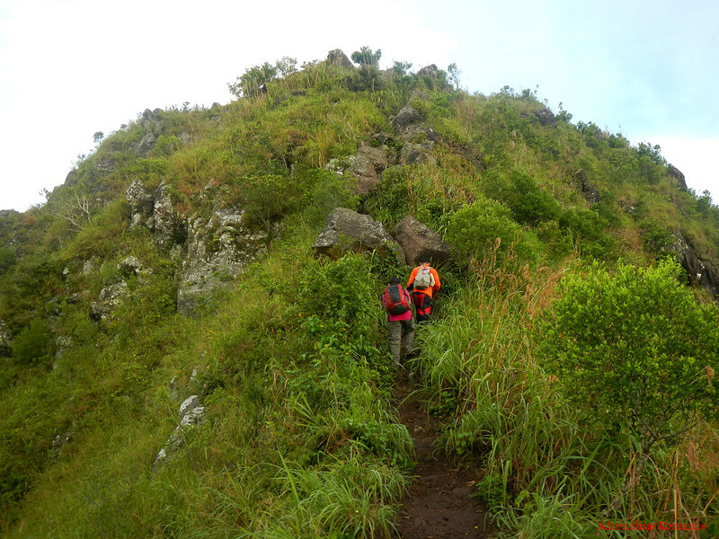
We can see the rough dome of the Rockies as we approached the end of the roped section. Beautiful, isn’t it? Can you see the trail that leads to the summit?
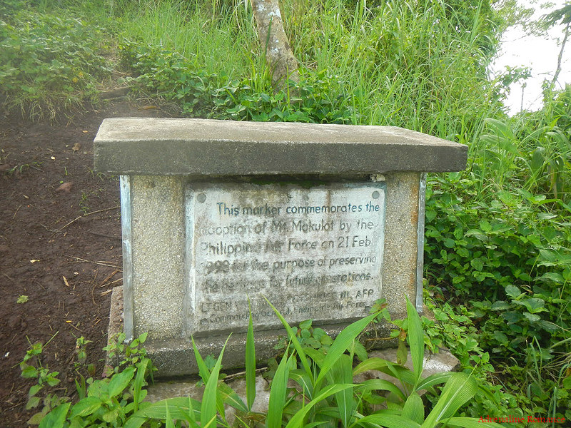
Like a lonely sentinel, this concrete marker was erected by the Philippine Air Force as a testament to its commitment in preserving the beauty of Mt. Maculot for future generations.
We traversed a small knife-edged section of the trail. Check out the sides of the trail; each side ends in a steep incline. This path becomes slippery during rainy season.
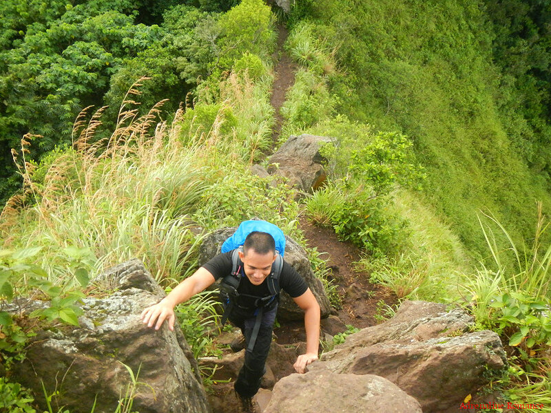
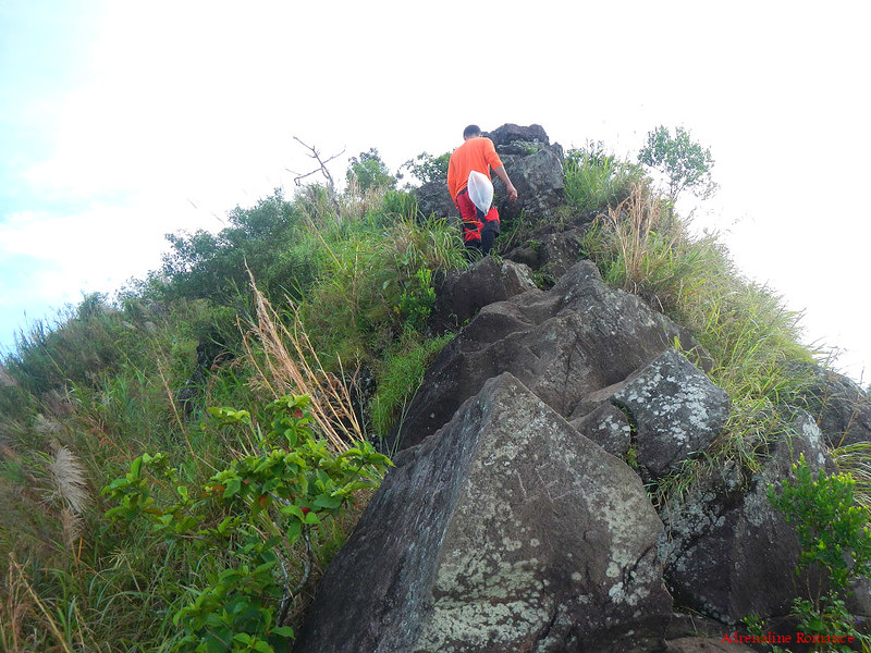
The last hurdle to the top of the Rockies is this boulder-strewn section. We had to scramble up those large rocks. Be careful, you might hit your head or knees on some of the larger ones.

Watch your step! Many of the rocks have smooth surfaces, tiny footholds, and moss-covered sections; so you have to watch where you step or hold on to.
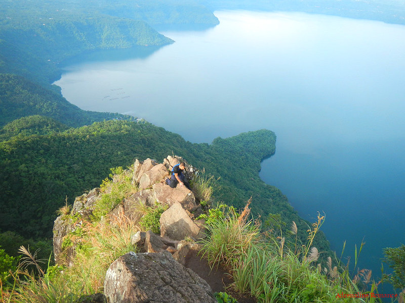
The small knife-edge trail is more pronounced in the photo below. You can just imagine what happens to you if you misstep to either the right or left of the trail.
We stopped for awhile to admire the amazing view below us. The photo below also shows the extreme steepness of the Rockies.

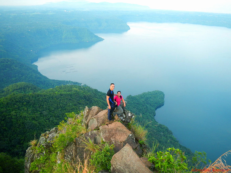
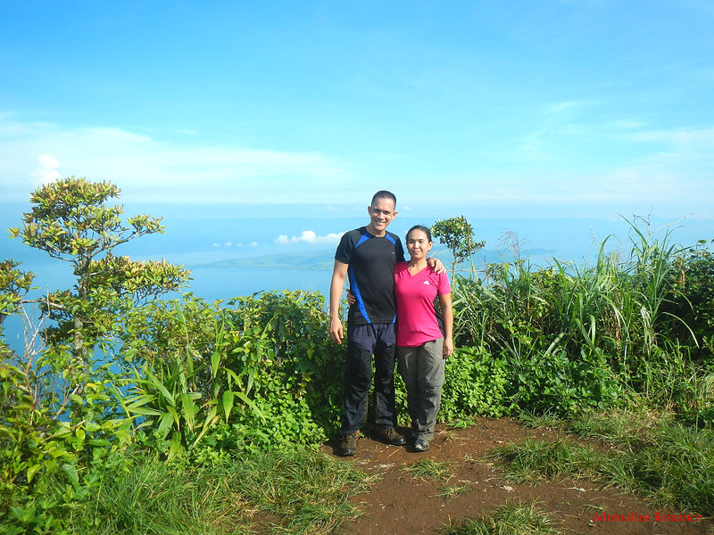
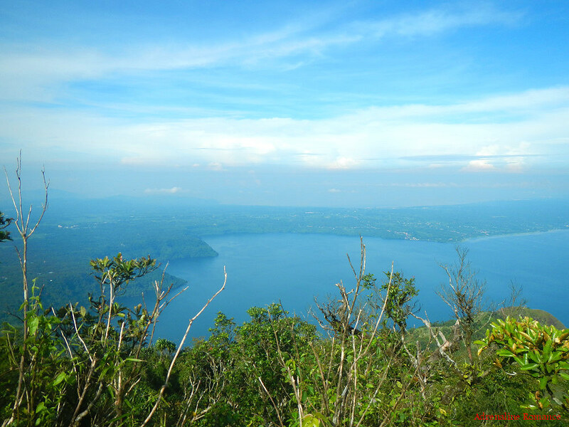
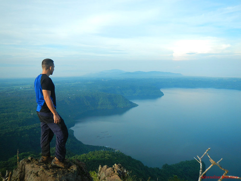
After a little over two hours of trekking, we finally reached the summit of the Rockies. Magnificent is not enough to describe the view. This 700-meter rock wall is said to be part of an ancient rim of the gigantic caldera that forms Taal Lake. Calderas are the remains of collapsed magma chambers after a huge volcanic explosion.
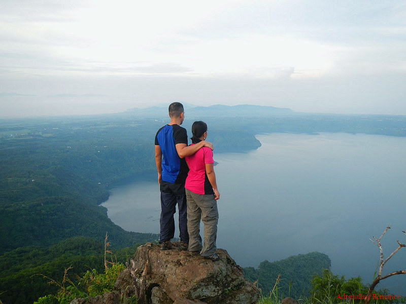
There’s another short trail that leads a few meters below the summit, which provides an even more encompassing view of Cuenca’s side of Taal Lake, the country’s third largest lake at 234 square kilometers. Taal Lake was formed after rainwater filled up the huge volcanic caldera that was left over after a series of massive eruptions between half a million to 100,000 years ago.
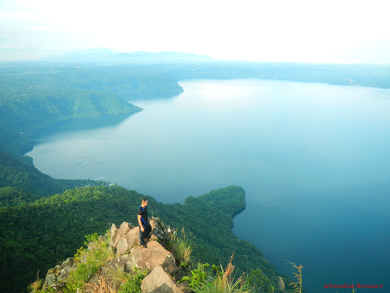
That’s the very edge of the Rockies. Can you see just how steep that is? A fellow outdoorsman and mountaineer, Victor Joel Ayson, died in this very spot. He somehow lost his balance and fell to his death 700 feet below.
Mother Nature is beautiful, yes. But the moment we lose respect of her, she could turn into a savage, indifferent, and unmerciful monster.

Climbers need to take extreme care when negotiating this section of the Rockies. In fact, we had to firmly straddle the rocks as both sides of this promontory have deep, steep ravines that go directly all the way to the lake’s shore.
Those faraway structures in the lake are fish pens, which cultivate the bounty of Taal Lake.
It’s hard to believe that thousands of years ago, this was the site of a series of violent eruptions, venting out Mother Nature’s anger. The serenity of Taal Lake effectively hides the chaos that created it in the first place.
Seeing the lake, which has filled up the caldera, the original Taal Volcano must have been unimaginably massive.

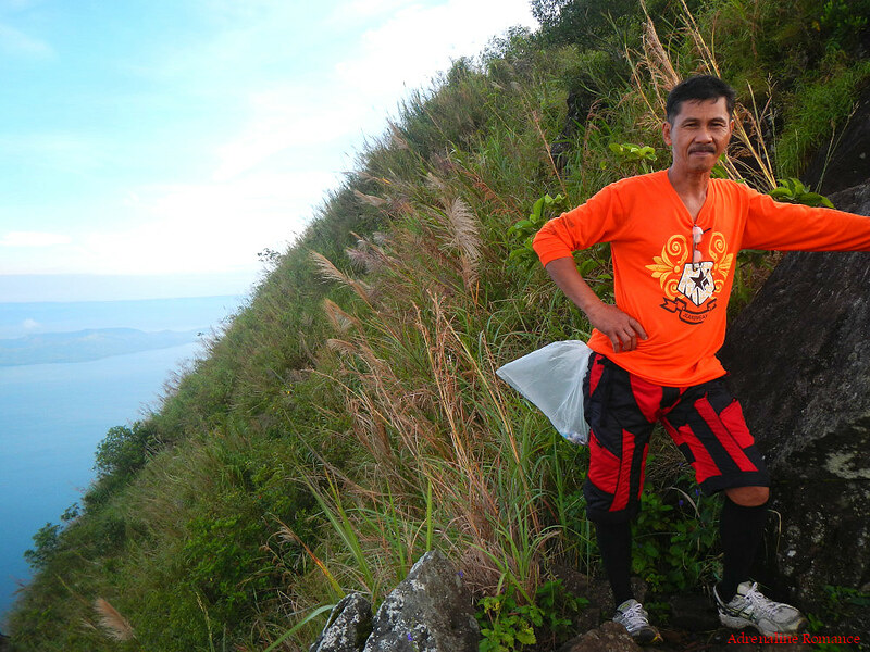
From our position at the edge of the Rockies, we needed to climb up these boulders. From the looks alone, we can deduce that these are igneous rocks, formed after lava cools and solidifies. Sir Edwin said that the explosion of the original Taal Volcano hurled huge rocks several kilometers away, some of which landed at the present Rockies.
Geologists, however, offered a different theory. Their analysis have led to the theory that the Rockies—and the entirety of Mt. Maculot—is actually one of the rims of the original Taal Volcano.
At the other side of the dome that forms the Rockies, we could clearly see the postcard-perfect and world-renowned Taal Volcano, which is situated in Volcano Island in the middle of Taal Lake. Within that island is Taal Volcano, the second most active volcano in the country. We will tell you about our visit to Volcano Island in a later post.
Three smaller islands—Lambauing, Bubuin, and Napayong—share the lake with Volcano Island.
Mt. Maculot’s Summit
After spending an hour on top of the Rockies, it was time to climb Mt. Maculot’s sacred summit. Getting down the Rockies was a little trickier than we thought.
Once again, we passed by the mountain’s 7-11 and continued along the trail between expansive fields of cogon grass. We could actually see the summit of Mt. Maculot from the shoulder. So near yet so far…

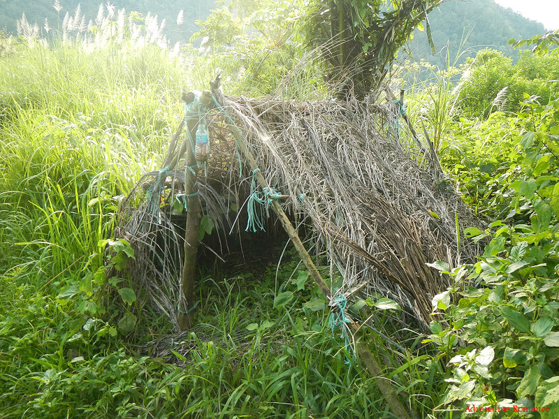
We found this makeshift shelter along the way. Sir Edwin said this used to be an emergency shelter for guides. But with the advent of lightweight, portable tents, emergency shelters such as these were left unused. Over time, they vanished against the combination of time and Mother Nature’s onslaught.
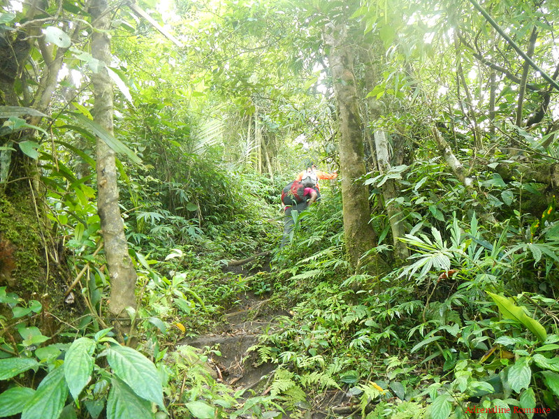
Soon, we left the cogon grass fields and slowly entered the treeline of Mt. Maculot. From here, it was a steady ascent up a slippery, slightly muddy trail.
We climbed this steep trail for more than an hour. However, the morning weather was pleasant, and the mountain air was refreshing. We didn’t feel tired; on the contrary, we were quite energized. The mountain has a way to replenish one’s depleted energy. The rustle of leaves, fresh air, and the silence of the forest all combine together in one sweet balm that surrounds you.
A clear view of the sky suddenly broke through the thick vegetation. There was no gradual transition—only a steep trail between two walls of thick bushes. Is this finally the summit?
Well, it turned out that the small clearing where we exited is indeed the pinnacle of Mt. Maculot! It was quite a strange feeling; for an hour, we were in dense, cool vegetation and then suddenly, we were out in the open under a blazing morning sun at 947 meters above sea level! It’s just like life; great fortune and good luck can suddenly come to you even if you are in the midst of struggle and sadness.
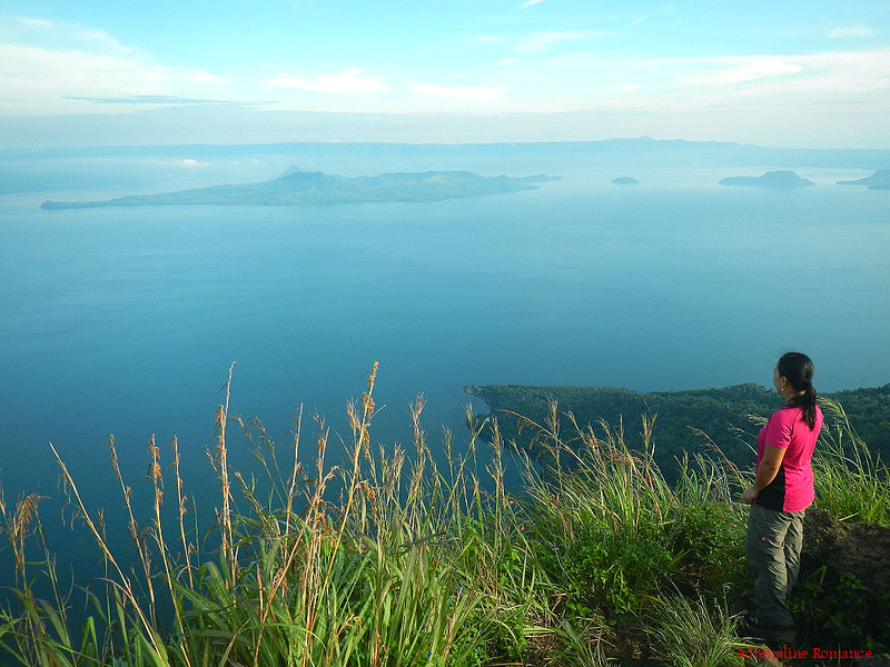
After checking our surroundings, we quickly agreed that Mt. Maculot indeed offers some of the best vistas we have ever seen.
That’s Volcano Island in the distance, which looks so peaceful—almost like a sleeping child. With this serene scene, it’s almost hard to believe that most of Taal Volcano’s modern eruptions have occurred there.

From the summit, we could also see Balayan Bay. At this viewpoint, the land that divides both bodies of water looks slender. In reality, however, the land is vast and would most likely take an hour or two to traverse that distance.
Those moss-covered trees do look creepy! That’s the entrance to the Grotto, an exit trail that leads to the other side of Mt. Maculot. We would like to traverse this trail someday. According to online sources, some parts of this trail requires the use of fixed ropes to safely ascend or descend. That should be quite exciting.
With the sun getting higher and hotter, it was time to leave the exposed peak and back into the shady refuge of the mountain’s jungle. The descent was a bit more challenging than the ascent as the slightly muddy trail made everything slippery.
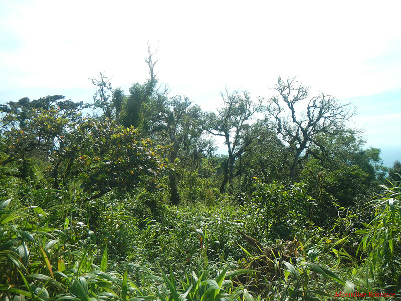
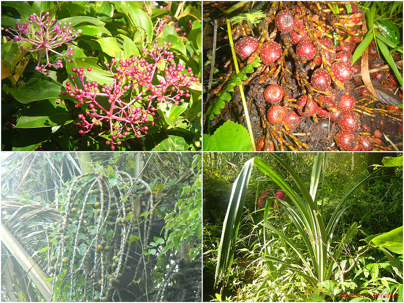
Strangely formed tree branches reach out to the sky. Those nooks and crannies make perfect homes for birds, insects and other organisms.
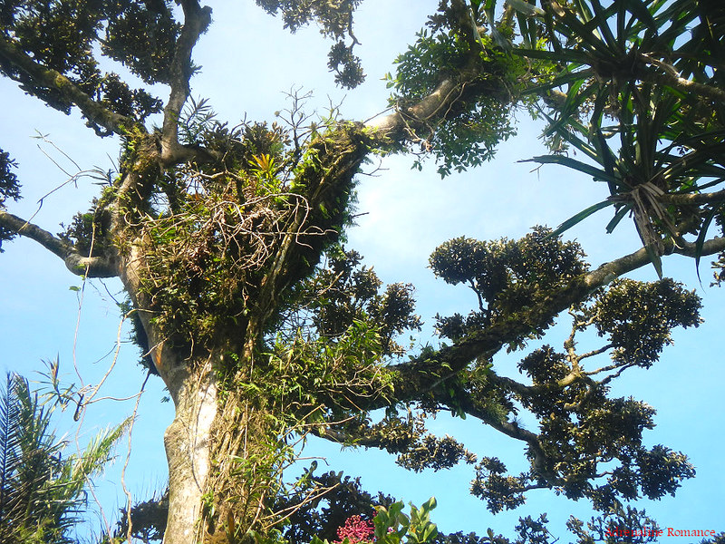
We also saw various strange—nuts? Fruits? Berries? Legumes? We’re not sure; the mountain holds a lot of secrets.
We had to be careful when we trekked down as vicious plants armed with saw-like leaves grow uncomfortably close to the trail. A scrape or puncture from the leaf blade can be quite painful.
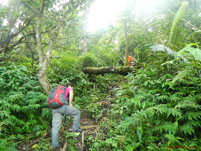
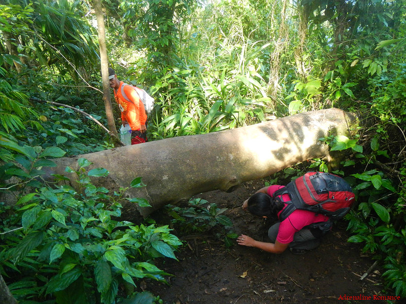
The trail is sometimes blocked by obstacles such as this fallen tree. Whether you go around it, over it, or under it, it’s up to you. Every problem has a variety of solutions anyway!
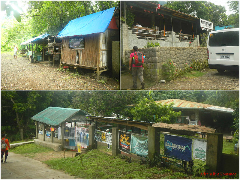
We walked rapidly down the trail once it leveled off. In no time at all, we were back at 7-11, which was now open. Now, looking at the photo below, you now understand why this is called 7-11. This small store in the middle of nowhere sells soft drinks, alcoholic beverages, snacks, candies, cigarettes—any merchandise that you can find in sari-sari stores. But items here are sold twice or even thrice the price.
Which made us wonder, how in the world did the sellers bring all those merchandise up here? That must be hard labor! And we dread to think where all that trash goes; we hope they are disposed properly.
On a personal note, while these “mountain stores” offer unprecedented convenience for hikers, we are not advocates of their presence. They diminish an important essence of mountaineering, which is conquering your limitations with basic gear and your wits, skills, and determination. This includes shying away, for the time being, from modern conveniences.
In addition, these mountain stores are alien structures in the wild. The convenience they offer attracts too many people who, oftentimes, spoil the unique, quiet and spiritual experience that mountaineers seek.

After taking a 5-minute rest at 7-11, we continued our descent. Check out the soil; the red color means that the mountain is rich in iron deposits.
We just had to pause for awhile to let the meaning of this vista sink in. Just check out the diminutive size of the town compared to the gigantic slope of Mt. Maculot. For us, this is a very poignant view of just how unimaginably big Mother Nature is compared to the man-made structures we are so proud of.
Sometimes, we can say, “How dare we to destroy nature just to give way to our greed.”

Roots and moss-covered rocks covered the trail, so we had to watch our step as we made the descent. Thankfully, we have re-entered the forest, and the shady canopy protected us from the brunt of the sun’s heat.
The empty rest stations that we passed by were now manned by locals who sell buko juice (coconut water mixed with milk), soft drinks, and snacks to weekend trekkers.

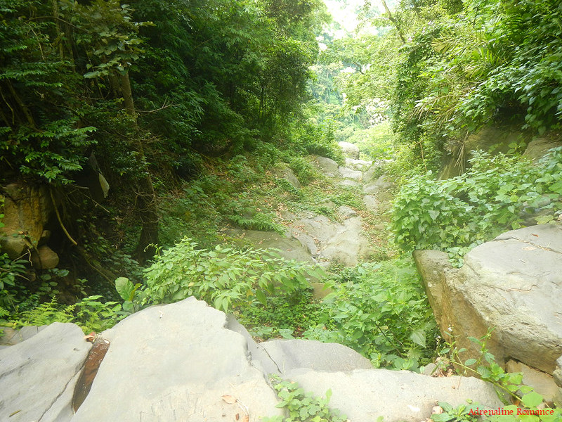
Near the end of our trek, we found this dry riverbed. Judging from the steep drop-offs, we reckon that this river must have had a series of powerful waterfalls.
Finally, after 6 hours of trekking, climbing, and enjoying the beauty of Mt. Maculot, we were finally back at where we started. Several houses, stores, and establishments along the way offer cool showers for hikers after a hike up Mt. Maculot.
Thank you for letting us visit your sacred slopes, Mt. Maculot! We will be back to discover more of your wonders. We still have to check out that Grotto trail!

Kapusod Treehouse
After ending our Mt. Maculot climb with a refreshing, cold shower, we headed to the neighboring municipality of Mataas na Kahoy to have a filling lunch. Then we headed to our very cool accommodation in the barangay of Kinalaglagan, a place called Kapusod Tree House.
It is actually a very humble and rustic resort with open-air nipa-and-bamboo cabanas for rooms. All the cabanas are situated in a carefully manicured garden. But that’s not the best thing about Kapusod Tree House.

That incredible scenery makes this resort a very special place. The facility is right at the edge of Taal Lake!
We saw Volcano Island and the surrounding peninsulas and bays. We saw local fishermen plying the waters of the lake in the hopes of catching something for dinner. Everything was suspended in surreal peace.
Taal Lake has one of the most most magnificent and fiery sunsets we have ever seen. We bade the sun goodbye and welcomed the starry night.
Our morning climb up enchanting Mt. Maculot was a great starter for our Batangas-Cavite adventure. It was here where we found another piece of wondrous beauty that effortlessly shows just how beautiful our country is. At the top of the Rockies and Mt. Maculot’s summit, we re-discovered how trivial we are under Mother Nature’s shadow. At the same time, we realized how important our role is in preserving her beauty.
Special Thanks
We would like to thank Sir Edwin Tripuli who led us safely up and out of Mt. Maculot. He is a model guide who made our climb fun, wholesome, and safe.
Itinerary
9:30 PM – depart Cebu airport, fly to Manila
10:30 PM – arrival at NAIA, ride jeep to Roxas Boulevard and Pasay crossing
11:00 PM – ride jeep to Buendia, take bus to Cuenca, Batangas
12:30 AM – depart for Batangas
3:00 AM – arrival at Tambo Exit, take early breakfast
3:30 AM – ride jeep to 7-11 in Cuenca, take tricycle to barangay outpost
4:00 AM – arrival at barangay outpost, registration, secure guide
4:30 AM – arrival at jump-off, start trekking to the Rockies
6:00 AM – arrival at Rockies, take photos
7:00 AM – leave Rockies, start trek to the summit
8:30 AM – arrival at summit, take photos
9:15 AM – start descent back to jump-off
10:30 AM – arrival at jump-off, shower and freshen up
11:00 AM – ride tricycle to Lipa
11:15 AM – ride jeep from Lipa to crossing of Mataas Na Kahoy
11:45 AM – ride jeep to Mataas na Kahoy
12:30 PM – arrival at Mataas na Kahoy, take lunch, ride tricycle to Kapusod Tree House
1:30 PM – arrival at Kapusod Tree House, relax
Estimated Budget*
- P 7.50 per pax – jeepney from NAIA to Roxas Boulevard-Pasay crossing
- P 7.50 per pax – jeepney from Roxas Boulevard-Pasay crossing to Jam Liner Bus Terminal in Buendia
- P 124 per pax – bus fare from Buendia to Tambo Exit, Cuenca
- P 7.50 per pax – jeep fare from Tambo Exit to 7-11 in Cuenca
- P 20 per pax – tricycle fare from 7-11 in Cuenca to Barangay outpost
- P 20 per person – registration fee
- P 15 per person – shower fee (if you wish to take a shower after the climb)
- P 20 per pax – tricycle fare from jump-off to Lipa
- P 18 per pax – jeep from Lipa to Mataas na Kahoy crossing
- P 8 per pax – jeep from Mataas na Kahoy crossing to town center
- P 80 per tricycle – Mataas na Kahoy town center to Kapusod Tree House
Guide Fee
- P 500 per 5 people – guide fee from jump-off to Rockies (P50 per excess person)
- P 50 per person – additional fee for Mt. Maculot summit
- P 1,000 per 5 people – guide free for Mt. Maculot traverse (P100 per excess person)
- P 800 per 5 people – overnight camping fee (P100 per person)
* We did not include our expenses for snacks, souvenirs, tips, and other fees in this rate sheet as you may have different needs, preferences, itineraries, and sharing scheme from us. Note that all figures are subject to change without prior notice.
Tips
1. Take note of the important numbers below
- Cuenca Police Station – (043) 342-9952
- Barangay Outpost – 0910-317-2853
2. The trail to the mountain’s shoulder is easy but relatively steep. Be careful of loose soil and mossy rocks as they tend to be slippery. Take extra care when hiking during rainy season as the trail can be muddy. Wear trekking shoes or sandals with an aggressive tread. You will need a lot of traction since you will be scrambling over loose soil and slippery rocks.
3. The trail from the campsite to the Rockies is characterized by steep declines and inclines. Take extra care and use the fixed ropes. Climbing up the Rockies involves some scrambling up huge boulders. Take time to ensure your grips and your footholds are secure as you scramble up.
4. Be very careful at the Rockies itself as the area is surrounded by deep ravines at all sides. Avoid standing at the edge of the Rockies; a hiker died here when he lost his balance. Straddle the rocks if needed so you can secure yourself.
5. Mt. Maculot is a very popular mountain, but this popularity has its drawback. It has become very commercialized, and with relatively minimal LGU control, the huge influx of hikers visiting the mountain has become unabated. Do your share to reduce environmental impact by keeping your group compact; we recommend 5 people at most. Remember to bring down your trash; it does not belong to the mountain.
6. To avoid large numbers of hikers, climb the mountain on weekdays or early in the morning.
7. As mentioned in the blog, we do not recommend buying refreshments at the mountain stores. Aside from being overly expensive, purchasing from them would increase commercial activities on the mountain. This will have negative effects in the long run as commercialization destroys the environment, increases trash, decreases self dependence, and invites less-than-desirable individuals.
8. Many parts of the mountain is exposed to the sun. Thus, don’t forget to bring a wide-brimmed hat, scarf, or umbrella to protect yourself from the heat. Don’t hesitate to tell the guide to stop if you feel exhausted.
9. Wear arm guards and trekking pants to protect your skin from the sun and prickly plants. Also, a dry-fit shirt or rash guard will help keep you cool.
10. Bring salt tablets or ion-filled beverages such as Gatorade, coconut water, or fruit juice aside from water. The hot sun, multiple ascents, and exposed trails can make you sweat a lot. When you lose enough ions and salts via your sweat, cramps will occur. If cramps happen, rest for awhile, drink a lot of water or ionic drinks. This will replenish the ions in your system. Bring energy-rich trail food such as nuts, crackers, bread, and bananas. Don’t underestimate the mountain.
11. Pack light but do bring the following:
- water (at least 2 liters)
- proper trekking attire (dry-fit clothes, trekking pants, etc.)
- trekking shoes or sandals with aggressive tread
- umbrella, hat, or scarf (some parts of the terrain are exposed and hot)
- trail snack
- rain gear (in case of bad weather)
- extra money for emergencies
12. Don’t forget to waterproof your belongings. You can do this easily by wrapping your stuff with plastic bags or zip-lock bags before putting them inside your pack.

wOwwww am soOo overwhelmed to see this post! I truly admire people like you who have no qualms in climbing those steep. Just looking at those pictures of the summit make my knees quiver heheh
Hi Aidirenr79,
Thank you very much for the compliment. Yup, it’s knee trembling in that part of the Rockies, but don’t worry. With extra care, you can do it! In fact, you’ll be rewarded with a fantastic view for your courage! Hehehe!
stunning view up there. 🙂 so WOW!
We definitely agree! It’s breathtaking!
Another great experience of yours po. Question? I have back surgery (lumbar), do you think I can make that one? hehehehe
Hi Lovekoanawangin,
Hey, how are you? Long time no hear. 🙂
Regarding your question, the climb is quite easy. We think you can make it despite your condition, but we strongly recommend you check with your physician first.
Awesome Sir!
Thank you very much! Mt. Maculot is a beautiful mountain. 🙂
A quick note lang po. Regarding Victor Ayson’s death, initially pinalabas na nahulog sya sa Rockiee then after a year, binuksan ulit ang kaso and it turned out that je was killed. Ninakaw ang mga gamit nya. Nag solo climb kasi sya.
Hi Adelle,
Hala! Really? Can you send a link to the findings?
Here: http://www.rappler.com/nation/55685-nbi-reopens-case-mountaineer-victor-ayson
http://news.abs-cbn.com/nation/regions/05/02/14/nbi-mountaineer-may-have-been-murdered
May foul play po na naganap.
Here:
http://news.abs-cbn.com/nation/regions/05/02/14/nbi-mountaineer-may-have-been-murdered
http://www.rappler.com/nation/55685-nbi-reopens-case-mountaineer-victor-ayson
May foul play po na naganap.
Thank you for this link and info. But the news says that foul play MAY have been a factor. Which means, it is a possibility, but not a definite cause of his death.
very informative. the best maculot climb blog i’ve read.
Hi Rozanne,
Thank you very much for the compliment. 🙂
hello miss adrenaline romance!!! lovely and informative!!!! can you please provide sir edwin’s number? thanks in advance!!!
Hi Girlie,
Thank you for the compliment. Actually, we tried to ask for his number too, but he said it’s not allowed. The Cuenca barangay officials are the ones who will assign guides to hikers who plan to climb Mt. Maculot. Thus, the selection of guides is random.
Don’t worry. Once you register at Cuenca, you will be assigned a guide. 🙂
Good read sir! I’m really looking forward to go here kahit alim pa ang chance because of work scheds pro I want to push it! Thanks for sharing!
Thank you, the dorzfallac! Please do climb Mt. Maculot. It’s a beautiful mountain. We recommend you climb it during weekdays or early in the morning so you can avoid the large crowds. 🙂
The guides are always available ba sir or do we need to contact them mga days before the trek? I mean the barangay.Do you have contact number of Sir Edwin? Para legit jud sir because na try na ninyo hehe…
Hi TheDorzFallac,
Don’t worry about the guides; they are always available. The barangay will assign you a guide once you register. They don’t give out their phone numbers for private guiding because they take turns in guiding; they have a “line.”
salamat sir! 🙂
*slim
[…] Mt. Maculot: Listening to the Whispers of Mother Nature / adrenaline romance […]
tour guide po ng maculot pls contact me 09163722649
Looking for a tourguide???come climb with me and experience the beaty of nature in Mt.Maculot…just contact me po…John Paulo Malate (09269960145) at your service.
(Mt.Maculot tourguide)
See you guys…godbless!!!
mark joseph hirao local tour guide po ng maculot pls contact me for more info 09366875962 🙂