Where can you find a nice, challenging weekend climb without draining your wallet? A mountain in Cebu where you can have a stunning 360-degree view of the highlands and the city at the summit? A hike that takes you to different kinds of scenery? A place where you think you’re in New Zealand? Is it a place that sounds too good to be true? Nope! Such a place exists in Cebu, the strangely named Mt. KM 28 in the highlands of Toledo.
Mt. KM 28, colloquially called Kalbasaan, is a grassland mountain at the outskirts of Camp 8 in the municipality of Toledo. It is the green and scenic playground of the local Body and Soul Outdoor (BASO) team of which our good friend and rock climbing guide, Sir Enie Yonson, is a part of. This lovely mountain has been in Team Sweetie’s cross-hairs for quite sometime.
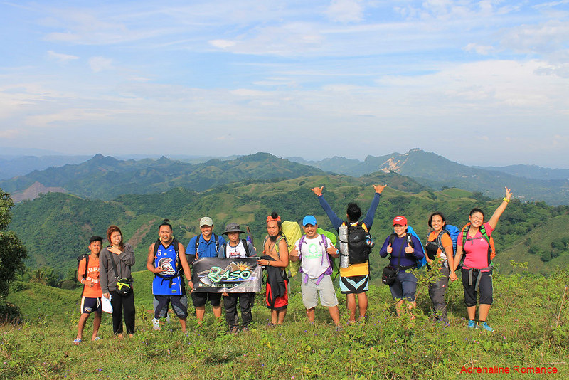
Sir Enie and the BASO team was kind enough to accommodate us when we expressed our desire to climb Mt. KM 28. Along with us in this weekend adventure was our daughter Alexa (this was her second mountain climbing experience) and good friends Lorraine (this was her first camping experience) and Halourd.
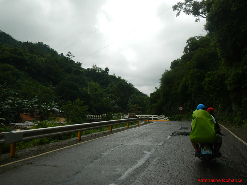
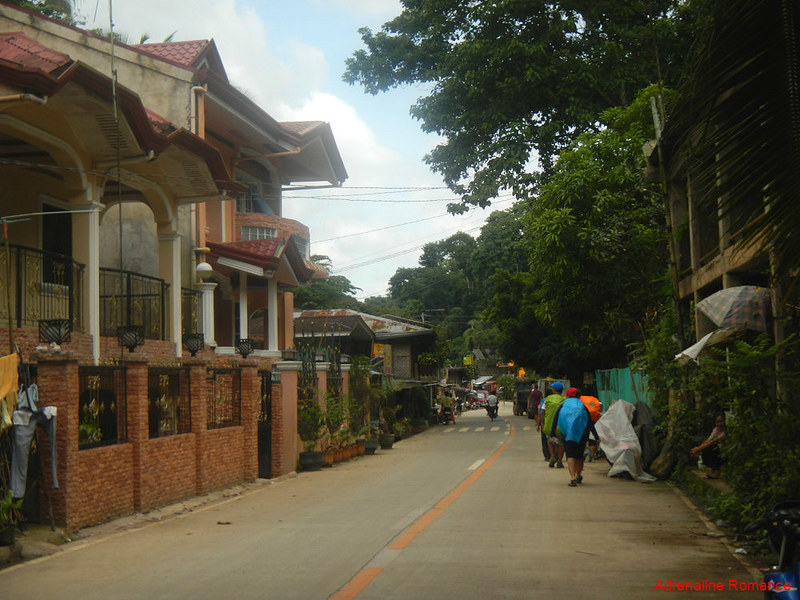
It rained hard when we arrived in Silangan, Cantabaco. But rather than curse the unexpected arrival of bad weather, we simply helped ourselves with freshly grilled barbecues from a local stand. Better fill our tummies with delicious food than fill our heads with anger.
It didn’t take long for the rain to abate. When the rain slowed down to a faint drizzle, we flagged down a few habal-habals to take us to our jump-off point in Campo Otso (Camp 8).
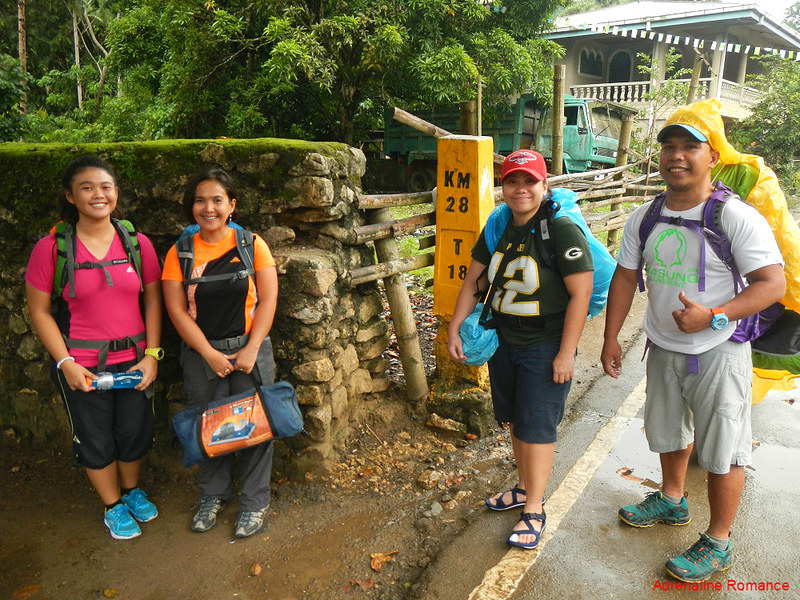
Sir Enie and the rest of the BASO mountaineers were already at the jump-off, buying a few vegetables and ingredients for a hot, spicy tinola that they plan to cook at the campsite. The rest of us repacked and waterproofed our stuff and did some last-minute adjustments.
Now, you may ask why this mountain was given a strange name. Well, Mt. KM 28 does not mean that it is a mountain that is 28 kilometers away. It’s simply a mark on the marker post at the jump-off; this point is 28 kilometers away from the Cebu Capitol. Got you!
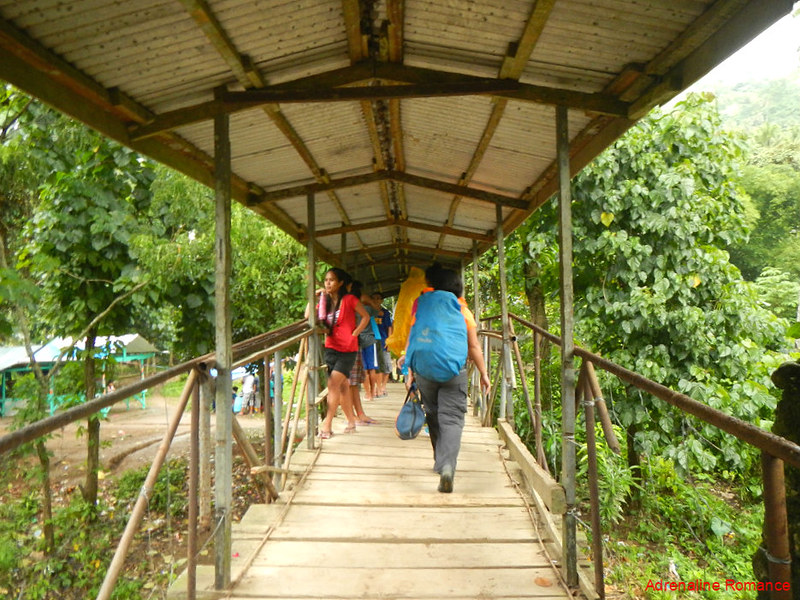
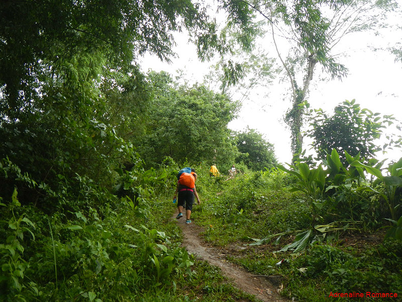
After a short briefing from the BASO team, we crossed the village’s rickety wood-and-iron bridge and started our trek to the top of Mt. KM 28.
The first part of the trek involved a steep climb up concrete steps that are affixed on the mountain’s slope. Our legs immediately began to groan in protest; we have a love-hate relationship with this kind of artificial feature. We are used to walking on steep dirt trails, and although these concrete steps make the ascent easier, climbing them is painful to our feet.

The ascent continued for more than an hour, but thankfully, the concrete steps disappeared and gave way to a muddy dirt trail.
The heavens opened up again, but the rain god only took a peep. Moisture hung heavily in the air, coating us with a refreshing film of water but not enough to drench us. With the fresh mountain air blowing around us, the feeling was totally refreshing.
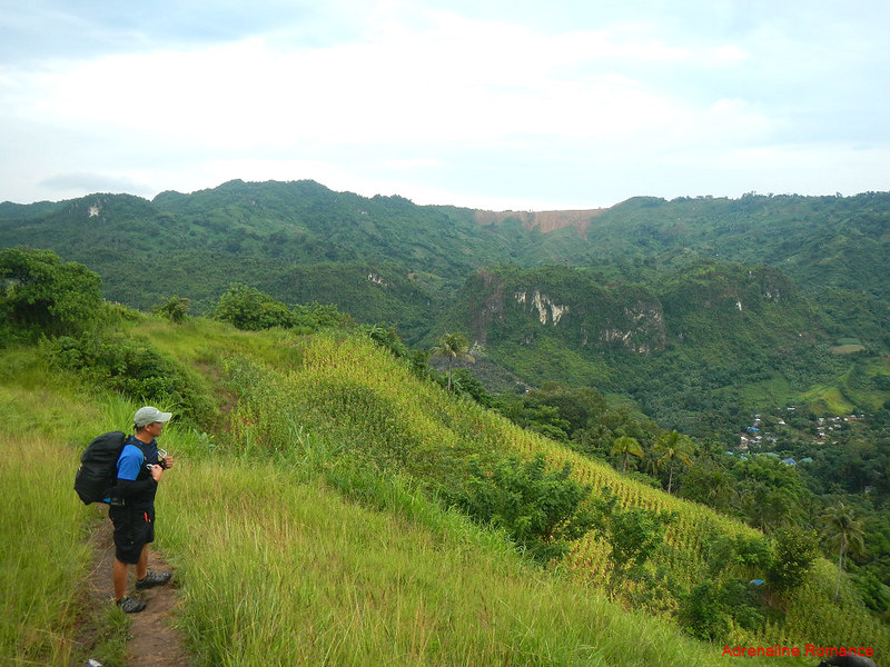
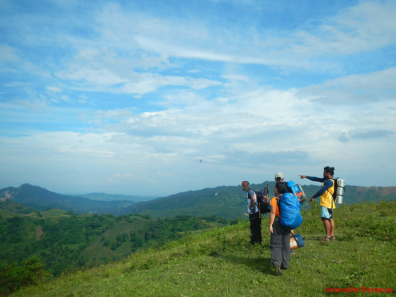
Let’s rest for a little while, shall we? On top of the hill, the surrounding views of fertile farms and verdant mountains unraveled before our eyes. Check out that wonderful view.
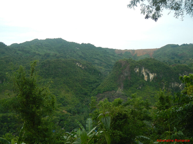
From our first rest stop, we could make out two interesting sights. One is the brown scar of a mountaintop caused by the massive mining operation nearby.
The other more interesting one is the large forest-covered karst formation less than a kilometer from the village. It looks like a beautiful candidate for the development of a rock climbing crag!
Look at Lorraine’s and Alexa’s happy faces. Obviously, they were enjoying the climb.
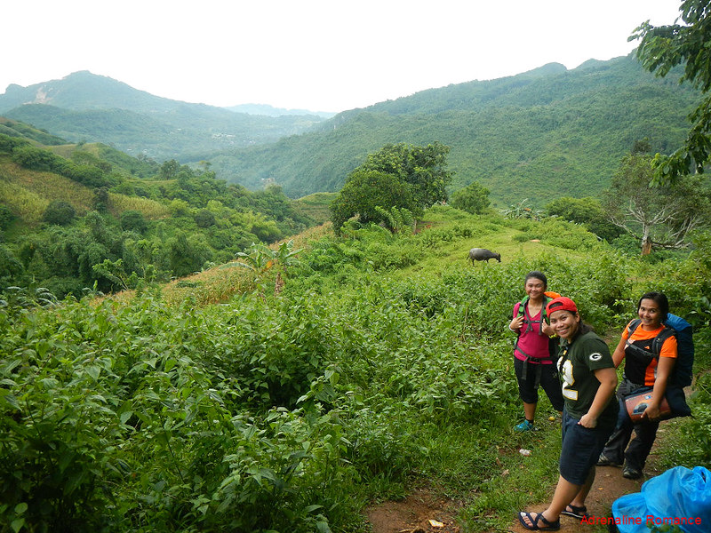
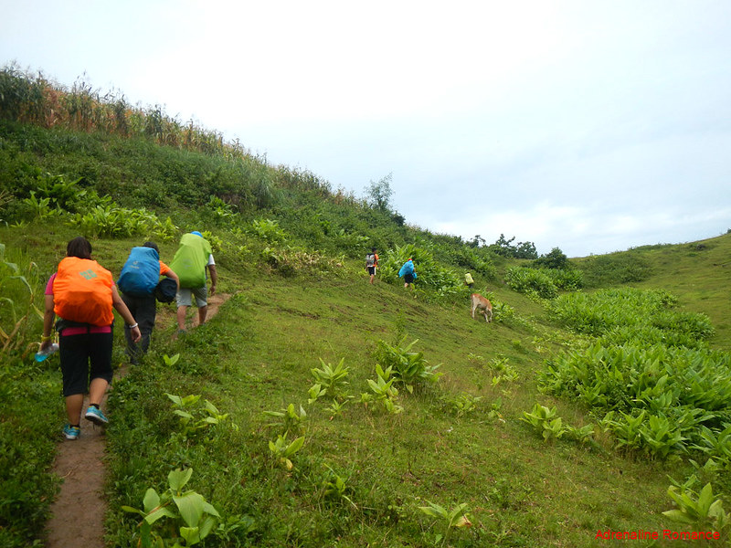
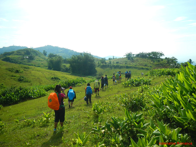
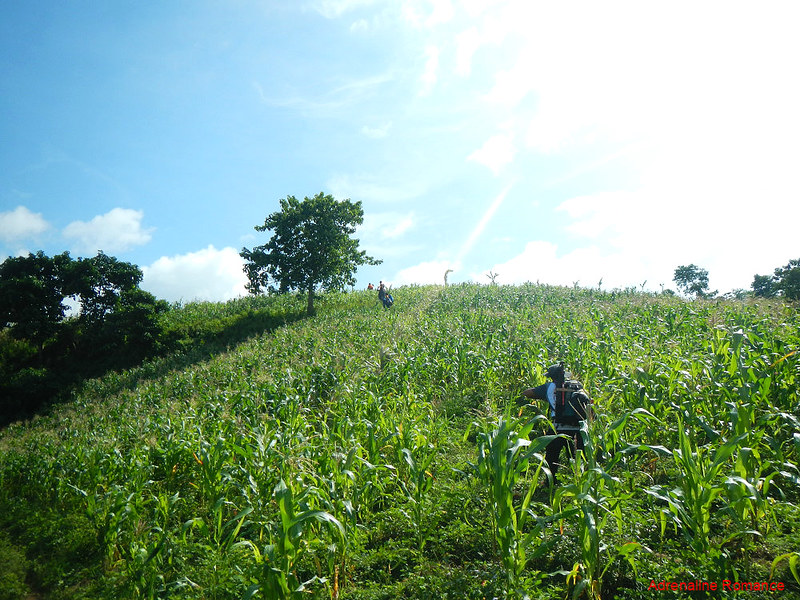
As we climbed higher, the view gave way to green farms that cover the entire mountainsides. Local farmers prefer these places, especially those that are far from the sea, as mountain slopes are covered with fertile topsoil.
Chest-high cogon grass covers the mountain with an everlasting carpet of green. It’s best to wear arm guards here; the blades of cogon grass are quite sharp. Check out the scale of the climbers against the slope.
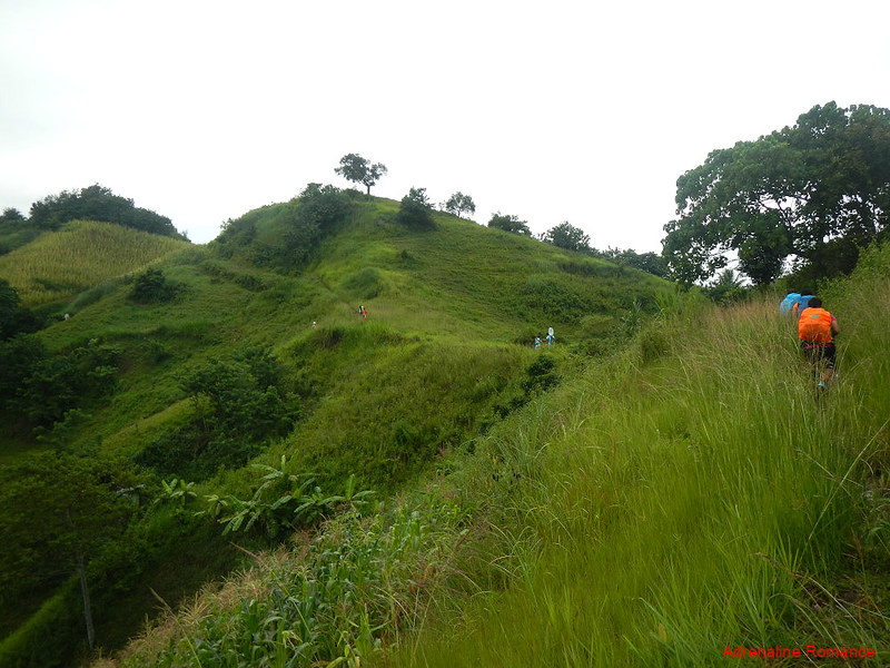
It took us almost two hours to complete the ascent. In actuality, we could have done in one. But if we did, we could not have truly enjoyed gorgeous views like these. Despite our camaraderie, the adventure was characterized with long moments of silence, and our team simply drank in the beauty of the place.
Being the fastest in mountaineering is not the point. Climbing mountains is not a race. It is not a contest about who is strongest, fastest, most experienced, or most skillful. Rather, mountain climbing is an enlightening, spiritual experience that reconnects you to yourself and to the earth.
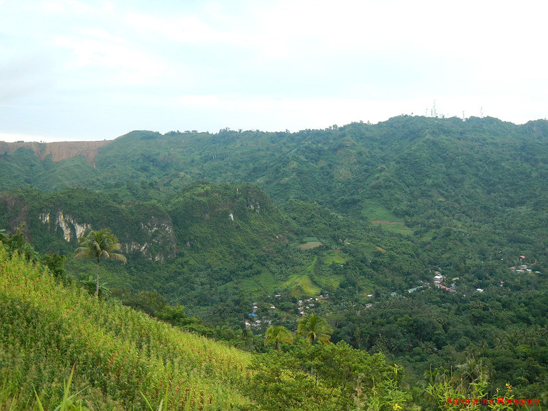
Far below us was the small farming town of Camp 8 where we started this weekend adventure. Also, check out that collection of massive antennas on top of the mountain across us. Sir Jocrose explained that it’s a communication relay station for aircraft heading to and flying away from the Mactan International Airport.
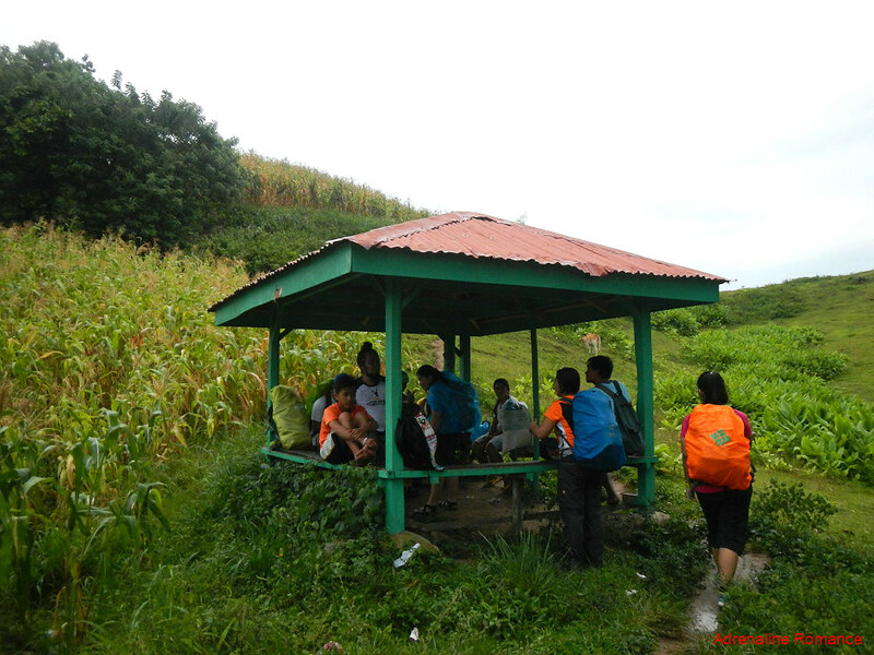
Halfway through the climb, we rested in an open-air shed that was built to shelter local farmers who are working in these vast fields. Rests like these are very welcome in the world of mountaineering.
The shed also marked the start of barangay Kalbasaan where the peak and campsite of Mt. KM 28 is located.
After rehydrating ourselves, we were on the trail again. The sun has already started its downward journey, and we want to be in the campsite before the light disappears.
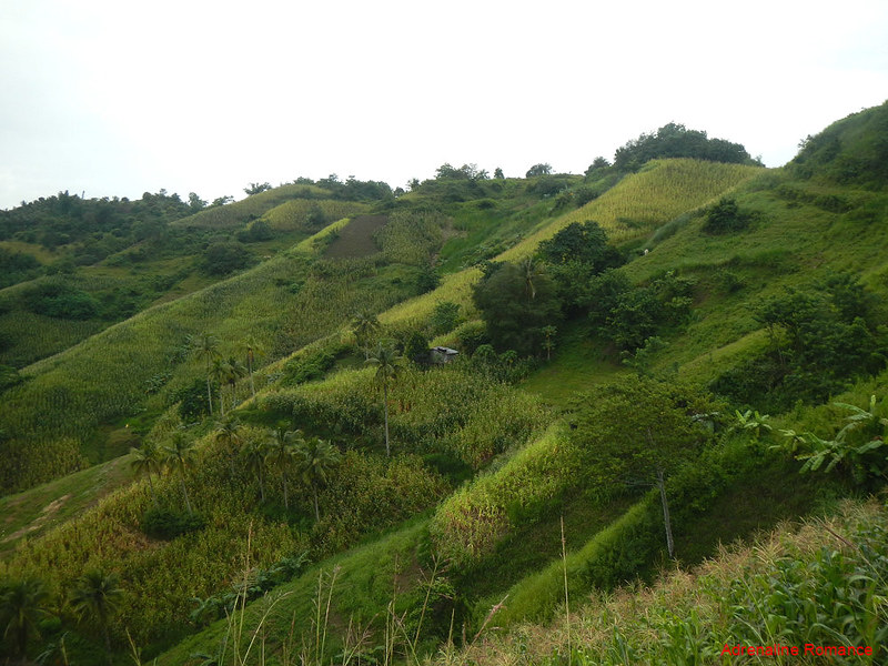
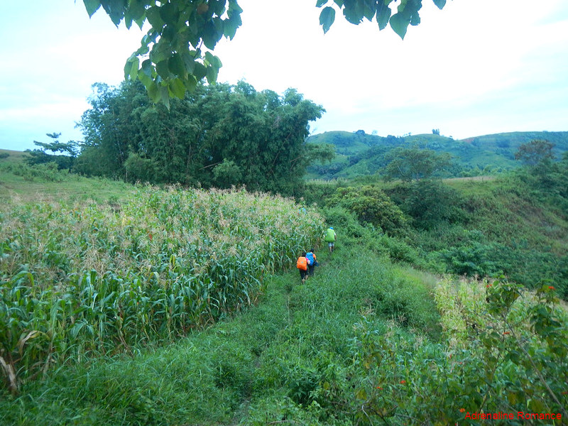
On our way, we passed by healthy cornfields that stretch for acres. You got to admire the local farmers’ industriousness in growing, taking care, and harvesting these crops, which are then sold at the market. The profit margins are so thin that we find the pricing really unfair considering the immensely hard work farmers do to raise the crops.
When we climbed Mt. KM 28, the mountainside seem to be utterly devoid of humans although signs of human presence were all around us. Few denizens, such as this cute kid and its mother, shared the trail with us.

Let’s hasten up a bit, shall we? The vibrant colors of the afternoon began to mute as the sun sank deeper into the western horizon. It was a good thing that we were walking on rolling terrain; there were no steep ascents to hamper our speed
See that small grove on top of the hill on the horizon? Yes, center right of the photo below. That’s our campsite.
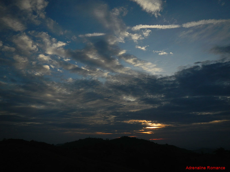
The darkness of true evening fell on us as we started the last assault. But that was okay because the combined illumination of soft skyglow and the pale light of the half moon above us lit the trail in front of us. In fact, we didn’t turn on our headlights, relying on our natural night vision, until we arrived at the camp.
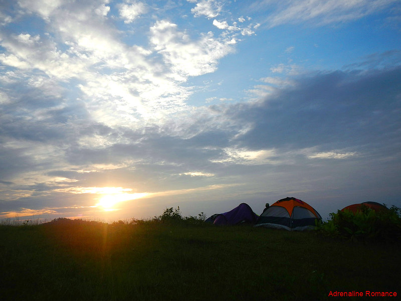
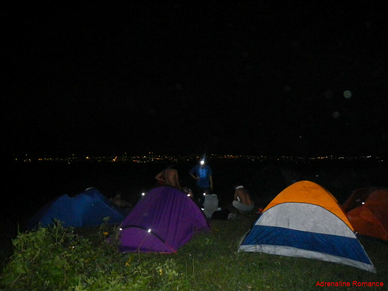
At 7 PM, three hours after we started the climb, we reached the summit of Mt. KM. 28, around 700 MASL. We congratulated ourselves and started to pitch our tents.
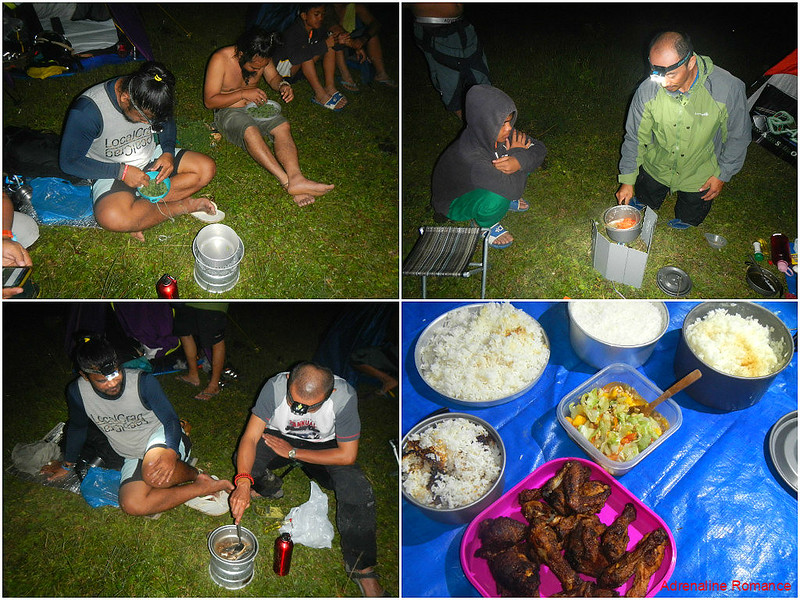
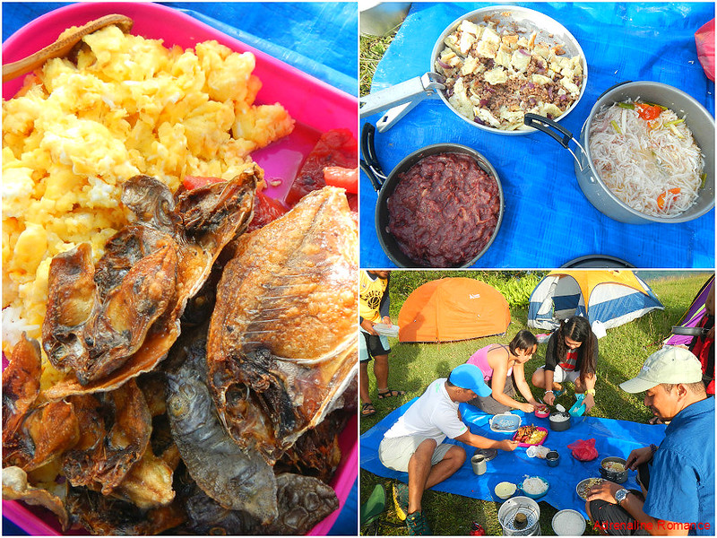
For some reason, preparing dinner is more fun up in the mountain. The taste seems to be magnified ten times in the campsite. Yes, the food seems more delicious when eaten outdoors.
Oh, the tinola was not included in the photo. Hehehe!
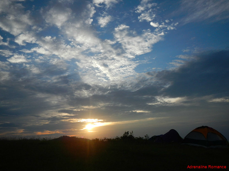
After dinner, the BASO team enjoyed shots of rum while the non-drinkers enjoyed a great view of the glittering southern city of Naga far below us.

Early the next morning, we woke up to an amazing sunrise and a brand new day full of promise and hope. Here in the mountains, sunrises are all different, and each of them are indescribably beautiful.
In life, it isn’t night all the time. Darkness does not always prevail. Hope and change happen as surely as the sun rises every day.
One by one, starting with Sweetie and me, everyone crawled out of their tents, stretched their limbs, and greeted each other good morning. We started boiling water for coffee, the best starter of any day. Check out the carpet-like grass.

Sir Enie and the rest of the BASO team prepared breakfast under the rising sun’s soft rays. If you’re wondering why some of them are wearing jackets and sweaters, it’s because the morning air is quite chilly.

While the rest of the team prepared breakfast, I took the time in taking photos of the surrounding areas. The campsite of Mt. KM 28 is the perfect venue as it offers an encompassing 360-degree view. Here’s a photo of the northern hills beyond the campsite.
We can see more mountain ranges at the south of Mt. KM 28. The faraway pointed peak at the center left of the photo is Mt. Naopa, and the BASO team mentioned that there is actually a trail here that leads to the latter mountain.
We could also see another massive subsoil scar—the presence of a massive excavation—on a faraway mountain range.

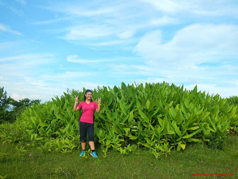
What kind of bushes are these? They are all around the campsite, forming a protective barrier against minute gusts. Check out their giant leaves.
West of the campsite, we can see where we came from. Hectares upon hectares of farmlands look like chalkboards plastered all over the hills. Beautiful, isn’t it?
Also, notice the groves of trees that break the monotony of the farms. Those groves act as property markers for local farmers.

“Breakfast is ready,” Sweetie and Enie announced. Whoopee, we love the most important meal of the day. And it’s even better when taken early and up in the mountains with the beauty of Mother Nature all around us.
We ate scrambled egg, fried dried fish, corned beef, misua stew, and a signature BASO dish made of ground pork and eggs. Yummy!
After a hearty breakfast, we disassembled our tents and packed up our things. But before we left the site, BASO pointed out some of the interesting landmarks and locations around us. What a great start for a fun-filled Sunday!
We started our descent before the sun scorched the summit. Thank you for allowing us to stay in your bosom, Mt. KM 28. We will surely visit you again.
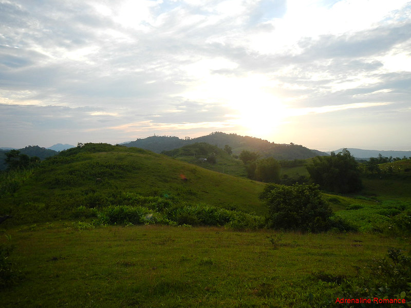
Is this a vast, green meadow in New Zealand? No, that’s a lovely grass-covered hill in Kalbasaan. As the sun rose higher, locals headed into the open to have some fresh air before doing their daily duties.

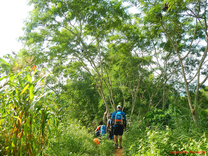
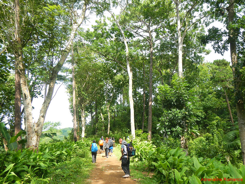
Although most of the mountain is made of natural grasslands or plowed to make way for farms, there are still snippets of light but lofty woods such as these. Their canopies shielded us from the glare and heat of the morning sun.
But at times, we had to suffer. Short but steep uphill climbs in super-exposed farmlands slowly but surely sapped the full breakfast sitting in our tummies. Sweat started to pour out from us in rivulets and later, in sheets.
After trekking for more than an hour in rolling, exposed terrain, we saw huge trees with vast canopies. Compared to the exposed farmlands and grasslands, the air inside this forest is noticeably cooler.
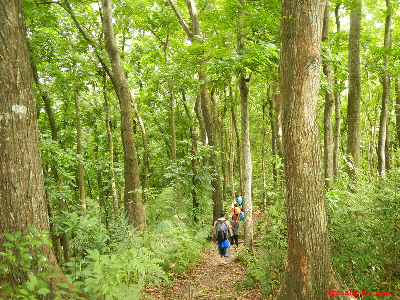
The thick forest, which was the last stage of this adventure, is part of a successful decades-long reforestation project initiated by the Region 7 Department of Natural Resources. If you remember correctly, this is the same forest which we went through during our White Cave adventure several years ago.
Although the trees are not endemic to Cebu, the Campo Siete forest is now host to various endemic birds, reptiles, insects, and plants.
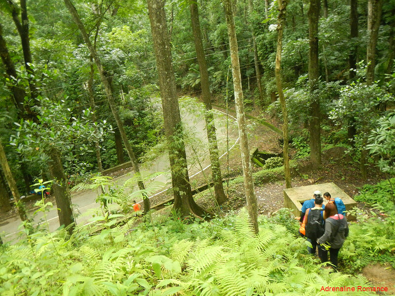
At last, after more than three hours of hiking through hot farmlands and green jungles, we finally saw the familiar sight of civilization—the Manipis road. We can also hear familiar sounds of a Sunday morning—a solemn sermon of a Sunday mass, the laughter of children, and the cock-a-doodle-dooos of roosters being readied for a derby.
After a five-minute rest, we walked along the road and arrived at the town of Campo Siete. We rewarded ourselves with cold Coke and crackers while the others enjoyed a gelatin dessert. All was well!
Going Down in Style
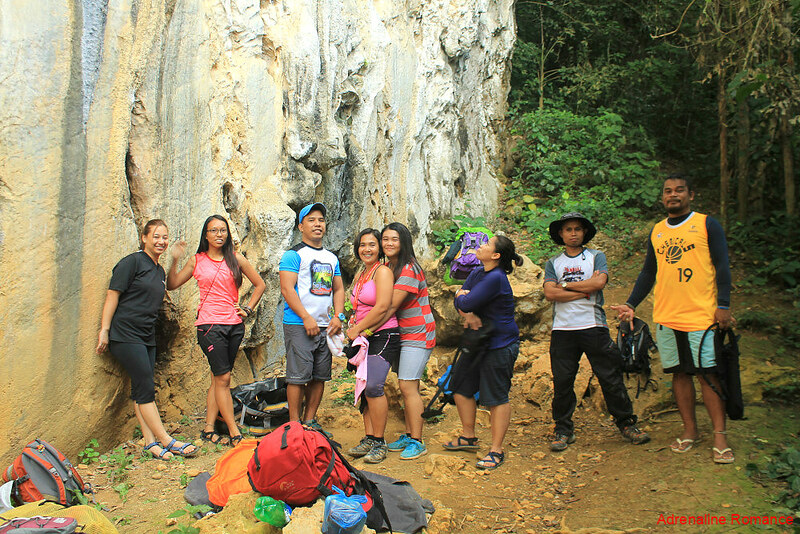
But our adventure was not over; it’s as if the hiking and camping in Mt. KM 28 was not enough to satiate our thirst for adrenaline. Thus, after taking our lunch below the cliffs of Cantabaco, together with our friends Apol and Mai-mai, we set off for another adventure.
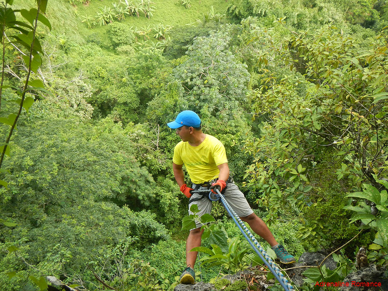
But first, we need to climb some rough, slippery rocks without safety equipment.
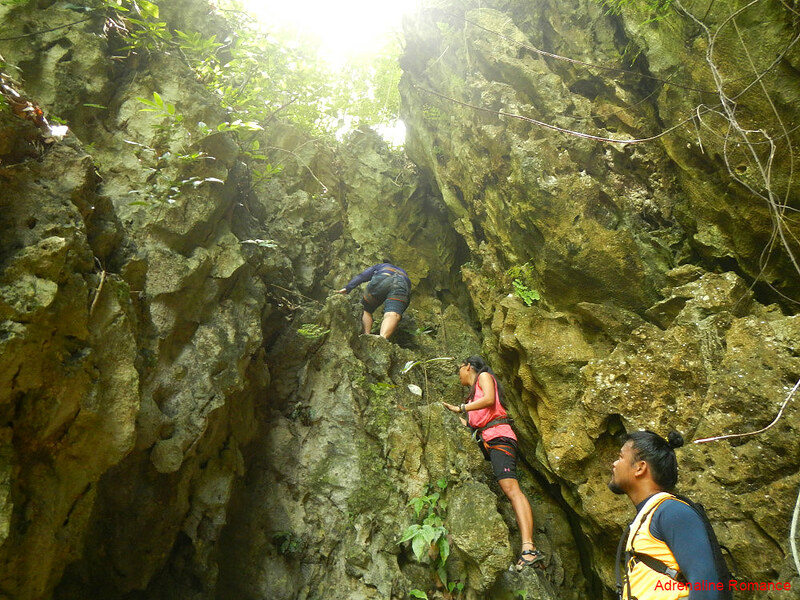
After almost an hour of scrambling and fighting against thick shrubs, vines, and thickets that now crisscrossed across our trail, we arrived at our destination—a small nook more than a hundred feet high at the side of a cliff.

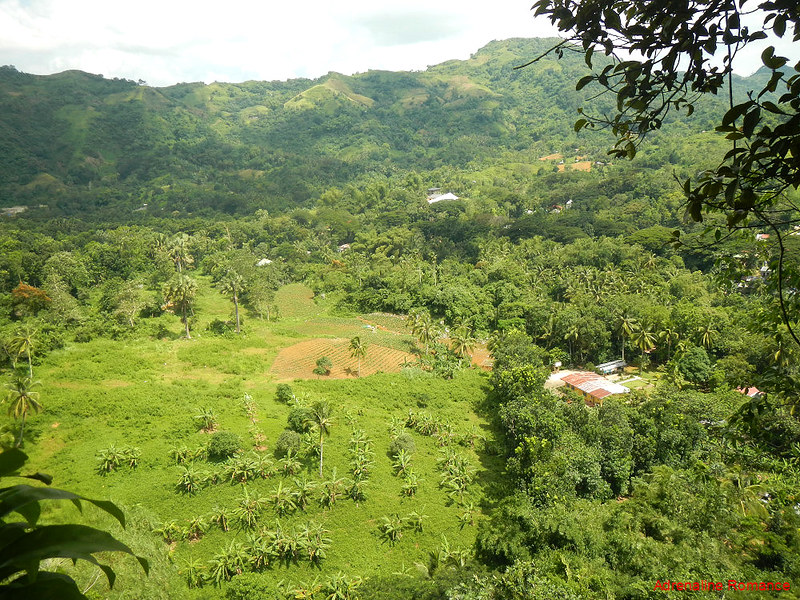
From this vantage point, we saw a stunning view of farmlands and mountains. We never get tired of quietly enjoying rural vistas such as these. The calming green of Cantabaco’s valley is a stark contrast to the chaotic and choked concrete jungle of Cebu City.
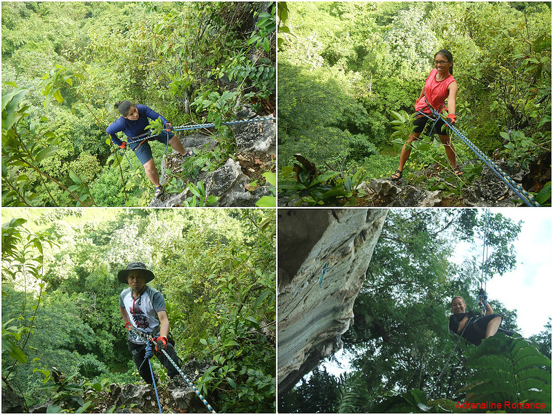
While we were busy chatting and laughing, Sir Enie quietly set up an anchor. As the rappel system took shape, everyone gradually became deathly quiet due to anxiousness, much to Sir Enie’s amusement. It was Mai-mai and Lorraine’s first rappelling experience, and they were visibly nervous. Although Apol has rappelled with us before, it was her first time abseiling from such an immense height.
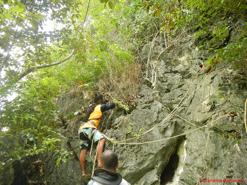
Normally, we would rappel using a single rope. But for safety, a second line was attached to our harness. Sir Enie would belay from above so that if something untoward happens, he could catch the falling jumper.
“Let’s go!” Everyone had pangs of nervousness as one by one they descended down the sheer cliff. Remember, that’s a hundred-plus fall if things go wrong (knocks on wood).
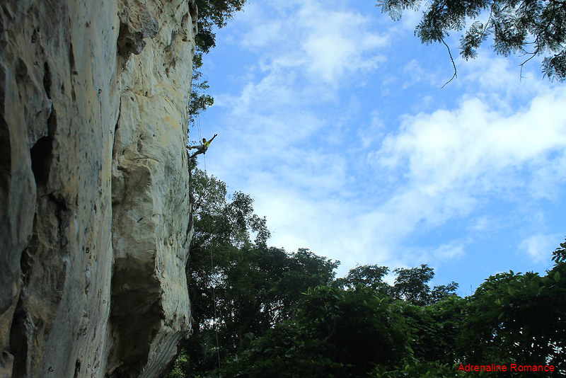
But of course, mixed with fear is the feeling of heart-pounding excitement. It’s not every day where you can pretend to be Ethan Hunt doing an impossible mission. Or Indiana Jones going down the Well of Souls.
Special Thanks
Thank you, Halourd, Lorraine, Apol, Mai-mai, Alexa, and Sir Niel for joining us in our rapelling activity. Our huge appreciation, of course, to Sir Enie who safely set up the anchors and being a wonderful guide as always.
Of course, we would like to thank Sir Enie and BASO team for letting us tag along their wonderful adventures. Thank you for guiding us to Mt. KM 28, one of the most scenic Cebu mountains we’ve ever climbed. You guys never fail to astound us with your awesomeness!
Having an exciting weekend adventure doesn’t have to be expensive. You don’t have to go far to enjoy beautiful scenery. All you need is a small purse, some basic equipment, and the company of great friends! Visit Mt. KM 28 now!
Itinerary
Day 1
1:00 PM – meet-up at Cebu South Bus Terminal
1:30 PM – depart CSBT, ride Toledo-bound bus to Lutopan
3:00 PM – arrive at Lutopan, ride habal-habal to Silangan
3:10 PM – arrival at Silangan, meet guide
3:15 PM – depart Silangan, ride habal-habal to KM 28 jump-off at Camp 8
3:30 PM – arrival at jump-off, briefing and last-minute shopping
4:00 PM – start trek to Mt. KM 28
7:00 PM – arrival at camp site, set camp, prepare dinner
8:00 PM – dinner, socials
11:00 PM – lights out
Day 2
4:30 AM – wake up, prepare breakfast
5:30 AM – breakfast, watch sunrise, picture taking
6:00 AM – break camp
7:00 AM – depart campsite, start trek to Camp 7
10:30 AM – arrival at Camp 7, finish trek
For Rappelling Activity
11:00 AM – depart Camp 8, ride habal-habal to Silangan
11:30 PM – arrival at Cantabaco Area 5, lunch
12:00 PM – ascend to staging area
1:00 PM – arrival at staging area, start rappeling activity
4:00 PM – finish rapelling activity, exit the crag
4:15 PM – habal-habal ride to Landing bus stop in Lutopan
4:30 PM – ride bus to CSBT
Budget*
- P 40 – bus fare (non-airconditioned) bus fare from Cebu South Bus Terminal to Lutopan Landing Bus Stop (same fare applies on the return trip)
- P 10 – habal-habal fare from Lutopan Landing Bus Stop to Silangan (same fare applies on the return trip) **
- P 10 – habal-habal fare from Silangan to KM 28 jump-off in Camp 8**
- P 20 – habal-habal fare from Camp 7 to Silangan***
- P 10 – habal-habal fare from from Silangan to Lutopan Landing Bus Stop
- To be negotiated – guide fee. Note that the guide fee for rock climbing/rapelling is separate from Mt. KM 28 trek
* We did not include our expenses for snacks, tips, and other fees in this rate sheet as you may have different needs, preferences, itineraries, and sharing scheme from us. Note that all figures are subject to change without prior notice.
** We stopped at Silangan, Cantabaco because we planned to meet Sir Enie and BASO there. If you want, you can arrange with your guide to meet at the KM 28 jump-off point so you won’t have to stop at Silangan. Tell the habal-habal driver to stop at the Campo Otso waiting shed. Fare should be around P20.
*** We stopped at Silangan because we planned to have a rappelling activity. You can opt to go directly to the Lutopan Landing Bus Stop if you have no plans of rock climbing or rappeling after the Mt. KM 28 climb. Fare should be around P30.
Alternatively, you can negotiate with a habal-habal driver to bring you directly to Tabunok, Talisay. Fare should be around P100.
Tips
1. For guideship services, please contact Enie Yonson at 0943- 0688985 or 0948-7124875. You can also ask guideship services from any member of Body and Soul Outdoor (BASO). Click the anchor texts to link you to their FB pages.
2. This is a perfect adventure for cash-strapped adventurers. As you can probably infer from the estimated budget above, this trek is pretty cheap. You’ll probably spend more on drinks and snacks than the actual essentials of the trip itself.
3. The trek to the campsite and summit is moderately exposed. Thus, don’t forget to bring a wide-brimmed hat, scarf, or umbrella to protect yourself from the heat. Don’t hesitate to tell the guide to stop if you feel exhausted.
4. Wear arm guards and trekking pants to protect your skin from the sun and prickly plants. Also, a dry-fit shirt or rash guard will help keep you cool.
5. Bring a lot of water because there is no reliable water source anywhere during the ascent. There is an irrigation pipe near the campsite, but the water flow is intermittent.
6. Wear trekking shoes or sandals with an aggressive tread. You will need a lot of traction since you will be scrambling over loose soil and slippery rocks .
7. Bring salt tablets or ion-filled beverages such as Gatorade, coconut water, or fruit juice aside from water. The hot sun, multiple ascents, and exposed trails can make you sweat a lot. When you lose enough ions and salts via your sweat, cramps will occur. If cramps happen, rest for awhile, drink a lot of water or ionic drinks. This will replenish the ions in your system.
8. Bring energy-rich trail food such as nuts, crackers, bread, and bananas. Don’t underestimate the mountain.
9. Pack light but do bring the following:
- water (at least 3 liters)
- good-quality 3-season tent with fly sheet and ground sheet
- cookset (can be shared with the group)
- burner (can be shared with the group)
- cold weather gear (warmer, thermal underwear, fleece jacket, windbreaker or winter jacket)
- extra clothes (1 set for climbing, 1 set for sleeping, 1 set for returning home)
- swimwear
- trekking shoes/boots
- light flip-flops (for walking around the campsite)
- raincoat, rain jacket, or poncho
- hat, scarf, and sunglasses (to protect yourself from the sun)
- first aid kit
- food for dinner and breakfast
- hydration salts, table salt, or Gatorade (to avoid and relieve cramps)
- toiletries and sunblock
- toilet paper (for cleaning your cooking utensils)
- headlamp or flashlight
- whistle
- cellphone
- extra money
- trail snack
13. Don’t forget to waterproof your belongings. You can do this easily by wrapping your stuff inside dry sacks or dry bags.
14. Please mind your trash; do not leave any of your garbage behind.

Kanindot sa views oi 🙂 And lami jd kaayo tan-awon ang inung breakfast 😀 nam nam!
And it’s so cool kai asides from the scenic views and sa lamian na foods, naka-rappel pa jd ! 😀
Something that I’m wondering, though. Unsaon if naai “call of nature”? 😀
Hi Aya,
Indeed! Mt. KM 28 is among the most scenic mountains we’ve ever climbed. You should try to check it out.
To answer the “call of nature,” especially if it’s the “solid” one, we simply find a hidden spot far away from the campsite/rappel staging area. We dig a hole, do our business, then cover up the hole. Hehehe! 🙂
Hahaha. Nindot kaayo ni nga view from White Cave. Pero nagkatawa kos Mt. KM28 😂😂😂
Hi Dakilanglaagan,
Hehehe! But the views from Mt. KM 28 are spectacular. The trail itself, from entry to exit, is very scenic.
Excited to see such view soon. 👍👍👍
Hi Dakilanglaagan,
Nice! You can just contact Sir Enie or the rest of the BASO team. They will be happy to guide you there. 🙂
Sure. Will ask the group to plan for this. 😊😊😊
Wow, that’s a double adventure. I wonder where you get all the strength. 🙂 After that trekking and camping, I don’t think I can still go on with the climbing and rapelling. Hehe. The views are amazing! Witnessing the sunrise is a blessing.
Hi Rea,
Hehehe! Well, we just live a healthy lifestyle (e.g. eating healthy food, exercise daily, de-stress regularly, etc.).
The sunrise in Mt. KM 28 is spectacular. The BASO Mountaineers also said that the sunset view is amazing. Too bad we weren’t able to see the sunset during our climb due to cloudy weather.
I once lived for a year in Lutopan (2014) but never had the guts to climb the mountains nearby. I’m beginning to appreciate the beauty of mountain climbing through your blog. Thank you so much! I hope I can start climbing a mountain before I reach 40 which is 2 years from now. I hope you can help me with that.
Hi Sherwin,
Please do. Toledo has beautiful and easy mountains to climb. You can also check out our rock climbing blogs, particularly in Cantabaco and Poog. Those two crags are the best rock climbing spots in the Philippines. 🙂
Hi Gian and sheila ..:)first of all idol na idol ko po kayo…hehehe
I’m going alone this coming October 5,2016 (Thursday) at cantabaco Toledo city ..
Ganahan kaayo nako I try ang rock climbing dira…
Maka recommend ka ba ng guide ,gear and equipment..?
Hope to hear you back…
Thank you..
Hi Shiela,
Thank you very much for the compliment. Readers like you inspire us to continue traveling and adventuring.
As to your concern, yes, there is a local rock climbing guide there, and he has all the equipment you need. Get in touch with Enie Yonson. His contact number is in this blog post. You can also contact him through Facebook.
Hope this helps! Keep on adventuring! 🙂
This might be the most refreshing mountain trekking I’ve ever seen compared to others, there are rocky mountains and stiff hills. That greeny view from the mountain’s peak is stunning. Beaches are the best spot in the Philippines, I’m not informed, it has a beautiful mountain destinations too. Thanks for sharing.
Hi Faye,
Mt. KM28 is one of the most scenic and best local (Cebu) mountains that we’ve ever climbed.
Farmlands, grasslands, and forests make up varied vistas. Beautiful indeed!
Hi, there! I’m writing to let you know that I love Your blog! It inspires me, and I wish I’d have more time for travel like you. Hopefully I’ll have more of that when the rainy season is over.
For this reason I’ve nominated you for the One Lovely Blog Award. If you accept your nomination, you can find out how to participate here:
I’m looking forward to reading more from you!
Hi Claireleyhappy,
Thank you very much for the compliment. Sure, you can travel with passion and fun with thorough planning, budgeting, and research. 🙂
You always take us to something extraordinary. I’m a big lover of mountain and would wish to climb more mountains, even just the mountain that we have here in Cebu. This will surely be penned on my bucket list. Pakuyuga na tawon ko sa inyohang katkat Please.
Hehehe! Sure! Sige lang, we will plan out a mountain trekking weekend when the weather clears up.
[…] Mt. KM 28: Simplicity and Beauty at Their Finest […]
[…] Calbasaan, Minglanilla […]
Hi!!! BASO team. I can recommend also for another route going to that mountain in Calbasaan which is nearer compared to that of KM 28. You can pass the route to Pakigne, Minglanilla, then to Tubod Flowing water, then proceed either to Cuanos or Manduang, Minglanilla for another exciting views from bottom to top as you go along the different baranggays in going to the peak.
Hi Fely! Nice suggestion! We believe that Enie and the rest of the team will give this some thought. 🙂