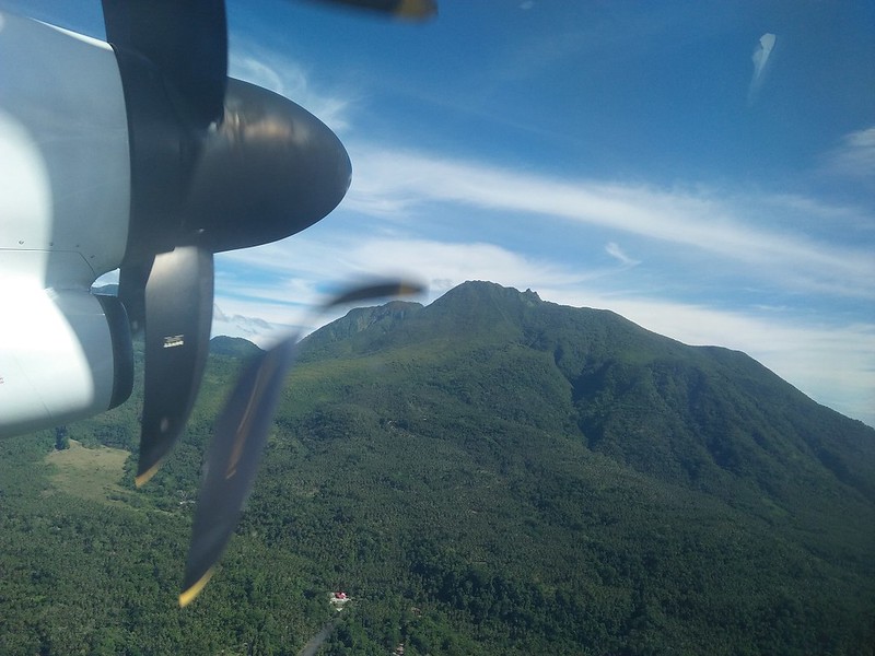
Mt. Hibok-hibok in Camiguin has always been in our sights since we started mountaineering. And there’s good reason that it is. At 1,332 meters above sea level, it is one of the most active volcanoes in the Philippines. It is a part of the Pacific Ring of Fire, and thus has a history of violent eruptions. All these gave it a certain charm that is impossible for us to resist. So we strapped on our Deuter Alpine backpacks, ready for an awesome adventure!
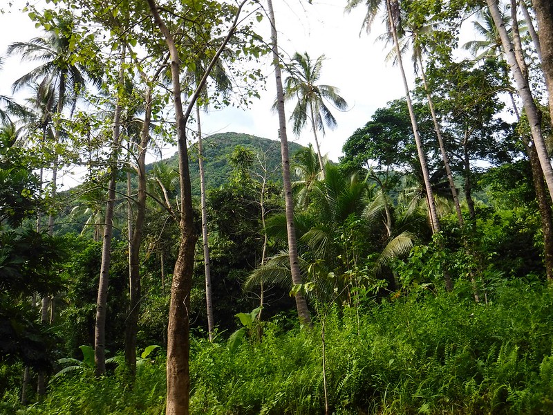
Fellow adventurer Aleah of Solitary Wanderer joined us in this climb. The first part of the climb was a hike through a huge coconut grove that covers an area of several hectares. Coconuts remain a major crop not just in Camiguin but also in other places in the Philippines. Coconuts are the raw materials for a lot of things—feeds for domestic animals, oils for soaps and shampoos, lumber for construction, and many more. The coconut tree is not called the Tree of Life for nothing!

The grove was huge, and the trees were tall. But every now and then, we come across clearings where we can see glimpses of beautiful Mt. Hibok-hibok. We can see its jungle-covered slope; we can’t wait to get in there so we could take shelter from the hot blaze of the morning sun.
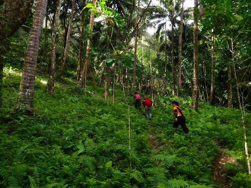
Soon we arrived at an area where coconut trees became more sparse and lush wild ferns took over. The land began to rise, signalling the start of our climb proper. We have some tuna sandwiches in our packs, and we have refilled our water bottles from a water source not far away from here. We’re definitely ready!
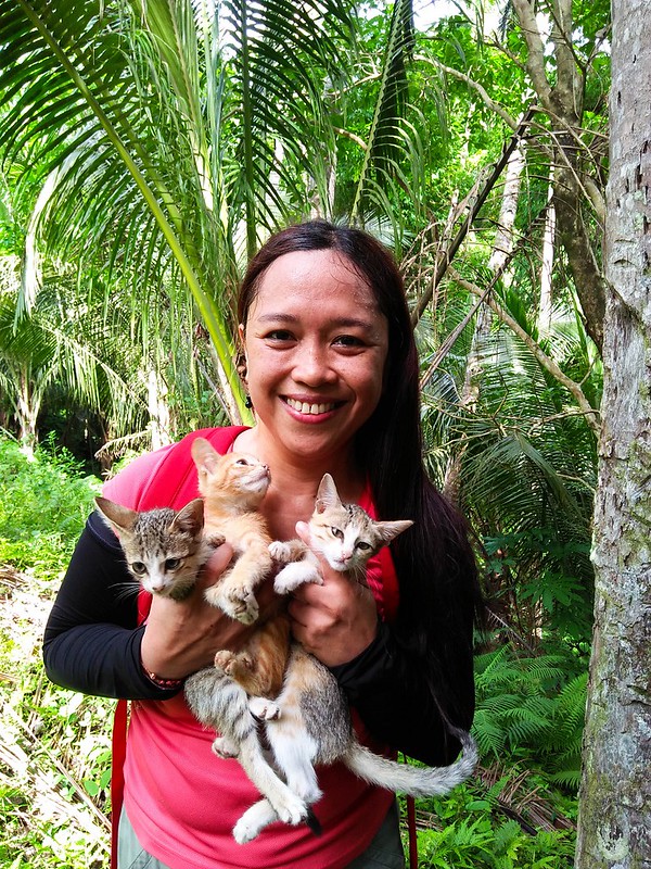
Oh, look! Aleah made new furry friends! Hehehe! These cutie kittens are using the edge of the forest as their playground. Oh don’t worry about them getting lost; when we put them down, they trotted to a nearby house, which is probably their home.
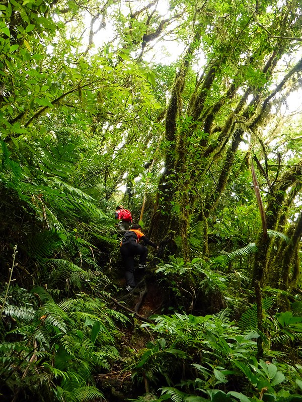
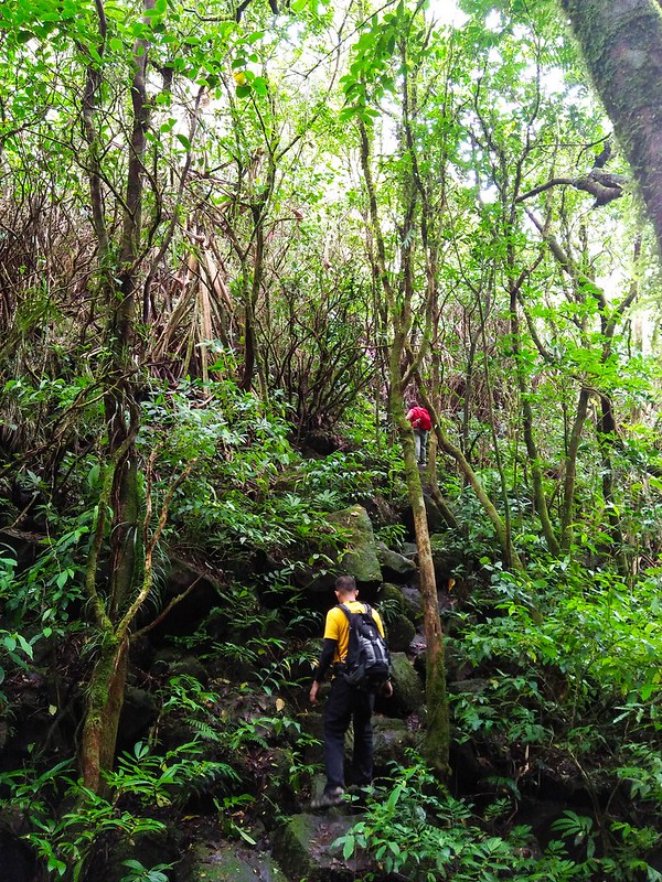
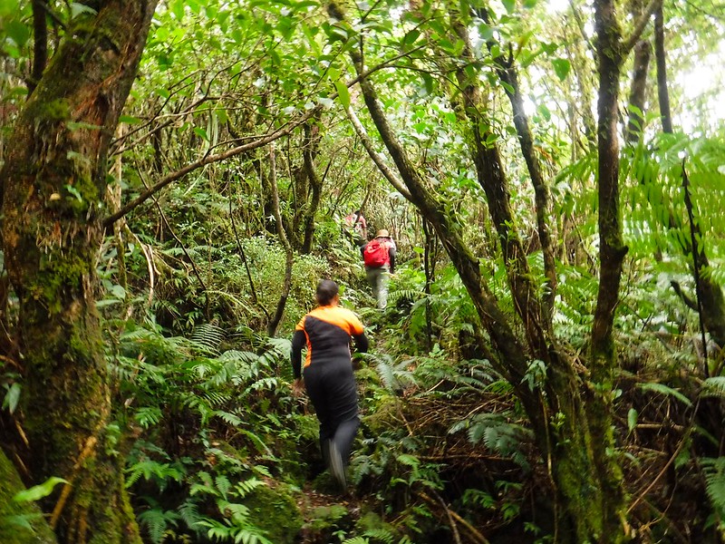
Soon, we left the farmlands behind and entered the rainforest that covers the slopes of Mt. Hibok-hibok. From here until the rim of Mt. Hibok-hibok’s crater, there was no level, descending, or rolling terrain. The trail steadily went up, and our thigh muscles started to throb due to the constant ascent.
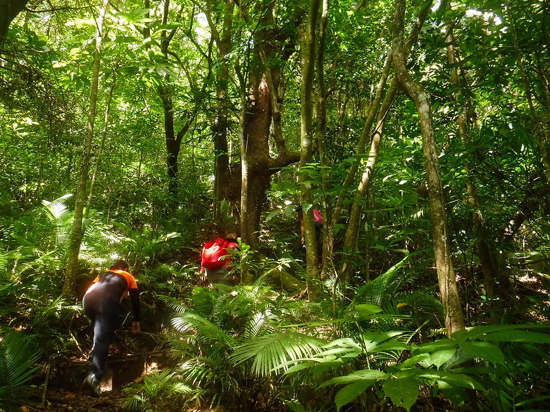
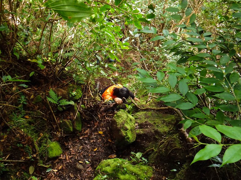
Some parts of the trail were so steep—about 60 to 70 degrees. We had to hold roots, trunks, and branches to help ourselves up. Fortunately, we were under the shady canopy of the woods. So, despite the fact that sweat poured out our skin in gallons, we enjoyed the cool, refreshing forest air.

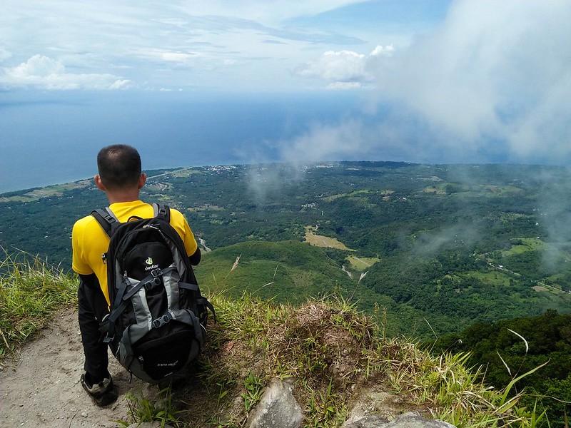
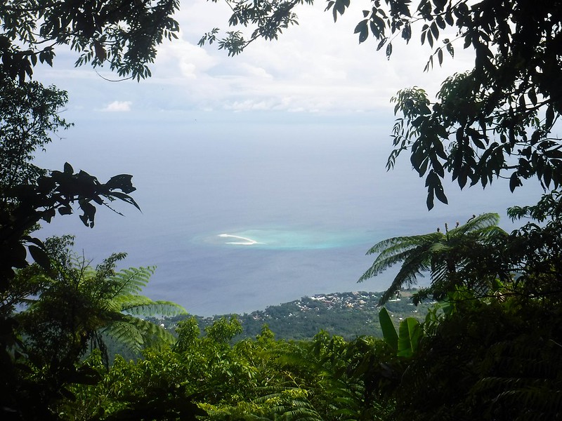
At around 10 AM, 2 hours since we left the jump-off point, we rested on a small flat spot designated as a rest area. From here, we could see beautiful White Island below, like a white scar amidst a tranquil blue sea. Somewhere near the edge of the sandbar is the wondrous Black Forest dive site where we explored the day before.
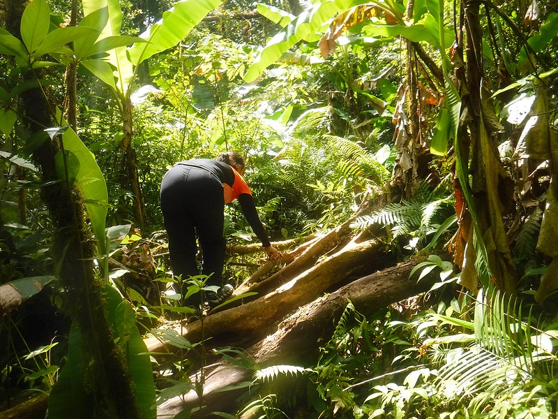
No time for dilly-dallying. There was still a lot of ground to cover, and we plan to exit the mountain just after mid-day. So after a short water break, we proceeded higher up the mountain. The trail became narrower and overgrown with roots and branches. In some places, we had to climb over fallen tree trunks.
Without any sort of indication, the trail began to descend, indicating that we have reached the lip of a crater. Both excited and relieved of the constant ascent, we hastened our pace.
The trees here were old and covered with moss, a usual indication of a first-generation diptherocarp forest.
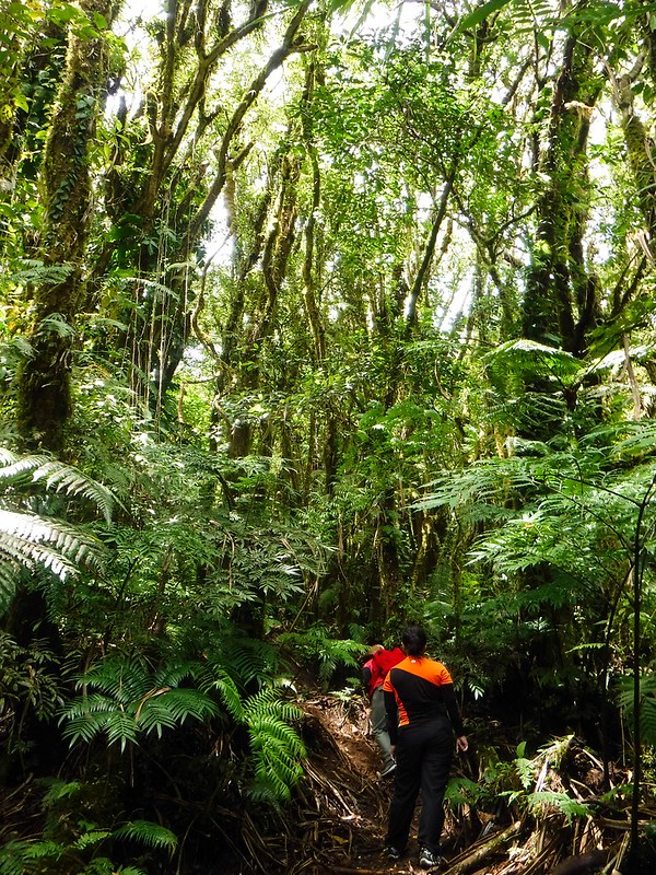
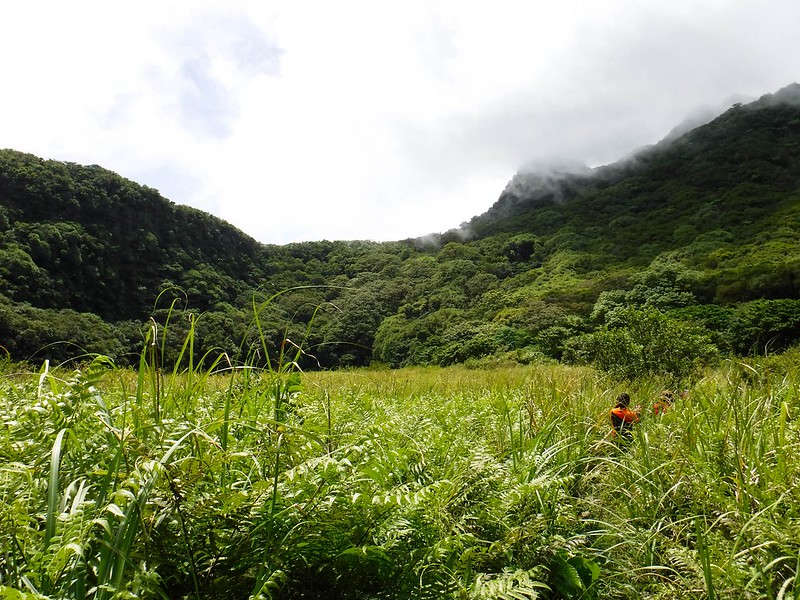
Then suddenly, we were in an open field with very tall sword-sharp cogon grass. It’s a stark contrast against the thick jungle.
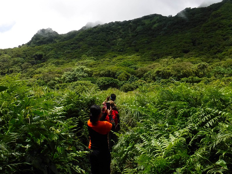
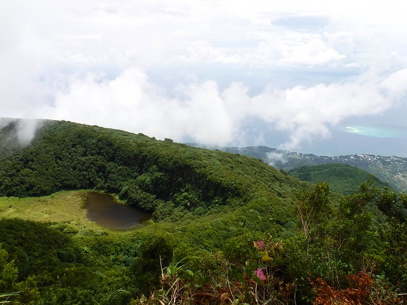
Sure enough, we were in the old crater of Mt. Hibok-hibok, surrounded by tall tree-covered cliffs! What an awesome feeling to be in the heart of a volcano.
Mt. Hibok-hibok has three craters—Kanangkaan Crater, Itum Crater, and Ilihan Crater, each one created in 3 separate eruptions in the volcano’s recorded history. We’re not exactly sure what crater is this though.
Mt. Hibok-hibok is still a very active volcano; its last eruption was in 1950. And we’re standing on its crater….
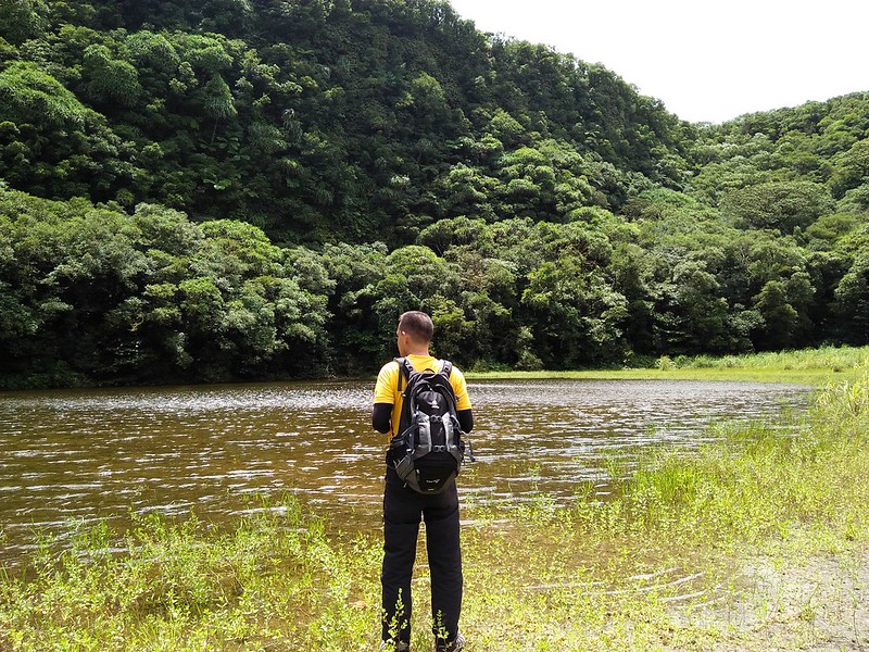
An accumulation of water from rain and hidden springs gave birth to this shallow crater lake. No, don’t drink from this water. It may look clean (well, it is), but it is stagnant and can contain leeches. Ewwwww!
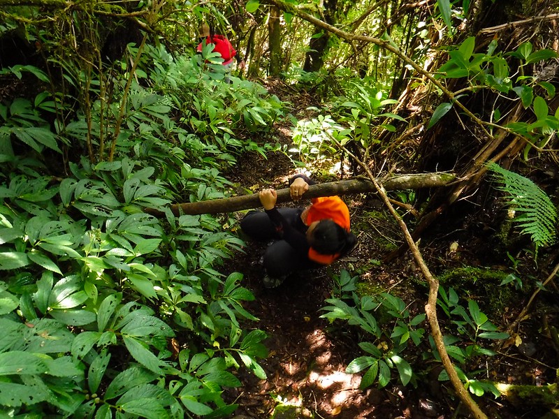
After resting for a while, we proceeded on our way to the summit, which involved a lot of steep climbs. Good thing though that there were lots of ledges, roots, and branches to hold on to, making the steep ascent relatively easy.
One of the highlights of the trail is this 90-degree section that we have to climb. For safety, our guide bough a sturdy rope for us to use in our ascent.

Near the top, you need to be a little bit of a gymnast to reach the handholds and footholds. Hahahaa!
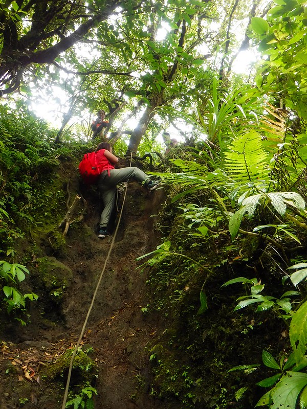
As we neared the summit, we came across this last obstacle—an ancient rockfall. The boulders were covered with a thick layer of moss, making them quite slippery even with our Vibram soles. Thus, we needed to be extra careful; a slip can be disastrous.
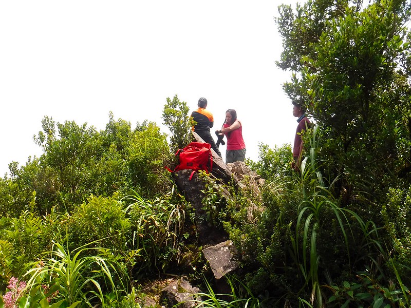
Finally, a quarter past 12 noon, we stepped on the very top of the Island of Fire’s highest point. We reached the rocky summit of Mt. Hibok-hibok. We made it!
The summit is actually the tip of a rocky outcropping that jutted out of the main peak. We squeezed through the small space while we ate the tuna and egg sandwiches that we brought along.
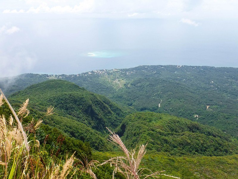
From the tiny summit, we have a commanding view of the surrounding area. The grassy crater where we came from came into full view. We could see the town of Mambajao and the beautiful sand bar of White Island very clearly.
Notice that thick carpet of first-generation trees that cover the mountain slopes. That’s what a healthy jungle looks like!
After our light lunch, we proceeded to another trail that leads towards a secondary summit. This trail intersects the one that we’re going to use to exit the mountain, the standard trail that starts near the popular resort Ardent Spring.
15 minutes later, we arrived at the second summit, which offers a much more open, much more scenic view of the surrounding area! Woohooo! The second summit is actually just a small ledge that juts out to open space.
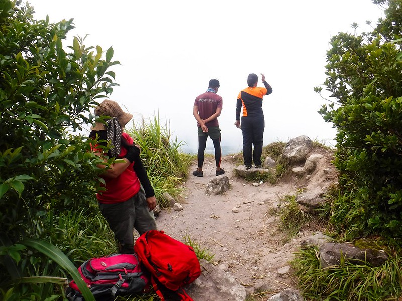
We had to be extremely careful when approaching the ledge because there’s nothing that blocks anything from falling over the edge. The lip a “gateway” to an abyss that is hundreds of feet deep.
From our guide, we have heard of foolish tourists tempting fate as they stand on the ledge with no protective gear. Please don’t do that!
Despite the danger, however, the second summit provides us a vast 180-degree of an entire quadrant of Camiguin. The town of Mambajao, White Island, surrounding farmlands, the airport—we all watched everything from up here. It was an ecstatic feeling!
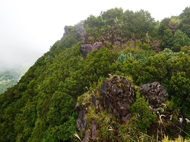
Limestone karst promontories become ideal habitats for birds, reptiles, and other forest creatures. We saw rare ferns and trees reminiscent of those in Mt. Madjaas in Antique.
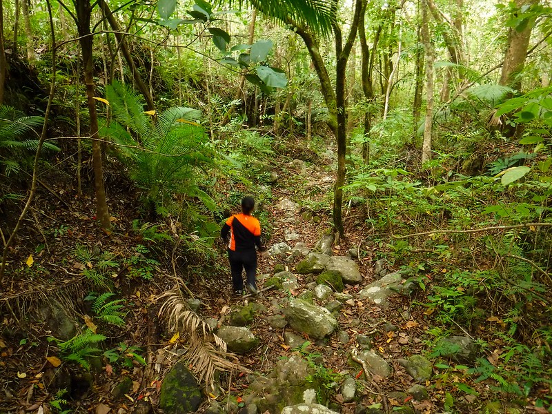
After spending about half an hour at the ledge, we decided to go back down to civilization. We opted to do a traverse rather than backtracking our way to our jump-off point. The first part of the trek home involved a steep descent down the mountain’s face. At times, we had to use our hands to hang on as we try to feel for safe and stable footholds.
Sometimes we go over, and sometimes we go under branches. Soon, our hips hurt from bending. Hahaha!
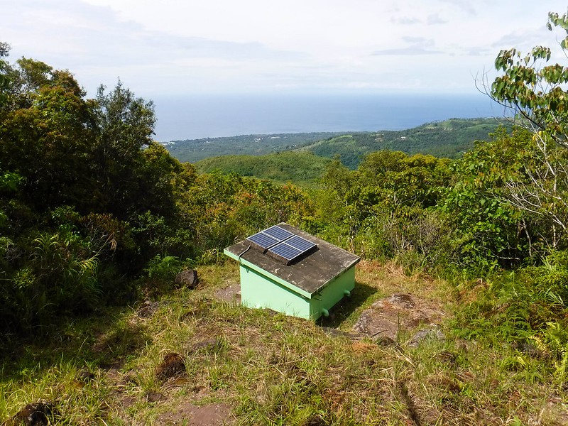
As mentioned before, Mt. Hibok-hibok is still very much an active volcano. As such, the mountain’s geological activity must be constantly monitored for safety and study. While on the way back down, we came across this solar-powered remote monitoring station that does just that.
It was a long, hot descent, and we were already quite hungry. Remember, we only had some sandwiches for lunch at the summit which was now far behind us.
Almost 3 hours later, however, we reached this dry riverbed. It was a quite a relief; our guide said that if we see a riverbed, we’re almost at our exit point. Wohooo!
This may be dry for now. But when rainy season comes, this river becomes alive and flows with clear, fresh water.
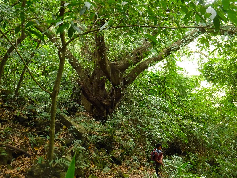
A huge balete tree seems to be the guardian of the river. Check out how small our guide is.
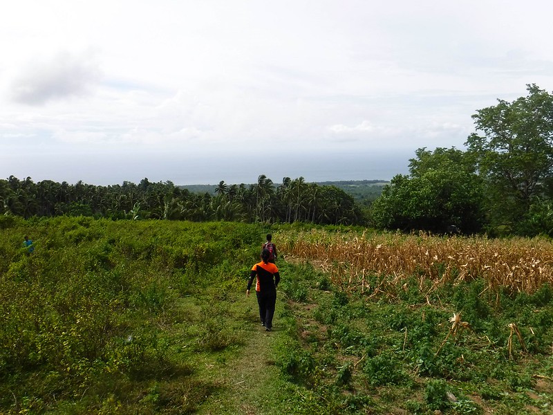
At long last, after 3 knee-pounding hours of descending down the mountain and a total of 7 hot hours of trekking, we finally made it back to civilization. We sighed in relief as we saw farmers, small houses, and farmlands. Our exit point, a side trail beside Ardent Spring, is just beyond that coconut groove.
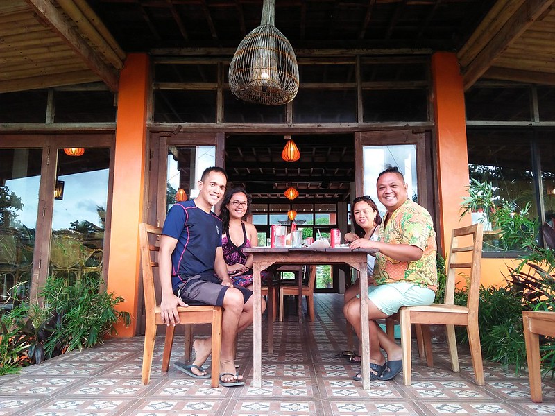
What a great dayhike! To celebrate our successful climb on a beautiful mountain, Potpot of the award-winning blog Travel Trilogy treated us to a very delicious dinner at Guerrera Rice Paddy Villas and Restaurant. It was both his birthday treat and a celebratory dinner!
We have just climbed one of the most active volcanoes in the country. A day before, we explored its depths. And we have to say, Camiguin has a lot of natural gems and adventures to offer! We can’t wait to go back for more!
Special Thanks
We would like to thank Potpot for giving us the privilege to dive and climb in Caminguin. This was one awesome adventure we’ll never forget. Be sure to check out Potpot’s blog Travel Trilogy for exciting travel stories and useful travel tips around the Philippines and beyond.
Thank you to Camiguin’s tourism office, Villa Paraiso, and the cool restaurants that made our stay so comfortable and enjoyable.
Last but not the least, thank you to Aleah for accompanying us through our Camiguin adventure, be it under the sea or high up in the mountain. Check out her blog Solitary Wanderer for her cool trips around the world.

Contact Details
This was a sponsored climb, so we’re not exactly sure about the public transportation rates, guide fees, and permit fees involved in climbing Mt. Hibok-hibok.
As such, get in touch with the Camiguin Tourism Office using these contact details below for obtaining a guide, guide fees, and other information related to climbing Mt. Hibok-hibok:
- Camiguin Tourism Facebook Page
- Email: camiguin.tourism@gmail.com
- Phone number: 0917-706-0688
Please note that Mt. Hibok-hibok is a protected area by law. It is illegal to climb here without a permit.
Going to Camiguin
Cebu Pacific and Philippine Airlines have direct flights to Camiguin from Cebu or Manila. Please check with their schedules.
Alternatively, you can take a ship or flight to Cagayan de Oro City. Head off to Agora Bus Terminal and take a bus or v-hire than will take you to Balingoan Pier. From there, you can ride a ferry that sails across the channel to Benoni Port in Camiguin. Check out our Camiguin, Island of Fire blog for more details.
Tips
1. Mt. Hibok-hibok is an active volcano. Cancel your climb if the Philippine Institute of Volcanology and Seismology (PhilVOCS) or the local tourism office issues a no-climb advisory.
2. The trail we took was a long traverse trail that snakes through all the interesting features of Mt. Hibok-hibok. You can take the easier Ardent trail or the shorter, newer Maitum trail. By doing so, however, you’ll only be able to go to the summit and the secondary summit. To go to the crater, you need to go down from the summit, then back up the summit so you can exit through Ardent or Maitum.
As such, we highly recommend you go through the traverse trail.
3. Mt. Hibok-hibok can be done as a dayhike. We were able to complete ours in 7 hours. That’s 5 hours going up and 3 hours going down including rest stops and lunch. Yours may be faster or slower, depending on your pacing, length of rest time, number of members on your team, and more. We recommend you start early in the morning before the sun burns the land at its full power.
4. The trek is exhausting due to the trail’s inclination. Be sure to hydrate often. Bring a wide-brimmed hat, scarf, or umbrella to protect yourself from the heat. Don’t hesitate to tell the guide to stop if you feel exhausted.
5. The last water source is near the jump-off point. Fill up all your water bottles here.
6. Wear arm guards and trekking pants to protect your skin from the sun and prickly plants. Also, a dry-fit shirt or rash guard will help keep you cool.
7. Be extra careful when standing on the summit or secondary summit. The ledges are totally exposed and surrounded by cliffs. Crawl if you have to. Abort your climb if the weather is windy or rainy; do not tempt fate.
8. Wear trekking shoes or sandals with an aggressive tread. You will need a lot of traction since you will be scrambling over loose soil and slippery rocks .
9. Bring salt tablets or ion-filled beverages such as Gatorade, coconut water, or fruit juice aside from water. The hot sun, multiple ascents, and exposed trails can make you sweat a lot. When you lose enough ions and salts via your sweat, cramps will occur. If cramps happen, rest for awhile, drink a lot of water or ionic drinks. This will replenish the ions in your system.
Bring energy-rich trail food such as nuts, crackers, bread, and bananas as well.
10. Pack light but do bring the following:
- water (at least 2 liters)
- trekking attire
- trekking shoes or sandals with aggressive tread
- umbrella, hat, or scarf
- packed lunch
- trail snack
- rain gear (in case of bad weather)
- extra money for emergencies
11. Don’t forget to waterproof your belongings. You can do this easily by wrapping your stuff with plastic bags or zip-lock bags before putting them inside your pack.
12. Please mind your trash; do not leave any of your garbage behind.

Wow, you were with Solitary Wanderer! Haven’t met her, but I knew her blog a decade ago. Nice to know she’s still active in blogging. Such longevity is uncommon.
Hi AJ! Yup, the three of us—Aleah, Sheila, and I—were invited to cover the Dive Camiguin festival. Since we had a free day after the dive festival, we decided to climb Mt. Hibok-hibok.
Aleah is really cool! 🙂
Beautiful blog with some natural images. Thanks for sharing such amazing post. Cheers!!
This is so cool! What an adventure – everything is so green and lush. I bet y’all were exhausted by the end, it looks like a long day.
I think this climb is way beyond my abilities. I was almost sold until I saw the photos of the ropes and the gymnastics you guys had to do in certain spots. Well done though! What an accomplishment.
OMG! Such an amazing article and so comprehensive. I am glad I came across this article as I was planning was next trip to Mt. Hibok-hibok soon. Everything looks so lush and green I am not a great climber but your pictures inspire me to add it in my activities list when I visit Mt. Hibok-hibok.
You guys did great. To be able to hike this mountain is an accomplishment. Thanks for including important tips. For a beginner like me, I find them very helpful.
This looks so amazing but is this climb moderate or difficult? I am not a keen hiker and always look for easy treks to do.
That looks like a very immersive experience! I’d love to do that hike and see those stunning views in person. Very comprehensive look at your experience here… I think I’d have to spend months training to be fit enough to do this!
What an adventure climbing to the top of Mt. Hibok-hibok was.
It’s certainly a brave feat to face one of the most active volcanoes in the Philippines, to that I applaud you.
I can only imagine how exhausting it was to tackle that jungle, but those views certainly must have made up for it.
Thanks for sharing this great post.
The hike to the mount of fire looks adorable and so lush green. The views are incredible and I wish I knew about this place while in Philippies.
Hiking the summit of Mt. Hibok-hibok when the weather is agreeable truly seems like an amazing experience. We love incorporating hiking into our travels so this sounds like something I’d love to add to our bucket list. Hiking through the coconut grove and then up the lush green forest must have been such a unique experience. The views from the summit and also of the White Island while hiking up are incredible. Thanks for sharing all this information and the important tips you’ve shared!
oh! that hiking seems hard but beautiful. I mean, you are in the middle of the jungle with all the greenery and the palm trees. Philippines is really a beautiful country. I was there some years ago. Need to go back!
What an amazing adventure for you. Reaching the summit in such heat and an arduous climb is a feat. I love the tips at the end, so important to be careful and pay close attention to details. I can imagine how hungry you must’ve been after.
Such a breathtaking place! I am so proud that I live in a country rich with this beauty.
I have been wanting to climb Mt. Hibok-hibok for the longest time now. Aiming to do it next year. As always enjoyed reading your article kuya Gi and ate Shei hope to see you around.
Hi Geemiz! That’s great! Mt. Hibok-hibok is really nice, and it can be done as a day hike. 🙂 Good luck and enjoy your climb! 🙂
[…] incredible beauty and history of violent eruptions of majestic Mt. Hibok-hibok in Camiguin gave it a certain charm that is impossible for us to resist. We just had to climb it! […]
[…] incredible beauty and history of violent eruptions of majestic Mt. Hibok-hibok in Camiguin gave it a certain charm that is impossible for us to resist. We just had to climb it! […]