In our Social Studies, Science, and Philippine History classes during our elementary school years, our teachers usually ask us to enumerate some natural geological wonders of the Philippines. One of the wonders that most often come up is beautiful Taal Volcano in Batangas. For us, seeing a picture of a small volcano in the middle of a lake was a sight that could induce a huge wow from the class.
After three decades, we finally had the chance to see this natural treasure. Taal Volcano is considered as one of the smallest active volcanoes in the world. But don’t let its small size fool you. It is the second most active volcano in the country, spewing death and destruction at least 33 times in Philippine recorded history. It is also among the world’s 16 Decade Volcanoes as classified by the International Association of Volcanology and Chemistry of the Earth’s Interior. Decade Volcanoes bring the attention of the scientific community due to their large, catastrophic, and frequent eruptions and their proximity to large populated areas.
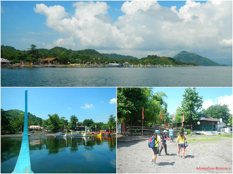
We woke up early since we knew that going to Talisay involved a network of tricycle and jeepney rides to take us to our jump-off point. We missed the sunrise, but we won’t get to see it anyway because it occurs on the other side of the land.
Nevertheless, we were treated to a beautiful view of Taal Lake. The gentle morning light bathed the lake, letting it exude a wave of hope and renewal over our spirits.

The ride got particularly fun and interesting when a particularly jolly jeepney driver and his equally funny passenger friend interacted with us. He was flirting with our girls, and the whole exchange became the entertainment for the passengers.
After arriving at Talisay, we met our friendly guide Angelo and paid our fees.

We were then led to our sturdy boat. Taal’s outrigger boats have an unusual design. Each has a high bow (you can almost consider them as a vertical bowsprit) and an equally high stern. We’re not exactly sure what’s the purpose of the extra height.
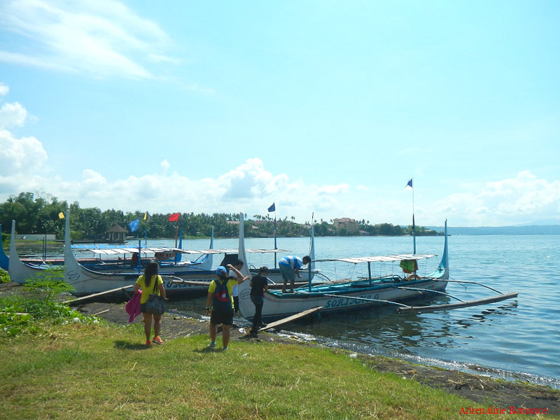
Off we went! Just check out the genuine excitement on our faces. For safety, we were required to wear life vests. But, just a note. Boatmen, please do wash your life vests regularly for hygenic purposes. Many of your vests are unbearably stinky.

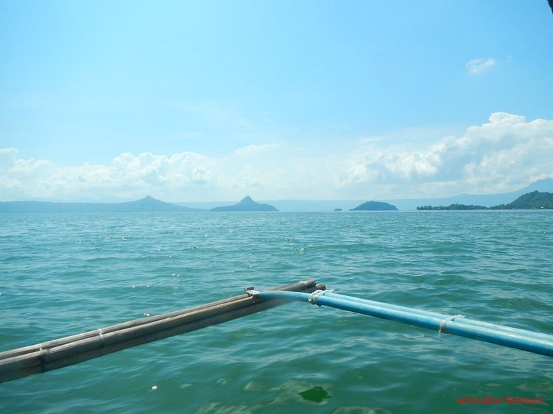
We cruised along Taal Lake at a rather uncharacteristic high speed. We were actually surprised how our boat cleanly and effortlessly cuts across the waves. It was like riding a speedboat rather than a pump boat.
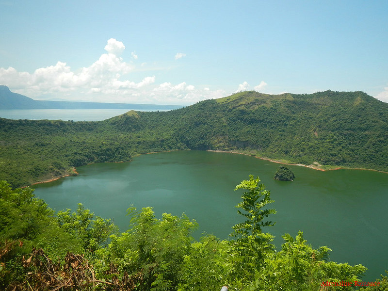
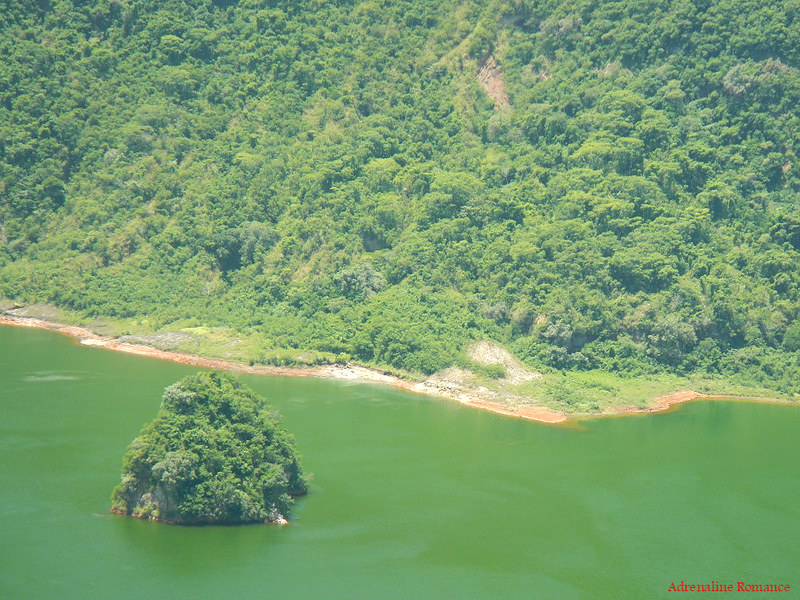
Taal Lake was formed millions of years ago when rainwater, groundwater, springs, and other sources flowed into the remains of Taal Caldera.
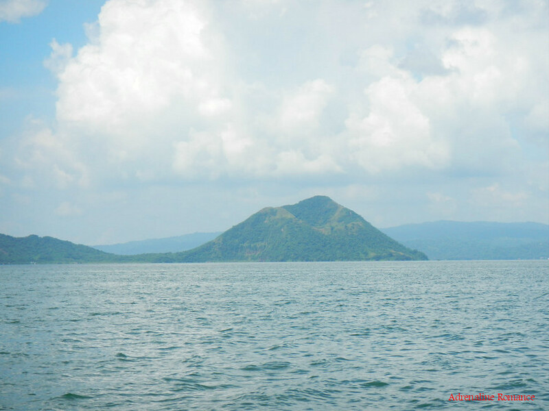
Just ahead of us is the 23-square kilometer Volcano Island where the world-famous Taal Volcano is located. Volcano Island is formed as a result of a series of violent eruptions in the past.

Near Volcano Island are three smaller islands—Lambauing, Bubuin, and Napayong. We wonder what natural wonders are in store in those islands. We would definitely love to explore them.
As we neared Volcano Island, we had a clear view of Binintiang Malaki (Big Leg, in English). This is a large parasitic cone that erupted violently in 1707 and 1715. Today, it is dormant; but Mother Nature is unpredictable.
In a little over 15 minutes, we docked at the shore town, which is still under the jurisdiction of the municipality of Talisay. It is actually scary to think how a town like this could exist at the rim of a very active volcano.
Officially (and therefore, in theory), the Philippine Institute of Volcanology and Seismology (PHILVOCS) prohibits permanent settlement on Volcano Island. The institution has declared the island a Permanent Danger Zone and high-risk area.
Not heeding of the warnings, a thriving community has settled on the island, making a living through farming, fishing, and recently, tourism. All the while, they understand that they are risking their lives due to the unpredictable nature of Taal Volcano.
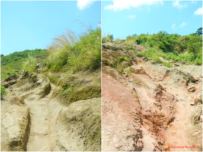
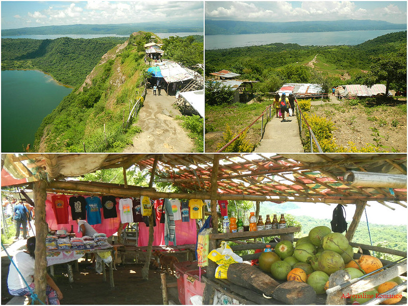
The dusty trail to Taal Volcano’s crater rim is very lightly wooded. Shady shelter is almost non-existent. Yes, we’re telling you, you’ll definitely roast here on a hot day. Better bring massive sun protection equipment such as sunglasses, arm guards, and umbrellas. Local guides even wrap their heads with T-shirts for more encompassing protection.
The trail is characterized by loose, dry, and dusty volcanic soil; so, it is advisable to wear the right hiking shoes or sandals.
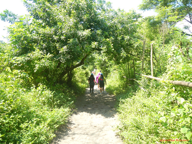
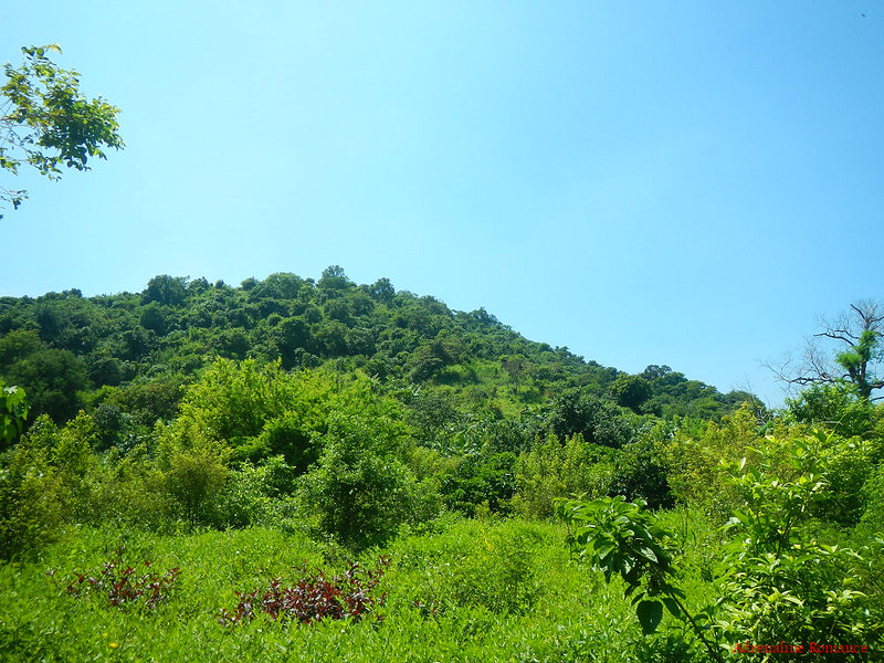
Despite the scorching, almost unbearable heat, the rich greenery around the island exudes a placebo effect of coolness. A lot of plants grow here due to the rich volcanic soil and the freshwater moisture coming from the lake.
Further up the trail, we trekked in the middle of a few human-excavated canyons. Although lots of places in the canyons are shady, the high walls block gusts of freeflowing breeze. Thus, the canyon has a disconcerting feel of suffocation.
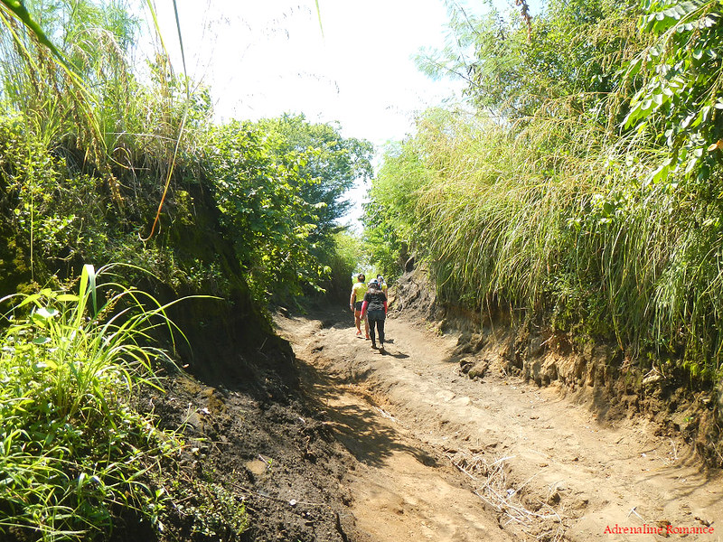
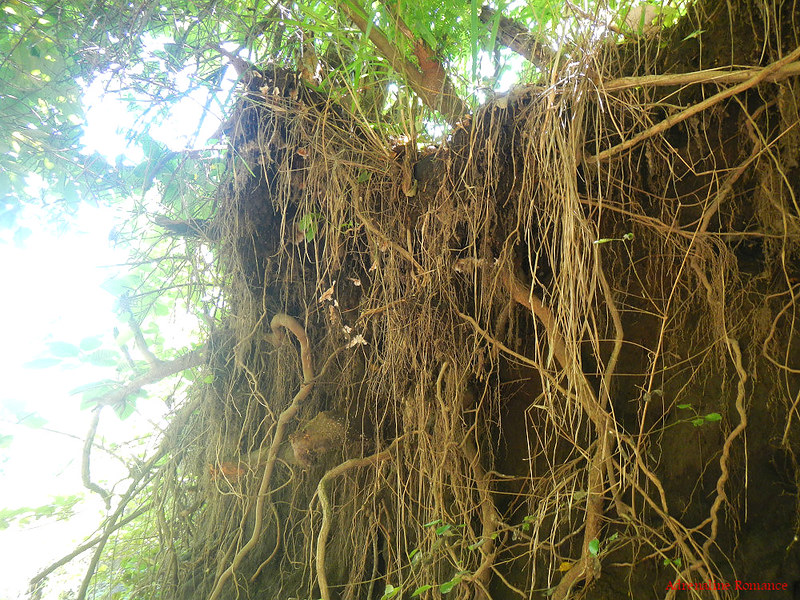
Roots from trees above the canyon burst through the canyon walls. Getting a bit of shade here is quite a relief.
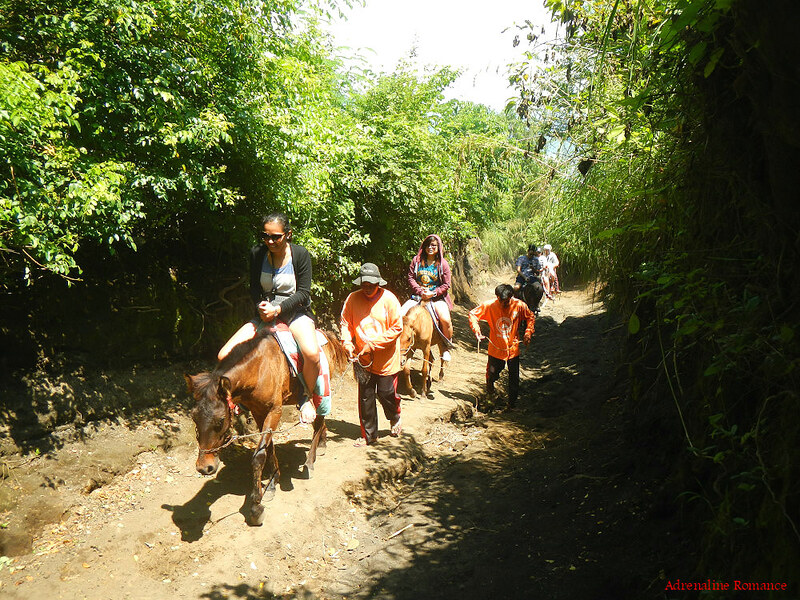
If trekking up a mountain is too much for you, you can ride a horse up the summit! Yes, this should be really fun, especially for kids.
We opted to hike as we wanted a more strenuous adventure, but we wouldn’t mind riding a horse the next time we visit here. When we do, I’ll wear a cowboy costume that faithfully resembles Clint Eastwood’s in the movie The Good, The Bad, and the Ugly. Yes, complete with a hand-woven poncho and biting a cigar. Sweetie will wear a costume inspired by Penelope Cruz’s character in the film Bandidas.
Then we’ll hire a porter who will bring a boombox playing The Good, The Bad, and the Ugly theme by Ennio Morricone. Hehehe!
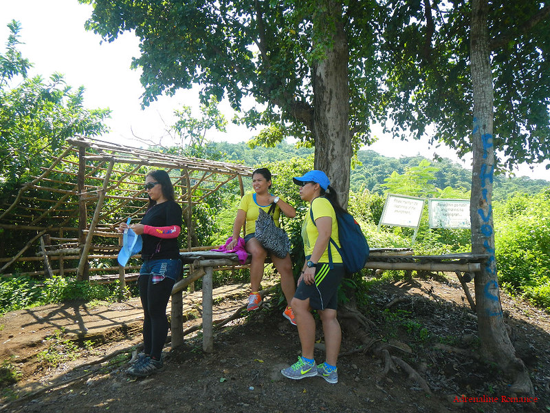
Thankfully, the Talisay LGU and the locals of volcano island set up these shady rest stations along the way where hikers and guides can take a much-needed rest and a water break.
It’s really not the loose soil or the slight ascent of the hike that poses a challenge when climbing Taal Volcano. It’s actually the intense heat that burns the exposed trail which makes the short 1-hour trek exhausting. Heat from the sun and heat radiating from the ground relentlessly batter us, poor humans.
See that cross? This hiking trail is also used by religious devotees who wish to undergo the Catholic ceremony of the Stations of the Cross during Holy Week.

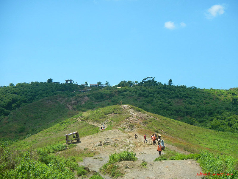
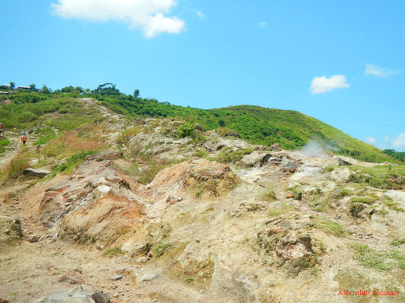
No shady trees at all, but look at that amazing view! It’s stunningly beautiful, isn’t it? Those structures on top of the hill is our destination; that’s the summit of Taal Volcano.
Gulleys and canals, both carved and natural, from a network of trails that people and horses can use to ascend the mountain. Check out the red coloration, which indicates rich iron content.
That’s a really rugged, rocky, and hot path. Check out how tiny the guide is (the guy in the orange shirt at the left side of the photo) compared to this barren stretch of rocks and stones.
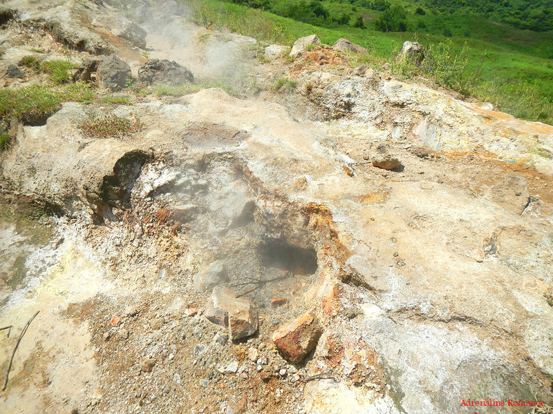
As we approached the volcano’s rim, we encountered these holes that emit noxious smoke. These are fumaroles, venting out steam and gasses from the earth’s crust. The presence of hot steam emanating from these fumaroles is a strong indication that Taal Volcano is very much alive.
Just a few more steps, and we’ll be there!
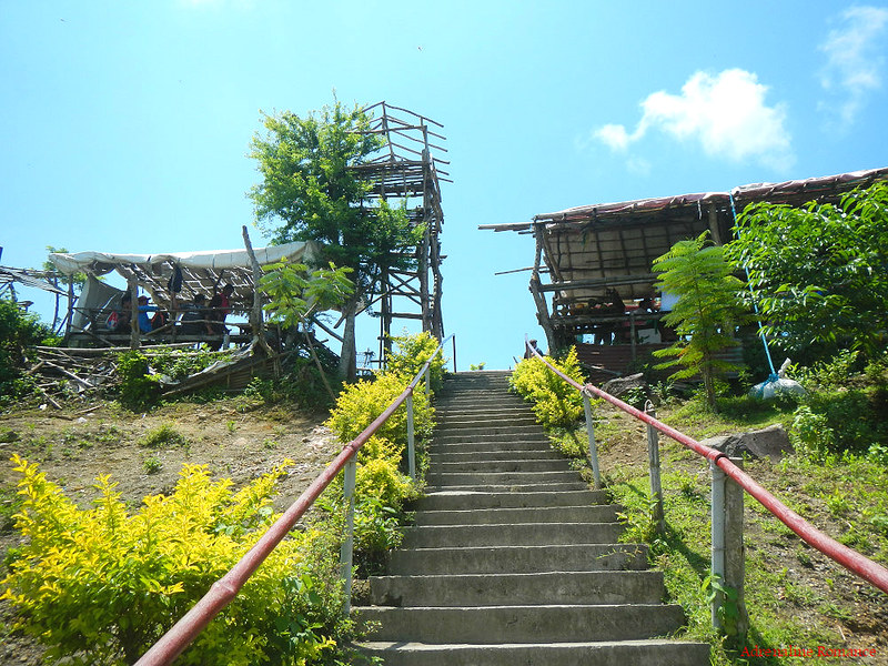
But we were a bit disappointed at the sight that greeted us. The artificial structures, which were supposed to be sari-sari stores, carenderias, and souvenir shops, were constructed hastily and haphazardly. Check out the photos below; the really ugly structures do not blend well to the volcano’s beauty. And that does not include the trash that we saw all around the place.
They are a far cry from the structures we saw in Mt. Pinatubo, which were designed to blend well with the surroundings.
We hope that the Talisay LGU will do something to rectify the appearance of these establishments as well as to clean up the place.
An ugly bare concrete tower offers an encompassing view of the entire crater area.
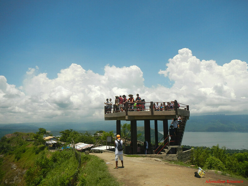
Of course, we almost forgot the ugliness of those structures when we saw the picturesque beauty of the heart of Taal Volcano. This main crater lake has an area of 2 kilometers and is the source of Taal Lake’s sulfuric content. At 311 meters above sea level, Taal Volcano is among the lowest volcanoes in the planet. Fertile volcanic soil allows plants to grow in the crater’s walls.
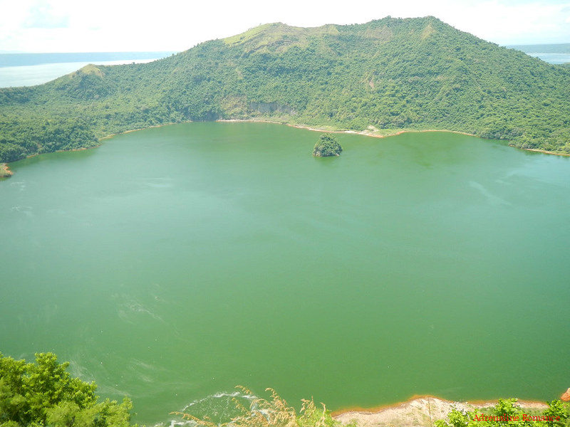
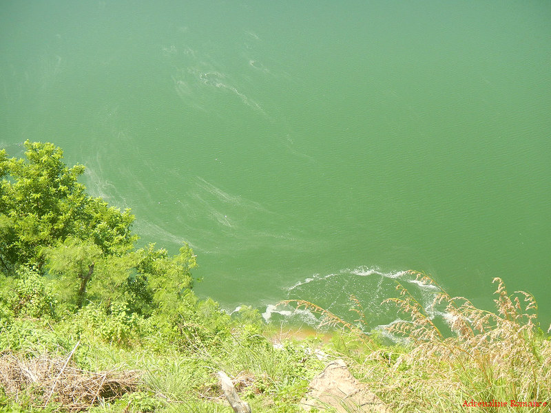
Underwater vents emit strands of sulfur that are visible from where we stand. One of the locals in the area offered to guide us to the main crater lake. We politely declined knowing that hiking to the bowel of the crater is prohibited.
At the center of the crater lake is Vulcan Point, a tiny foliage-covered rock outcropping. It has the distinction of being an island within a lake within an island within a lake within an island. Okay, let’s make it more specific. It is an island (Vulcan Point) within a lake (crater lake) within an island (Volcano Island) within a lake (Taal Lake) within an island (Luzon).
Let’s check out the sights around Volcano Island and Taal Lake. Here’s another view of the Binintiang Malaki parasitic cone. Our guide told us that there is actually a trail that leads to the center of the cone. We would definitely want to explore that someday.

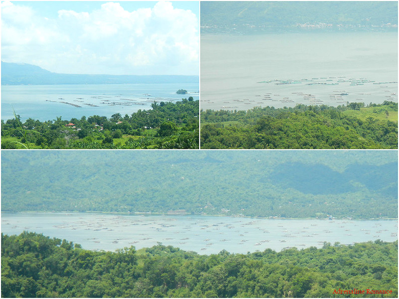
It’s no surprise that there are hundreds of fish pens in Taal Lake as it is a rich fishing ground. The lake was previously connected to the sea before it was landlocked. Thus, it is now home to endemic marine creatures that have adapted to the conditions of the lake.
There are populations of trevally, tawilis (freshwater sardine), and gobis. The lake also harbors the Philippine Freshwater Sea Snake, one of the rarest venomous snakes in the world. Bull sharks used to live here but were hunted to oblivion in the 1930s.
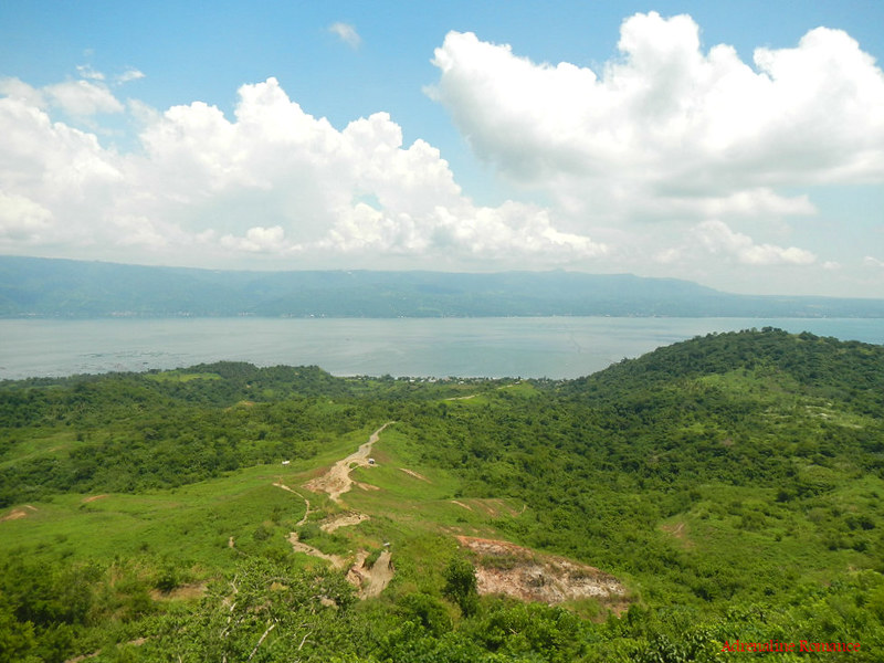
Mt. Maculot in the municipality of Cuenca is very prominent and visible here. The vertical drop at the right of the mountain is the Rockies.

Believe it or not, Taal Volcano and Binintiang Malaki are not the only volcanoes in the island. According to our guide, there are actually 47 cones and craters that are scattered all across the place! That is one geologically active island!
On our way back to our boat, we passed by this PHILVOCS solar-powered monitoring station. Seismographs and other instruments used to monitor the volcano’s geological activities are sent to this station.

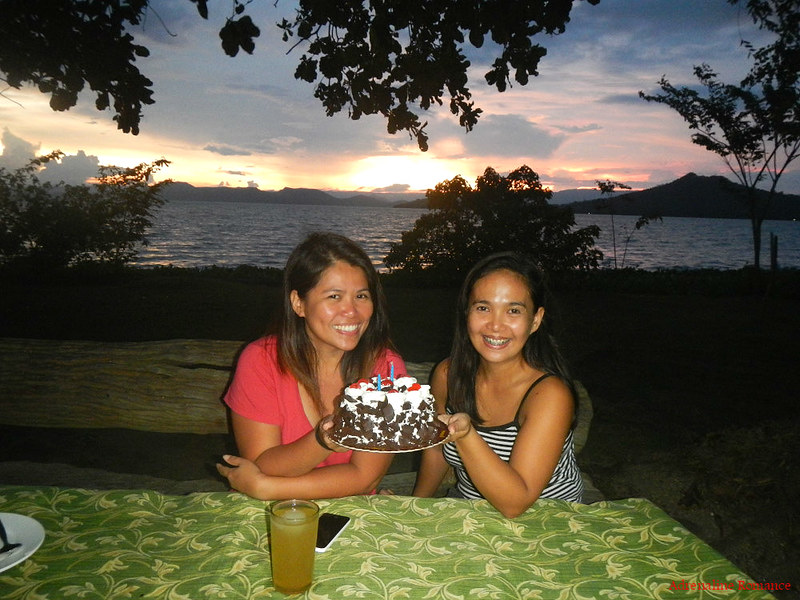
Of Birthday Celebrations and Sunsets
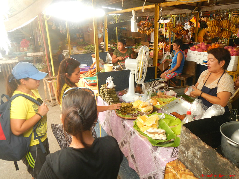
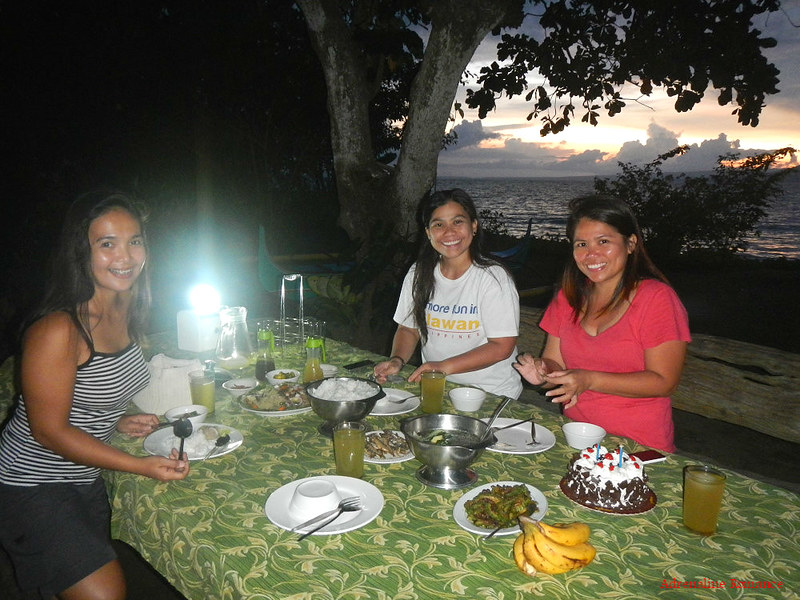
After spending a couple of hours in Volcano Island, we safely returned to the mainland. Exhaustion can really make the blandest food the tastiest meals! Hehehe! After having lunch at the Talisay public market, we bought some sweet native delicacies and a Black Forest cake to celebrate a special event.
Back at the Kapusod Tree House, we were treated to another spectacular sunrise. This time, the sky seemed to be painted in shades of orange and blue.

A great birthday celebration under a fiery sunset! How cool is that! Happy birthday, May and Sweetie Sheila! They have almost the same birth dates.
Even better, we had a fantastic open-air birthday dinner at the tree-laden shore of Taal Lake with a lovely sunset in the background. Ma’am Betty, the motherly caretaker of Kapusod Treehouse, cooked us a very delicious pancit guisado when she learned that we were celebrating a birthday.
After dinner, we shared our cake with Ma’am Betty and her crew while sharing stories of our travels and adventures. Indeed, this is the life!
Our trip to Taal Volcano was a hot and exhausting one. Nevertheless, it was quite enjoyable. The exposed terrain gave us a very encompassing and pretty view of Taal Lake and the surrounding municipalities. The fact that we were hiking on the slopes of a very active volcano made us realize just how vulnerable we are, and Mother Nature could snuff out our lives in a snap.
However, we did feel that Volcano Island has become too touristy. We felt that the place is rapidly beginning to lose its natural charm due to the heavy tourism activities in the area.
Tourist regulation is unrealistic and out of the question since Taal Volcano is a very popular spot. However, this can be alleviated by building structures that blend with the landscape, avoiding further destruction of the terrain, and beautifying the area with manicured gardens. It would also be better if locals would stop harassing tourists to buy drinks, snacks, and souvenir items; the non-stop harassment is just annoying.
Also, we strongly advice locals not to engage in activities that desecrate the volcano. There is a business there wherein tourists pay to “use” the volcano as a golf driving range. Supposedly, the tourist makes a wish and tries to hit the golf ball as far as possible into the crater; the farther the ball goes, the more chances his wish will come true. We found this activity very disrespectful to the volcano.

Special Thanks
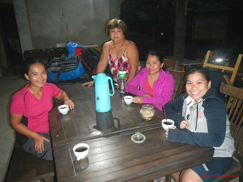
We would like to thank Aling Betty and the staff of Kapusod Tree House for taking very good care of us during our stay. Their service is exemplary and the food is beyond amazing! Thanks for the hot Batangas coffee too! We will surely go back and visit this beautiful place.
Itinerary
5:30 AM – wake up, shower, prepare
6:30 AM – hike to Balete, ride jeepney to Levitown
7:00 AM – arrival at Levitown, ride jeepney to Tanawan
8:15 AM – arrival at Tanawan, breakfast
9:00 AM – ride jeepney to Talisay
10:00 AM – arrival at Talisay, meet guide, register
10:05 AM – boat ride to Volcano Island
10:20 AM – arrival at Volcano Island, start trek to Taal Volcano summit
11:15 AM – arrival at Taal Volcano summit, take photos
12:00 PM – trek back to shore
12:30 PM – arrival at the shore, boat ride back to Talisay
1:00 PM – lunch at Talisay Public Market, buy goods
1:30 PM – ride jeep to Tanawan
2:30 PM – arrival at Tanawan, ride jeep to Levitown
3:30 PM – arrival at Levitown, buy cake at Robinsons
4:00 PM – ride jeep from Levitown to Balete
4:30 PM – hike from Balete to Kapusod Tree House
Budget*
P 20 per person – jeepney fare Balete to Levitown
P 20 per person – jeepney fare Levitown to Tanawan
P 22 per person – jeepney fare from Tanawan to Talisay
P 10 per person – tricycle fare from Talisay proper to dock (same rate applies from dock to Talisay Public Market)
P 25 per person – jeepney fare from Talisay to Tanawan
P 22 per person – jeepney fare from Tanawan to Levitown
P 20 per person – jeepney fare from Levitown to Balete
Taal Volcano-related Rates**
P 2000 per boat – 6 persons maximum capacity
P 100 per person – Entrance Fee
P 50 per boat – docking fee
P 500 guide fee for the whole group
P 450 per horse
* We did not include our expenses for snacks, souvenirs, tips, and other fees in this rate sheet as you may have different needs, preferences, itineraries, and sharing scheme from us. Note that all figures are subject to change without prior notice.
** Rates as of January 4, 2016
Tips
1. The itinerary and rate sheet above is more complex than usual because we started our trip from a far-off barangay in Mataas na Kahoy. There are more direct ways to get to Talisay from Manila.
- In Manila, take a bus bound for Lipa or Batangas City. This bus passes by Tanawan. Ask the driver to drop you off at Tanawan.
- From Tanawan, ride a jeepney to Talisay proper
- From Talisay proper, ride a tricycle to take you to the dock where you can rent boats to go to Volcano Island
2. For guideship services, contact Angelo at 0919-7280514.
3. It is best to hike early in the morning to avoid the unbearable heat. If you have to hike mid-morning, make sure you are well protected from the sun. Wear sunglasses, a hat, dry fit clothes, etc. Bringing an umbrella is highly recommended. Don’t forget to slop on sunblock.
4. Bring a surgical mask or wrap a scarf around your face to protect yourself from dust and volcanic ashes. Do not buy the masks sold by the locals; they are ridiculously expensive.
5. Bring a lot of cold drinks and snacks. Again, avoid buying merchandise from the stalls along the volcano as they are very expensive.
6. Hiking to the crater lake is prohibited. Don’t get swayed by locals’ offers to guide you there. Also, do not accept any offer or try any gimmick that desecrates Taal Volcano (e.g., hitting a golf ball or throwing a rock into the crater).
7. Pack light but do bring the following:
- water, soda, or fruit juice (at least 2 liters)
- snacks
- sunscreen/sunblock
- scarf (to protect yourself from dust)
- wide-brimmed hat
- sunglasses
- trekking pants
- dry fit shirt or rashguard
- trekking sandals or shoes
- extra clothes
- face towel
- rain gear (in case of bad weather)
- plastic bags (for waterproofing your clothes and gadgets)
- camera and extra batteries
8. Practice and observe the Leave No Trace Principles of a responsible hiker. Do not damage Taal Volcano more than it already is.

you guys travel so much, Gian and Sheila… Awesome 🙂
Hi Deeptesh,
Thank you! We’ll continue to travel and engage in exciting adventures as long as we can breathe! 🙂
hi! can I get the contact numbers already? we are planning to go to taal volcano this december 🙂
Hi Jabbar,
Your request is our command! Please check the blog post again. We placed the contact number of our guide, itinerary, budget, and a set of tips. 🙂
I also was there, and have the same impression like yours… 🙂
Hi Traveling Rockhopper,
Thank you! Actually, rectifying the situation is simple. Just beautify the place by making the stalls blend with the landscape, putting gardens, get rid of trash, etc. Educating locals about the basics of eco-tourism as well as cleaning and protecting Taal Volcano are also important. It is practically impossible to regulate tourists climbing Taal Volcano.
Oh, hiking to the crater lake is prohibited..I don’t remember being told so when we went in 2009. Ooops. But I remember we were being followed by horses while we hiked, trying to tempt us to hire ’em. Much as we were tempted to (it was very hot that day), we just couldn’t…we didn’t have money (our money was only enough for the boat and guide)!
Hi Mustachio,
Yeah, it’s prohibited although there were locals who were willing to guide us there. We didn’t give in else we could go to trouble. Hehehe!
Same here, we didn’t rode the horses. Too expensive. We even heard a horse rider as his guide, “Why are they walking?” referring to us. Hehehe!
[…] READ MORE […]
hi can you tell me where exactly is the meeting place to meet the guides? ill be bringing tourists to tagaytay and planning to go down the road where balai isabel is, is it near where the guides are? This is the only route I know from Tagaytay.
Hi Alain,
Guides are available at the island itself (you will be docking in a small town) or at the mainland in Talisay. We are not sure where Balai Isabel is.
Also, please check out the blog; there are tips, itineraries, contact details, etc. there. Most of the information you need is already in the blog post.
Thank you.
Thank you very informative but i have one question about horse ride is it mandatory?
Hi Whe,
No, the horse ride is not mandatory. You can hike up to the summit like us. 🙂