Never underestimate a mountain—any mountain. It doesn’t matter if the mountain is less than 1000 MASL, conveniently surrounded by human habitation, or frequently visited. It demands respect, reverence, and care.
An example of such a mountain is Mt. Kapayas, located in Sitio Kampanya, Barangay Kabangkaya in the bowels of Catmon, Northern Cebu. At 783 MASL and sheltering a couple of mountain villages that are yet to receive the full benefits of modern civilization, Mt. Kapayas is an enticing, relatively unexplored mountain that harbors plenty of secrets and challenges. For a relatively low mountain, it offers mountaineers a good dose of adventure.
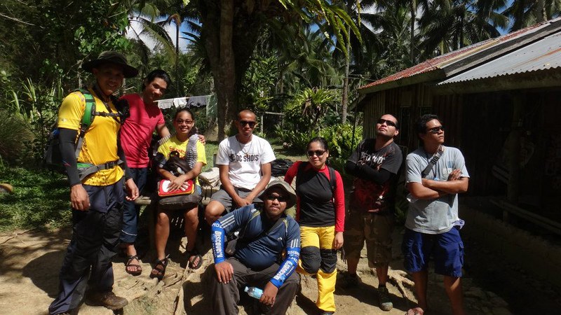
So last February 10, 2013, Sweetie and I decided to invite a few friends to climb Mt. Kapayas. I have already summited the mountain twice, and Sweetie accomplished her summit bid once. However, some of our adventurer friends haven’t set foot at the rocky Torre, the peak of Mt. Kapayas; and, well, let’s just say that our adventure stories may have sparked their curiosity and interest. Also, one of our regular adventuring friends, Sir Ronald Ramiso, wasn’t able to summit the last time we’ve been there. So, this was what he called his Mt. Kapayas “redemption” climb.
After a one-and-a-half hour journey, we arrived at Catmon proper. We started really early (we departed Cebu around 5:30 AM) to escape the hot sun and to allow enough time for us to explore the nearby Lumanoy Cave.
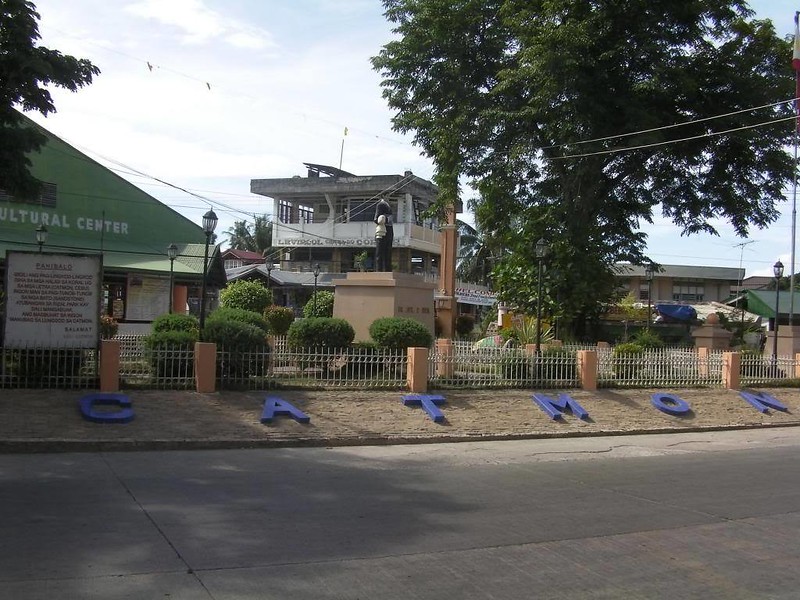
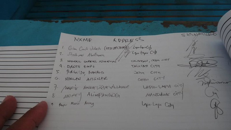
First things first, and that involves registration. We proceeded to the Catmon Police Station to register our names.
A friendly habal-habal driver told us that the habal-habal station is in Tambisan, a short walk from Catmon proper. So we had our warm-up at 8:00 AM.
It took us awhile to wait for four habal-habals that would take us to Sitio Kampanya. You’ll know why it took a bit of time to hire them in a few moments.
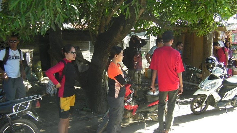
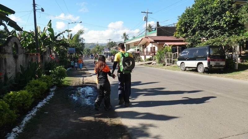
After securing four habal-habals and negotiating the fare, we started our journey to Mt. Kapayas. During the first hour of the trip, the motorcycles travelled through asphalted roads with some sections in terrible disrepair.
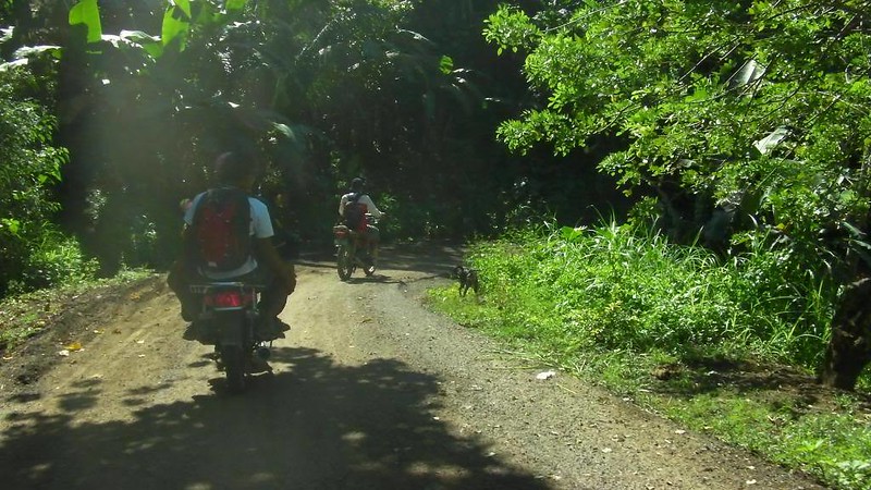
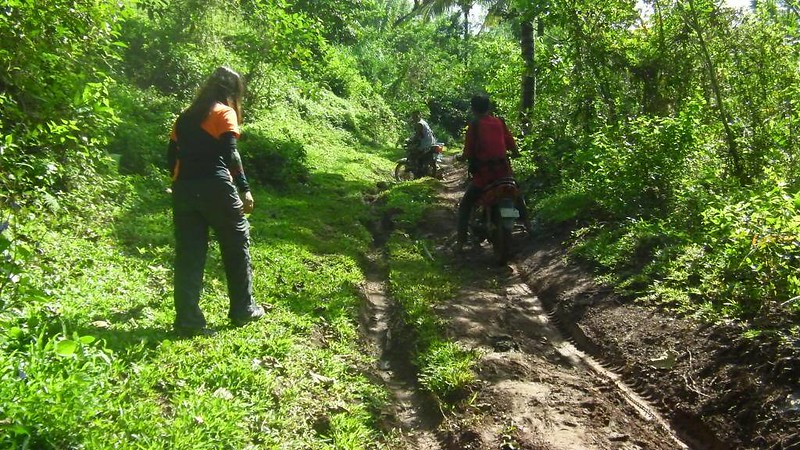
The road becomes even worse as we passed by Barangay Agsuwao, the gateway to Sitio Lumanoy. This is where you’ll understand why only very few habal-habal drivers agree to take you to Sitio Lumaony and why they charge large fees. The long road, which is a little more than a dirt path of sorts, is almost impassable. Only the toughest motorcycles are able to traverse the deep mud canals, the rocky ascents and descents, and the whiplashing vegetation. Less powerful motorcycles, multicabs, sedans, and even some 4X4s cannot traverse this length of road. In fact, we had to frequently get off the motorcycles in order for them to traverse certain sections of the road.
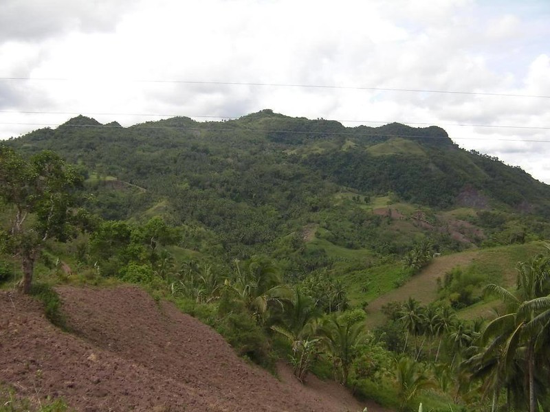
That’s the back end of Mt. Kapayas. The summit is at the other side of that mountain.
After almost two hours of bone-jarring motorcycle ride, we finally arrived at the jump-off point. At last, we could let our bruised butts rest.
Some of us refilled our water bottles at the nearby water source. The fresh, cool water flows directly from a mountain spring.
After a short prayer, it was time to start the trek. Immediately after the jump-off is this steep rise. Don’t worry; after ascending that rise, the path becomes a rolling terrain with gentle ascents and descents.
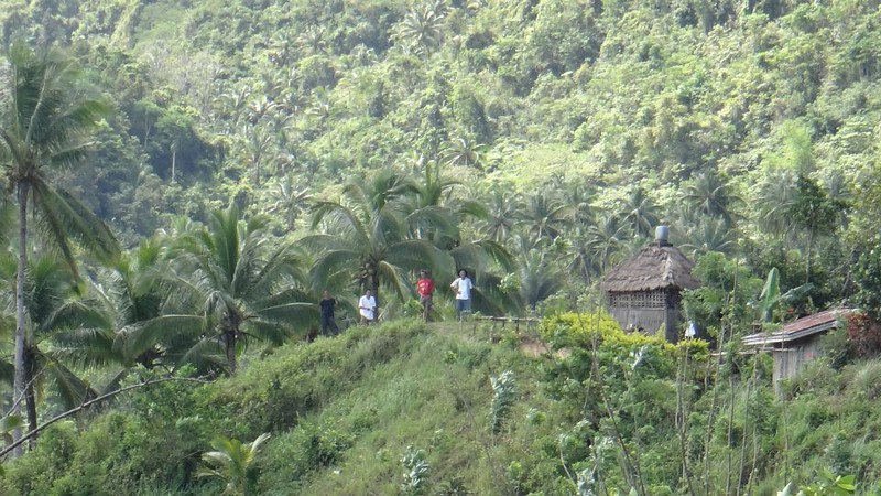
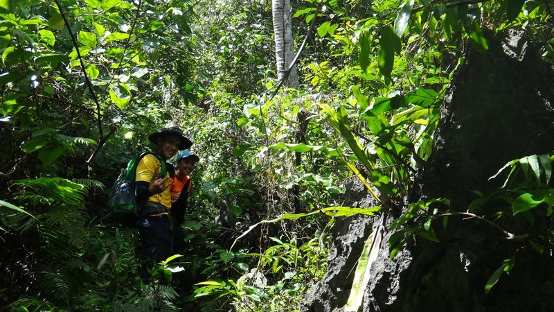
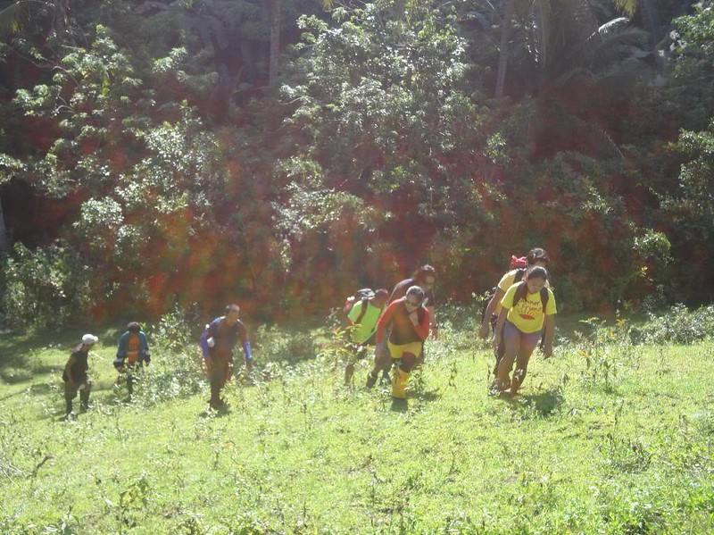
Along the way are small settlements of human habitation. We saw these folks looking curiously at us as we approached them.
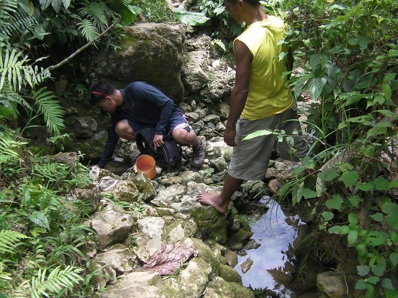
Around 30 minutes into the trek, the trail crossed this shallow stream. You can hop across it if you don’t want to get your feet wet, or you can simply wade through it so you can cool off your hot, tired feet.
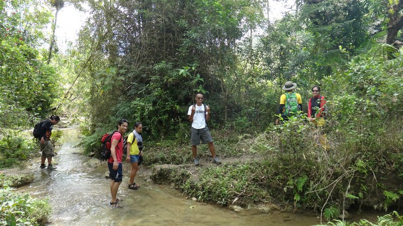
That’s a beautiful, clear, clean freshwater stream fed from rainwater and groundwater from the mountain.

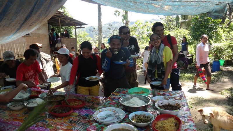
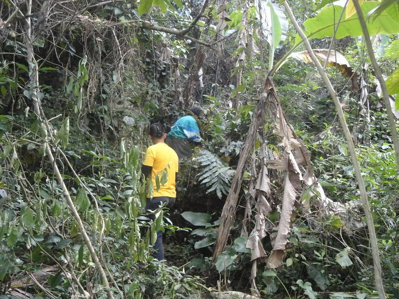
The trail continued to go up and right smack behind this small house. To our surprise . . . and embarrassment, we stumbled on a celebration. Specifically, it was a traditional “Kurenta Diyas,” the 40th and the last day of mourning over the passing of a loved one.

We were supposed to acquire our guide here then immediately proceed to the summit, but the kind missus who owned the house invited us for a meal. We vehemently declined while stating our original purpose. However, she was also equally persistent that we join the celebration. Thus, we were able to partake of a sumptuous lunch of viands made from farm-fresh ingredients! Delicious! And to think that this was not part of our itinerary!
After thanking the kind lady for the lunch and securing a local guide, we started the assault to Mt. Kapayas. But first, we need to pass this small stream which is filled with farm monsters. Can you spot the well-hidden monster here?

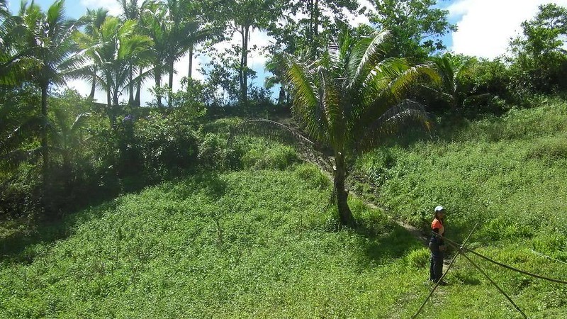
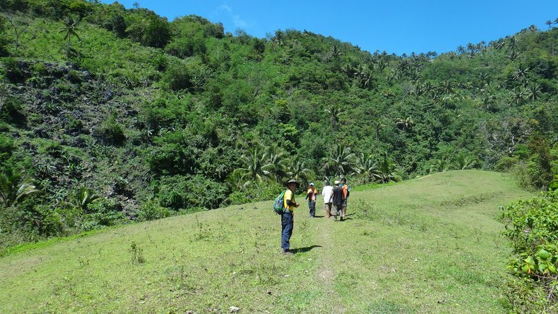
Beyond the stream is this grassy hill, the mountain’s shoulder. This also acts as a campsite in case mountaineers wish to stay overnight.
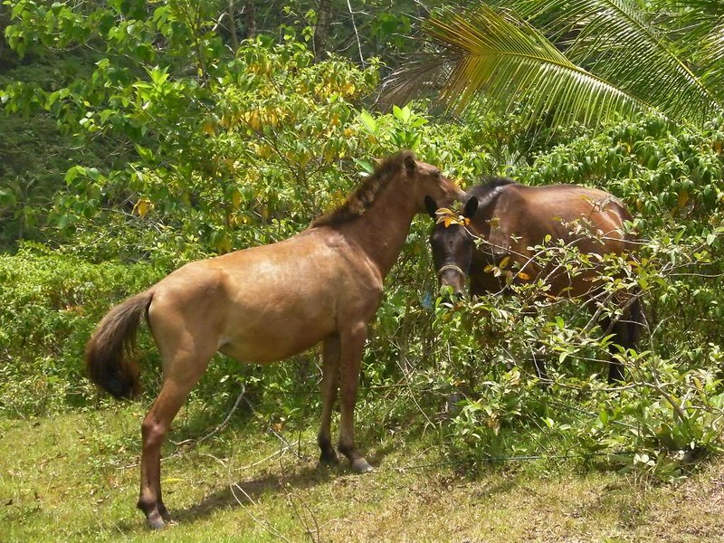
Along the way, we spotted these horses. From our guide, we learned that Barangay Kabangkaya is actually a breeding ground of horses, an immense network of meadows which horses graze around. Rich folks back in the city who are horse lovers buy their animals here.
The first segment of the trail to Mt. Kapayas’s summit is open and fully exposed to the sun. The main “obstacle” to contend with at this stage is heatstroke.
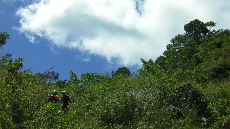
Thankfully, an hour later, we entered a lightly wooded area that protected the team from the full blast of the midday sun.
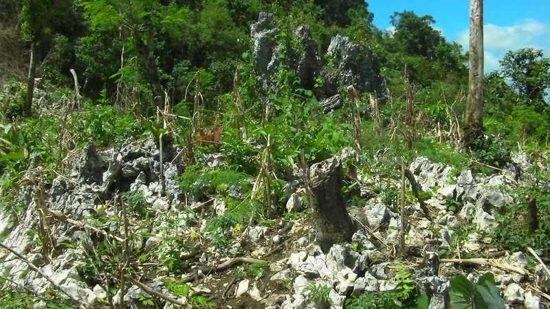
After a steep ascent in the wooded area, we emerged at this rocky section of the mountain. During rainy months, this becomes a small corn farm. But during dry season, this becomes just another parched, rocky patch on the mountain.
There was a farmer’s shelter nearby where we shielded ourselves from the brunt of the sun’s heat.
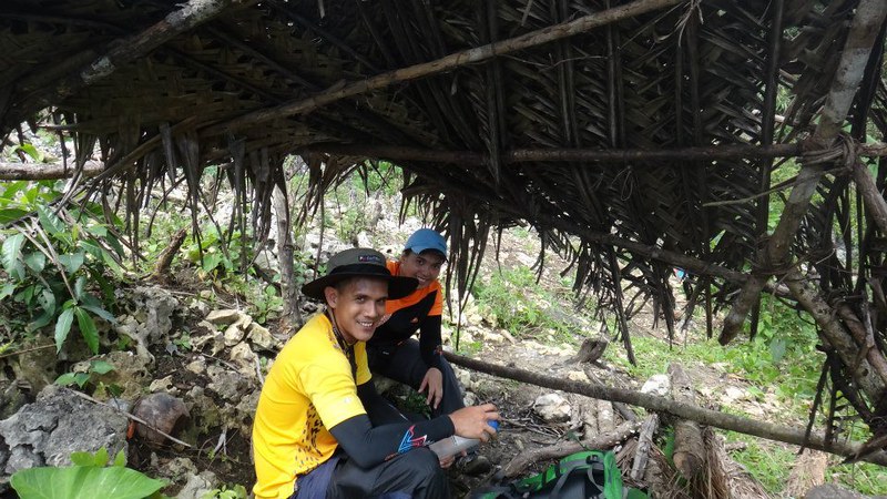
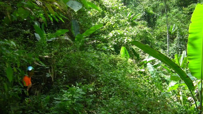
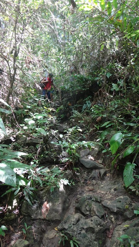
After a quarter of an hour of rest for everyone, we continued our assault. Thankfully, the trail went inside a much thicker jungle, which provided much respite from the power of the sun . . .
. . . but thoroughly punished our feet. The trail was littered with sharp, slippery, and loose rocks. Be careful! Watch your step here to avoid an embarrassing, possibly injurious fall.
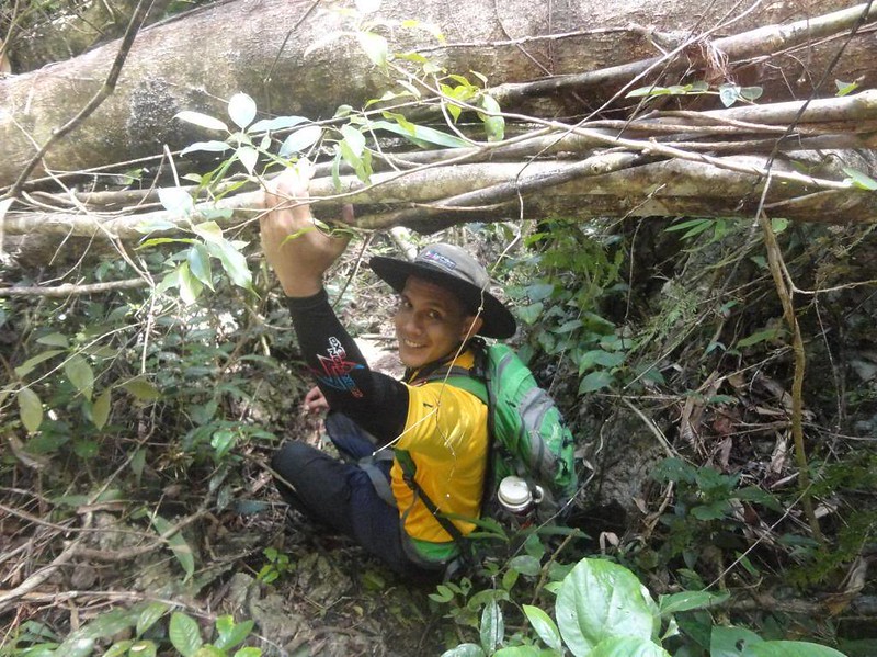
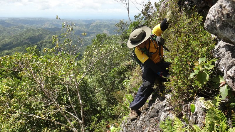
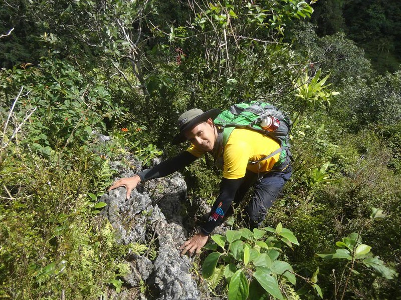
As we neared Torre, the peak, the trail became even rockier. Fallen trees block the trail, which forced us to duck under them.
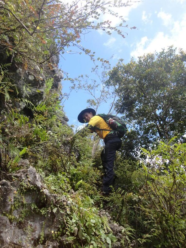
The best part of our Mt. Kapayas climb started at the base of Torre’s cliff base. To access the summit, we needed to free solo (i.e., climb without ropes) a 15- to 20-foot rock face that serves as a gateway to a passage that leads to the summit. Yes, it involves climbing up a vertical rock face!
With a magnificent backdrop of mountains, the climb was definitely spiritual! Here, you will feel how insignificant you are against Mother Nature. That realization puts you in your rightful place, humbling you. You will realize that there are powers out there that you can’t possibly comprehend, and you are just another insignificant, temporary occupant in this huge, huge world.
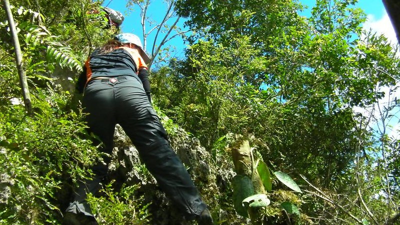
Sweetie started her ascent while others waited for their turn below her. Yes, you are looking at the actual verticality of the wall!
As rock climbers, Sweetie could hardly contain her excitement in scrambling up this cliff. The others were pretty hyped up too! In most mountains in Cebu, the summit can be reached via a simple trek. But in Mt. Kapayas’s case, it can be accessed only by climbing a cliff! Now that’s something different because it adds an element of real danger of falling down to the abyss below.

I call this section “Kiss the Wall” after its bigger and more popular counterpart in Mt. Guiting-Guiting. Sweetie is holding cracks in the rock that jutted a little bit outward from the main cliff face. See her foot? That is actually resting on the edge of the cliff. This means, climbers will have to lean slightly backward into the abyss.
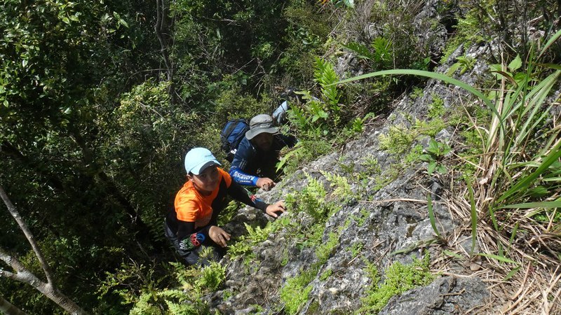
After safely passing through the Kiss the Wall, you simply need to scramble up this rocky passage to reach Torre.
The rest of our team emerged from the passage.
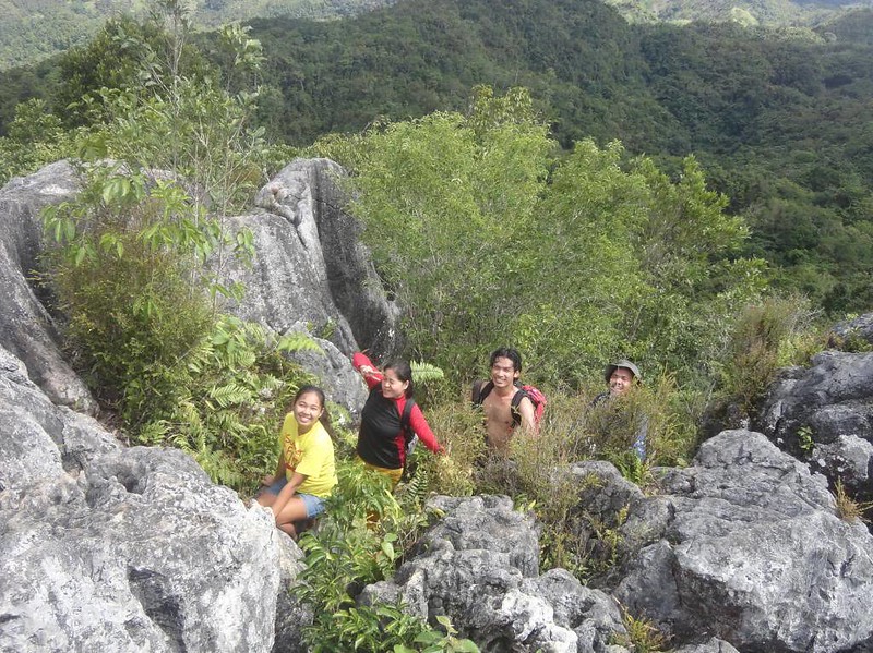
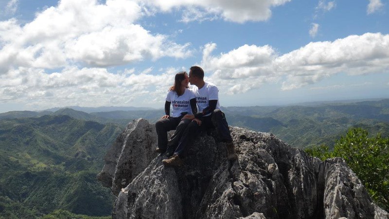
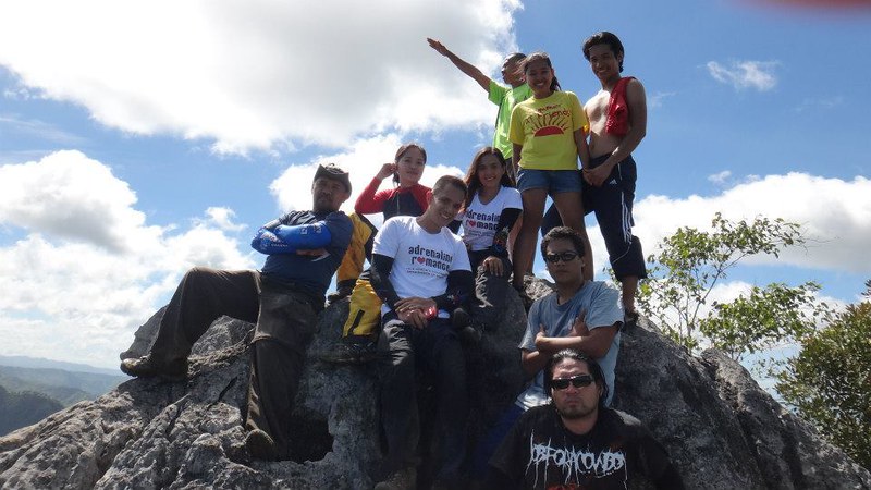
Torre is actually a rocky limestone outcropping on top of Mt. Kapayas. The summit area is small, perhaps just around 30 square meters, which can accommodate only a limited number of people. All around the outcropping are cliffs.
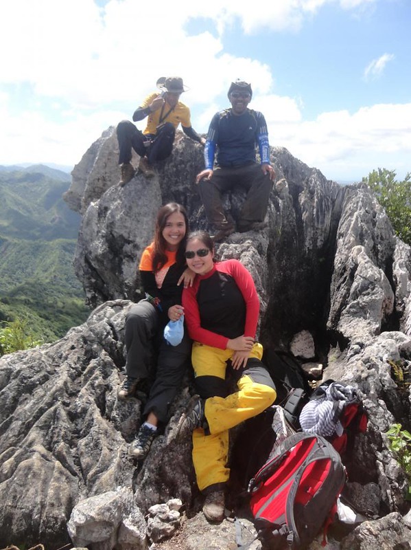
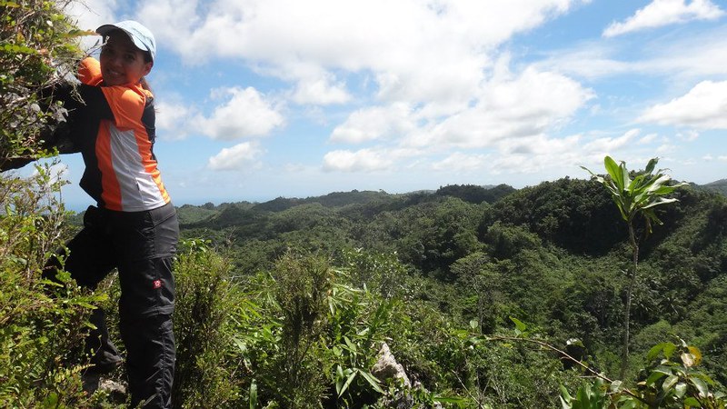
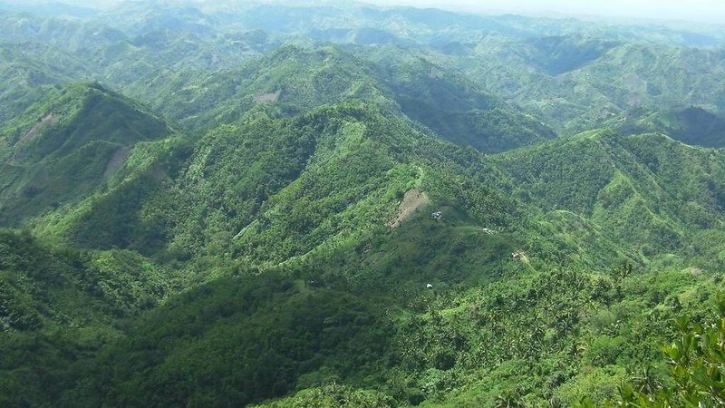
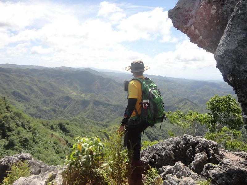
The view from the summit is simply breathtaking. You will never realize how huge and grand Cebu Island is until you have an unobstructed view of it from the clouds.
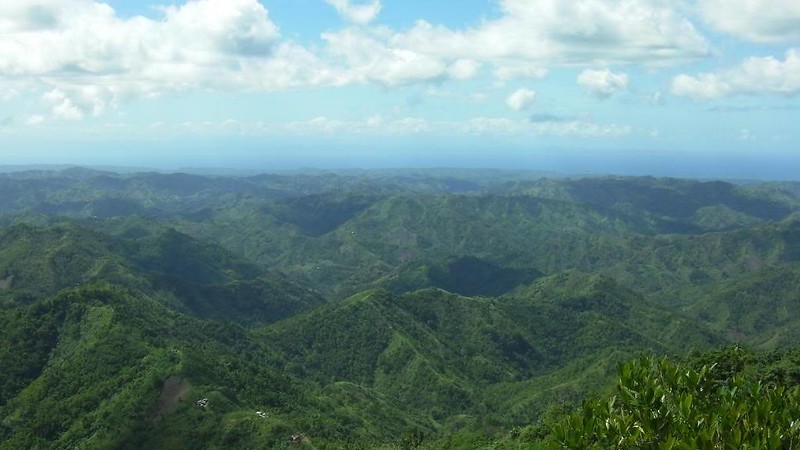
Houses and other man-made structures are just tiny dots on the top of hills. It’s a vividly accurate representation of how small we are in the great arena of nature. That is why we need to give Mother Nature the reverence and respect that are due to her.
Sweetie braved a rock outcropping at the very edge of the summit to have a better view of the magnificent landscape below. Look at how high she is. This is what you see on top of a 783 MASL mountain with a sheer drop. But notwithstanding the obvious danger, the spectacular show of nature leaves you breathless, amazed, and refreshed.

Just below Torre is a ledge where I indulged myself in my own silent sojourn, meditation, and reflection.
After half an hour enjoying Torre, we said our farewells to the summit and started our descent so we can continue on to explore the mysterious Lumanoy Cave.
Sweetie expertly navigated her way down the cliff face. Be careful here! Climbing down is definitely more difficult than climbing up.
We backtracked and descended the mountain for an hour until we reached the campsite meadow. See that high limestone cliff? Way below that is Lumanoy Cave.

Turning right from the meadow, we came upon this fallen tree near the pathway to the cave. We rested here for a moment while preparing our headlamps.

Some of our team members decided to stay by the tree, so we left our packs under their care. The rest of the group walked down the short trail that led to the small mouth of Lumanoy Cave.
The entrance of Lumanoy Cave is small and dark. However, the feeling of mystery, danger, and adventure is not diminished.
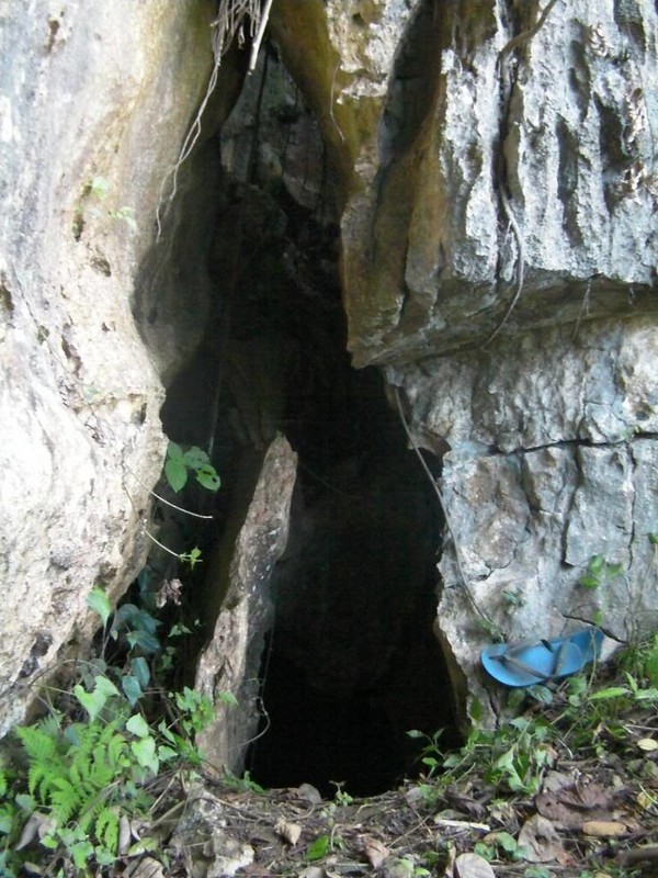
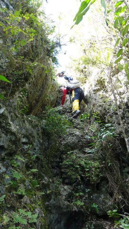
The start of the descent immediately involved a near-vertical climb down a rock “tongue.”

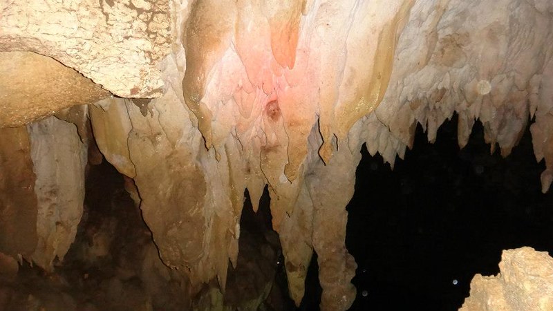
Unspoiled stalagmites hang from the cave’s roof like tattered curtains.
Descending carefully into the dark abyss with care. Yes, you need to be extra careful here because . . .
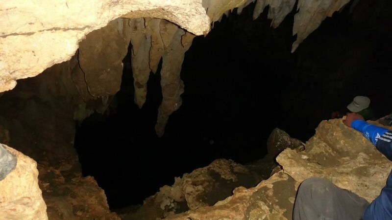
. . . at your right is this! At the bottom of that chasm is a pool of dark water whose depth is still yet to be measured.

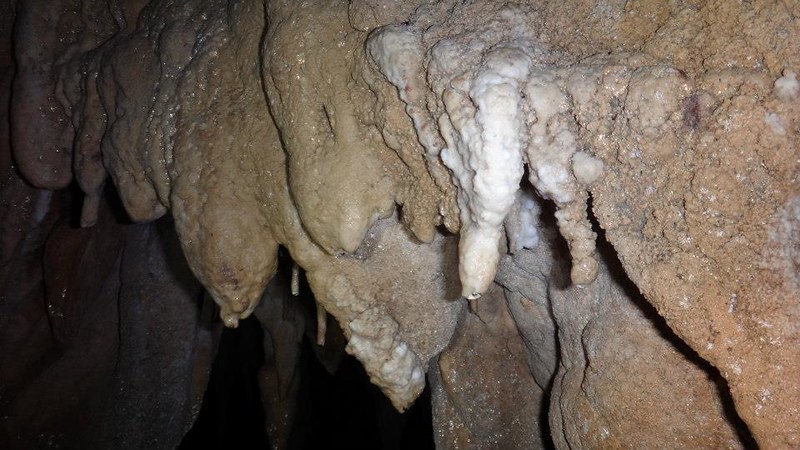
Young speleothems formed after hundreds of years of sediment accumulation. Nature moves in slow, gradual, and mysterious ways.
We didn’t stay long inside Lumanoy Cave although some of us did want to explore a passageway down the abyss. We have told the habal-habal drivers to pick us up at 3:00 PM. By the time we went inside the cave, it was already close to 3:00 PM. Thus, we exited the cave and headed back to Sitio Kampanya where the drivers patiently waited for us.
Kudos to the brave summiteers of Mt. Kapayas!
* Special thanks to Sir Ronald Ramiso for some of the excellent photos.
Suggested Itinerary for a Day Trek
5:30 AM – meetup at Pocherohan/Alberto’s Pizza Mandaue
6:00 AM – ETD Mandaue, going to Catmon
8:30 AM – ETA Catmon Municipal Hall, register at Municipal Hall or police station, negotiate habal-habal ride
9:00 AM – ETD Catmon Proper for Sitio Kampanya, Brgy. Kabangkaya jump-off
10:30 AM – ETA Sitio Kampanya, Brgy. Kabangkaya jump-off
10:45 AM – briefing, refill water, start trek
12:00 PM – ETA Torre (Mt. Kapayas summit)
12:30 PM – lunch at the Torre
1:00 PM – ETD Torre
2:00 PM – ETA Lumanoy Cave, explore cave
2:45 PM – Exit Lumanoy Cave
4:00 PM – ETA Sitio Kampanya jump-off
4:15 PM – ETD Sitio Kampanya
5:30 PM – ETA Highway and back to Cebu
Estimated Budget Per Person
P70 – Ceres Bus Mandaue to Catmon
P70 – Ceres Bus Catmon to Mandaue
P120 – habal habal ride from Catmon to Sitio Kampanya
P120 – habal habal ride from Sitio Kampanya to Catmon
TBC (to be computed, depends on the number of participants) – guide fee
Total Estimated Budget – P550
Tips
1. A Mt. Kapayas climb is best enjoyed with a small team of 3 to 10 people.
2. For guideship services, please contact Kyno Dumlao (0939-6586473) or Carlo Piezas Genovia (0927-3245456 or 0943-2672587). Please negotiate the rate with them.
3. If you wish to procure a local guide, inform Catmon Vice Manager Iris Ballon of your intention to climb Mt. Kapayas. She will assist in coordinating a local guide in Lumanoy for you. At Sitio Lumanoy, look for Ronald Roiles or Rey to guide you to Torre and Lumanoy Cave.
4. The mountain is located at the Central Northern part of Cebu, which is quite remote. The road to Sitio Kampanya is 20 kilometers from the highway.
5. The budget for a Mt. Kapayas day trek is relatively high due to the high price of the habal-habal fare. That’s because the road to Sitio Kampanya is almost impassable. During rainy season, the road turns into a canal of mud; and during dry season, an extremely rocky, dusty path. In fact, even certain 4X4 vehicles would be unable to traverse the entire length of the road. The habal-habal is the surest, quickest way to reach the jump-off. Considering that the extremely rough terrain can damage their motorcycles, habal-habal drivers are often reluctant to bring you to Sitio Kampanya. Be ready to disembark and hike at certain points (mostly steep, extremely rocky or muddy roads) to allow the drivers to negotiate the rough terrain.
6. Make sure you negotiate with the habal-habal drivers to either wait for you at Sitio Kampanya or to fetch you there at a certain time. That’s because there are hardly any habal-habal drivers to take you back to Catmon if you depart from Sitio Kampanya. If the drivers are not willing to wait or fetch you, you need to hike to Baranggay Agsuwao, which is more than an hour of trekking from the jump-off. Then, you can take a habal-habal from Baranggay Agsuwaw back to Catmon proper.
7. If you bring a 4-wheeled vehicle, you may have to park your vehicle at Baranggay Agsuwaw (you can give a little tip to a local to watch over your vehicle). Also, this is the farthest point that most habal-habal drivers from the city are willing to take you. Then, you can hike to Sitio Kampanya following the road. The catch here is that it takes 2 hours to reach the jump-off point.
8. Pack light but do bring the following
* water (at least 3 liters)
* trekking attire
* trekking shoes (terrain is rocky)
* umbrella, hat, or sarong (terrain is exposed and hot)
* packed lunch
* trail snack
* helmet (protection for caving)
* headlamp (for caving)
* rain gear (in case of bad weather)
* extra money for emergencies
9. Wear good-quality trekking shoes with an aggressive tread. The trail is quite rocky, and your shoes will definitely need to endure a good beating.
10. Wear arm guards and leg guards to protect yourself from sun and the plants that can scratch your skin.
11. Take salt tablets or beverages that are filled with ions (e.g. Gatorade, coconut water, etc) besides water. The hot sun and the steep ascent can squeeze the fluids off you. When you lose enough ions and salts through your sweat, you will suffer cramps. Remedy cramps by resting for a while and eat salt to replenish the ions you lost.
12. Bring energy-rich trail food such as nuts, crackers, bread, and bananas.
13. You can camp at the meadow at the mountain’s shoulder. The ground is grassy and flat, providing a really comfortable bed.
14. Be sure to watch your footing when you ascend the Torre as it involves a bit of rock climbing. There are numerous handholds and footholds that make the climb relatively easy. Still, be careful of loose holds and slippery ledges.
15. Lumanoy Cave is relatively unexplored. Exercise extreme caution when you enter the cave because to your immediate left from the entrance is a deep, 30-foot chasm that leads to a vast underground pool. The depth of this body of water is not yet ascertained. There are deeper passages in the cave worth exploring, but be sure you bring adequate caving gear and a professional spelunker with you.

weeeh! Thanks a lot Sr Gian and Ate Sheila! Morey and I loved the adventure!
You’re welcome, Angel! 🙂
nice detailed info sir.
Hi Jmartillan,
Thank you, sir! We hope this will help you on your Mt. Kapayas climb. 🙂
very informative thread sir.
Tatay Opaw,
Sir! Thank you for the compliment. Rock on!
nice!!!
DD Dawnz,
Thank you! Just give us a ring if you want to join our adventures. 🙂
Great blog post thanks for posting
Nindota ani sakaon ui.. Nice post!
Hi Sir Leandro,
Thanks, sir. Yes, it’s a really nice mountain to climb. Ang problema lang ani sir is that mahal ang iyang fare, especially the habal-habal. It’s the most expensive dayhike we ever had.
Wow! What an adrenaline-filled adventure – a bumpy ride, then trekking and rock climbing to a magnificent view!
Welcome to PTB, by the way. =)
Hi Claire,
Oh, definitely! You should try climbing Mt. Kapayas when you visit Cebu.
Thank you for the welcome. Adventure on!
Hello Sir Gian and Mam Sheila,
mag ask unta ko sa range sa guide fee nila…and ang sa habal-habal only one per motorcycle? or pwede duha?
and then ang guides na gi recommend ninyo diri (Kyno and Carlo) are they locals from Catmon or Brgy. Kampanya? Thanks to this informative blog, i’m itching to climb 🙂
Hi Xayide,
Actually, there is no fixed guide fee; we think P300 to P500 will be a good benchmark. Sa habal-habal, pwede duha aron ma share ang gasto.
Kyno is a local in Catmon proper while Carlo is from Lapu Lapu. You can contact either of them para maka guide ninyo. If di ninyo ma contact sila, you can follow Tip #3 and secure a guide there.
Nice na nga mountain. 🙂
Gian and Sheila
A great adventure starts when you know where you start from.
want to visit this peak….soon………………………
Hi Ruel,
Thanks for visiting our blog.Yup, it’s a very nice mountain. Just be prepared for a very rough motorcycle ride and difficulty of securing transport. Also, we would advice you to negotiate with the habal-habal drivers to wait for you or fetch you after your climb since it would most likely be very difficult to secure a motorcycle going back to Catmon proper.
nice info. wish i could join on ur climb sometime
Hi Mika,
Sure! You are welcome to join us. Just drop us a message through our Contact Us form (under the About Team Sweetie tag) or send us a message in our Adrenaline Romance Facebook page.
Hi Sir! Did you go through the Tourism office and acquire permits? I read sa istorya mahal daw.
Hi Maloy,
Thanks for the inquiry. That is what we heard from the grapevine too that they are implementing exorbitant fees daw.
When we went there, such policy was not implemented, and we didn’t go to the tourism office. We simply registered our names at the police station, went to the aforementioned barangay, and paid the person who guided us.
Thus, unfortunately, we can’t really provide you any information about this new policy of theirs. We suggest you go to Carmen and inquire about this policy before organizing your climb.
Hope this helps. Thanks!
i have a friend who actually guides there. you might be interested, you can contact me through this number, 09227676050… thanks!
Hi Sir Gian,
I’ll be using your itinerary cause I’m interested to climb this place too. I just hope the guide fee won’t be that steep though.
Happy New Year!
Hi Maam Marianascha,
Thank you! But please do check with the municipal hall first. We heard there are some changes on the protocols there.
Hey Gian, salamat sa tips! 🙂
Hehe! Walay problema maam. 🙂
Moadtu mi next weekend! When are you going there?Basin mgkita ta hehe!
Wow nindota ikuyog oi! Wala pa ko nakaadto. Share niya itinerary Karen. Thanks!
[…] Image brorowed from Adrenaline Romance […]
Ganahan ko ani. Iapil sa lista bi. 😀 😀 😀
Go go go! 🙂
Pero mag-imagine kos two hours nga habal2x. Haha. 😀 😀 😀
[…] Image borrowed from: Adrenaline Romance […]
Hiked up there yesterday. Way harder than I was expecting, without a doubt one of best adventures in the Philippines!!!! Tourists go to the beach, adventurers go to the mountains. SO LOOKING FORWARD to using this website to find new adventures!!! Thanks so much!!
Thank you, John! There’s also a cave underneath the mountain, but it is still unexplored.
[…] Image borrowed from: Adrenaline Romance […]