There is always a tougher mountain than the last. Something that is so imposing, isn’t backing up, is punishing you, is indifferent to your pain, and is telling you to quit. Something that is ready to extinguish your life with no qualms. It is on this mountain where you will finally know yourself as a human being. For us, Mt. Guiting-guiting, which is situated in remote Sibuyan Island in the Romblon Provice is that majestic and unforgiving mountain.
A climb up Mt. Guiting-guiting, also known as G2, has always been in our bucket list. It deserves to be so because it is considered to be one of the most technically challenging and difficult mountains to climb in the country. It took us several long months of preparation, planning, and physical and mental conditioning to declare ourselves worthy to climb up its sacred slopes. Such is our huge respect for this grand mountain.
Still in high spirits after our unexpected side trip, we were totally excited for this climb. However, the pump boat remained docked even as the scheduled hour of its departure at 9AM passed. Wondering what was going on, we asked the skipper why we haven’t left Culasi Pier. Bad news! The vessel, which was recently repaired, was not given a certificate of seaworthiness by the Philippine Coast Guard. Specifically, the skipper failed to apply for that certificate the day before. Worse, it was a Sunday, and the PCG officer in charge won’t be back in the office until later in the afternoon. Come on, PCG, you are supposed to operate 24 hours, 7 days a week!
Frustration and disappointment set in. Are we going to be stranded in Roxas City for another day? We have already filed our leaves for one week! If we get stranded, what are we going to do there for a week?
At almost 11AM, we decided we had enough of waiting and exited the pump boat. Then at the last possible moment, the skipper decided to sail to Sibuyan Island anyway, regardless of the penalties and sanctions that they will incur. Although Halourd and I were resigned to abort the climb, Sweetie was adamant that we get this climb on the way. Reluctantly, we re-boarded the boat, which, filled to the brim with cargo and passengers, looked doubtfully seaworthy.
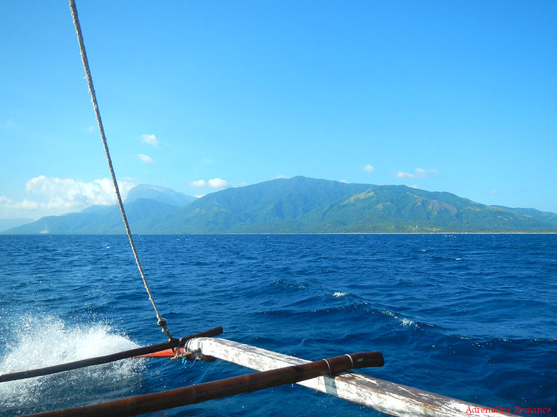
Sailing to Sibuyan Island from Roxas City required a dangerous 6-hour voyage across open water. That means, the waves were humongous and the sea was considerably rough even in fine, sunny weather. We were quite concerned about our safety because many sea vessels, including large passenger ships, sank in these treacherous waters.

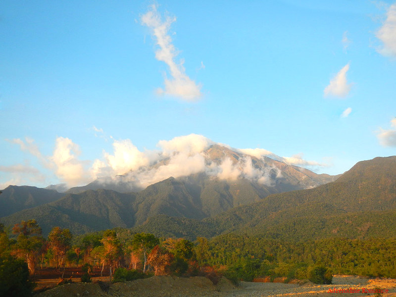
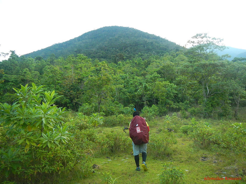
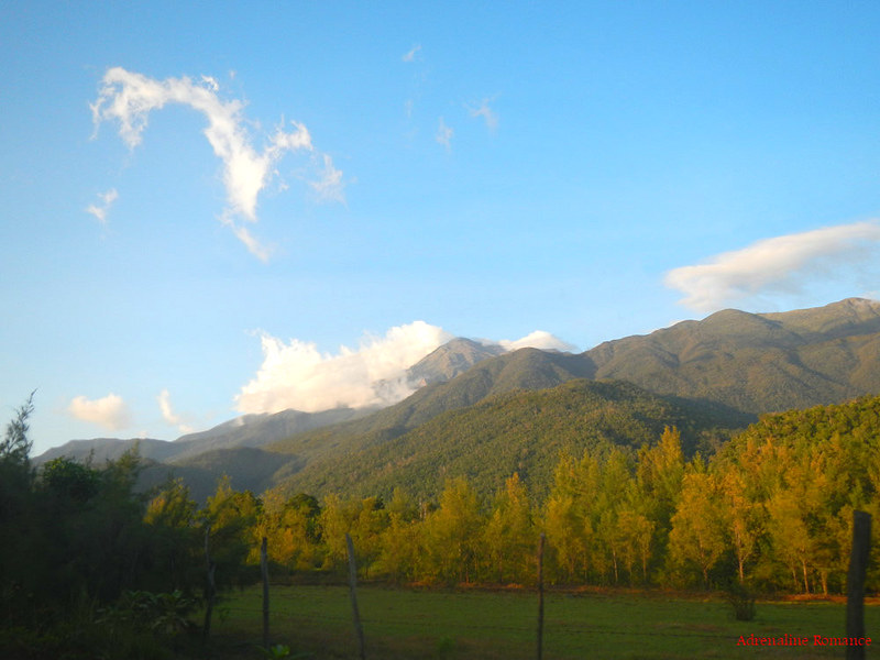
After a tense, exhausting, and jarring 6-hour cruise across the Sibuyan Sea, we finally saw the verdant Sibuyan Island, which is the second largest island in the Romblon archipelago. Look at those mountain slopes; they’re covered with lush forests. Beyond the shore, partially covered in cumulus clouds, is the imposing peak of Mt. Guiting-guiting.
A very interesting fact about Sibuyan Island is that never in its geographical history is it connected to the Philippines or the world. In other words, it has been a sole, lonely island surrounded by the sea even in its inception. Thus, Sibuyan Island is called the “Galapagos of Asia” by scientists all over the world.
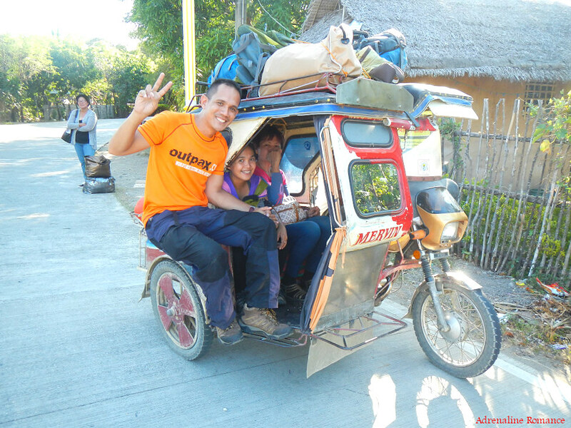
Due to the large waves, we were diverted to an alternative port instead of the main port of San Fernando. After docking, we rode a tricycle to town where Sir Remy, the head guide of the traverse trail, was waiting for us. Check out their unique tricycle, which is also common in Roxas City. Each has two baggage racks, one behind and the other on top, to allow a larger volume of items to be carried. Furthermore, it has an extra seat outside the sidecar for an extra passenger (as if 7 passengers on a motorcycle-powered contraption is not enough). Riding on the outside seat was risky, but it was pretty exciting for me.
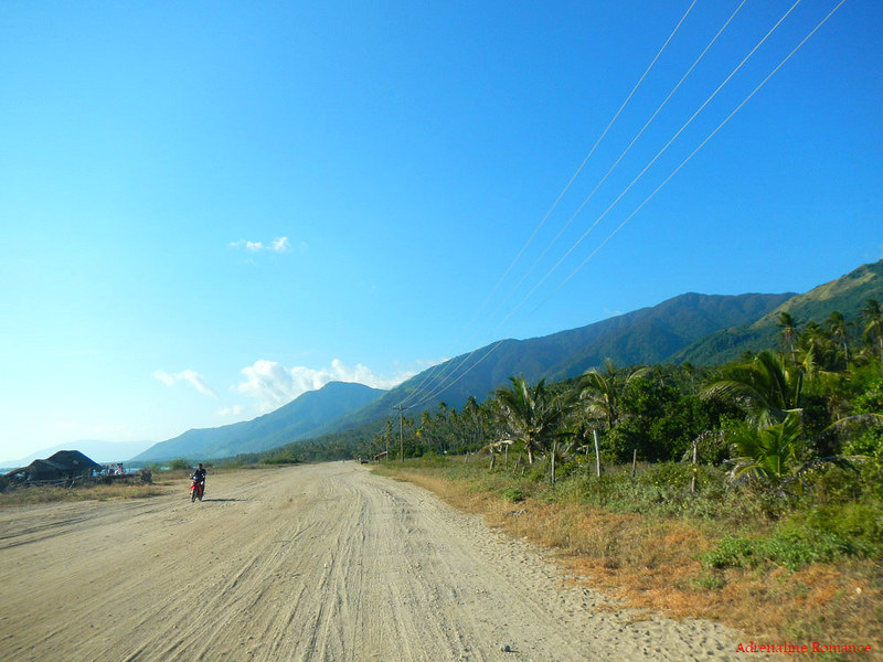
Because of the island’s isolation and, subsequently, the apparent lack of government attention, the circumferential road around Sibuyan Island is mostly rough and unpaved. However, it does offer amazing views of the surrounding mountains and the sea.
While we were awed by the majestic sights, we still have a lot of serious concerns. First, based from our earlier experience, the boat schedules, which are advertised as fixed, were actually irregular. We don’t know if there will be an available boat for our return trip to Roxas City. Second, we don’t have the phone numbers of the skippers of the other boats to confirm whether there will be return trips or not. Lastly, our team-mates from Manila have already gone up the mountain. While we texted them the day before to modify our arrangement, we don’t know if they left us any food, butane fuel canisters, and supplies. In other words, this climb was a risky gamble.
We said goodbye to our good Samaritan Ate Ville and met Sir Remy at the San Fernando marketplace. Because Sir Remy told us it was already late and we need to hurry up, we bought whatever we can grab our hands on—canned food, package soups, rice and bottles of Gatorade. This was our first-ever climb in which our meal plan was thrown out of the window, but we also don’t want to take chances.
After a bumpy one-hour ride, we arrived at Sir Remy’s place and the jump-off point in Sitio Olango. We met some friendly Manila-based climbers who shared their delicious dinner with us. Best of all, one of the guides volunteered to confirm our return boat’s schedule as he knows the captain personally. To our huge relief, the guide confirmed that there’s definitely a trip to Roxas City on the day we plan to leave Sibuyan Island.
In addition, Sir Ken Agasway, the leader of the Manila team and the one who arranged this climb, left us with butane fuel canisters and some food. He also forwarded our guide and porter payment to Sir Remy. All was well!
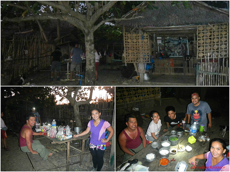
We had a short briefing, met with our assigned guide Angie and porter Andrew, prepared our stuff, had a cool shower, and slept early. At the crack of dawn, we were up and had another quick shower. After a heavy breakfast and some last-minute checks, we finally commenced this dream climb. We were walking along the dry Olango riverbed when the sun rose high enough so we can use our cameras without firing the flash.
Sweetie confessed that she almost shed tears of joy and relief. That was totally understandable. After all the uncertainties we experienced, we couldn’t believe Mother Nature actually gave us the chance to achieve the adventure of our dreams.
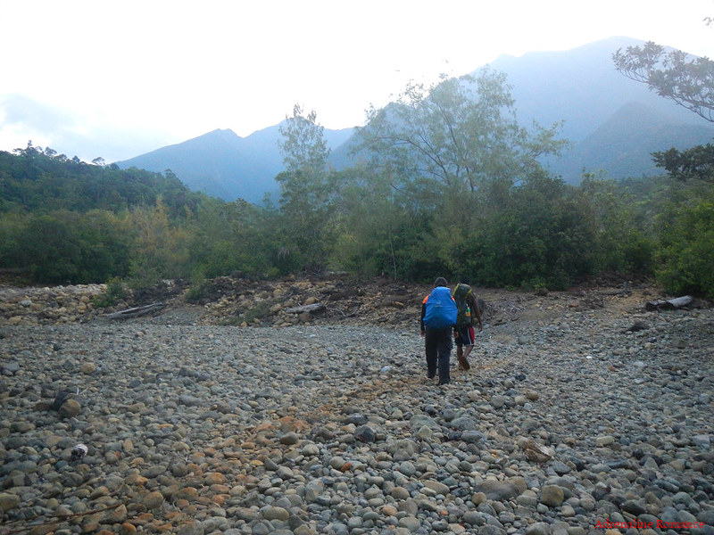
We were pretty sure there were lions, hyenas, and cheetahs hiding somewhere here. Hehehe! The grasslands plain below the mountain look very similar to African savannas. Our country definitely has so many wonders.

The combined onslaught of summer and a quarrying operation somewhere upstream dried this river. According to Angie, this was supposed to be a powerful river in the past. Today, water flows in the waterway only during rainy season.
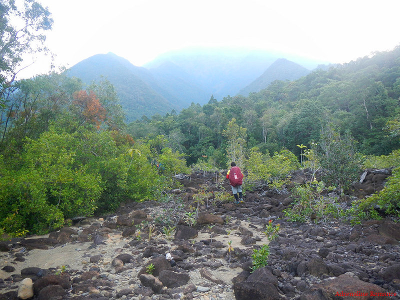
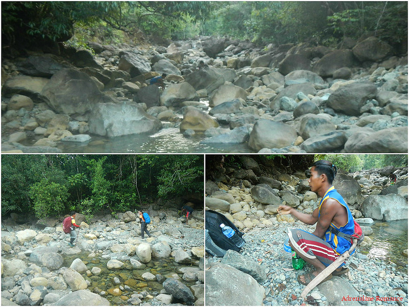
Before proceeding, we took a rest at the base of the mountain. We rested for a bit while Angie and Andrew filled up all our water bottles from a hidden spring; we need them full because it was going to be a hard climb. Angie also secured his bolo, which he uses as a tool and a weapon.
After the short break, it was time to do serious business—the actual assault to Mt. Guiting-guiting’s summit. Angie said that this was going to be a grueling 10-hour ascent. Suddenly, I remembered my unfortunate cramping episode when we climbed Mt. Pulag’s steep Akiki trail. Although we had plenty of workouts, dayhikes, and jogging sessions to prepare for this adventure, I still hope I won’t have cramps this time.
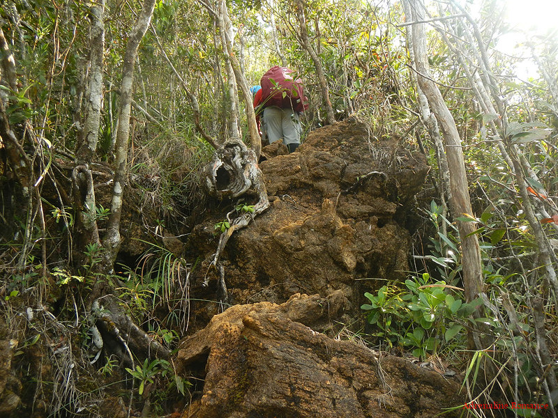
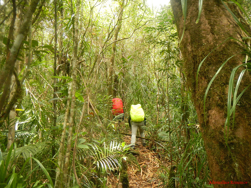
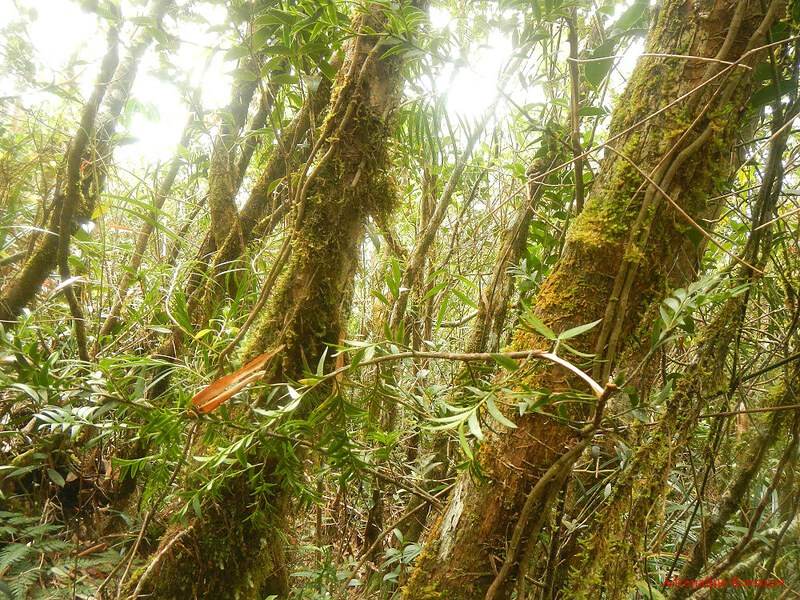
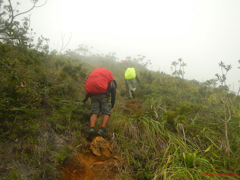
The trail began to rise steeply as we entered the forest. At first, we thought the features of the trail, which comprise of loose forest soil, roots, and occasional boulders will remain the same until we reach the last camp on this side of the mountain. Boy, we were in for a big surprise!
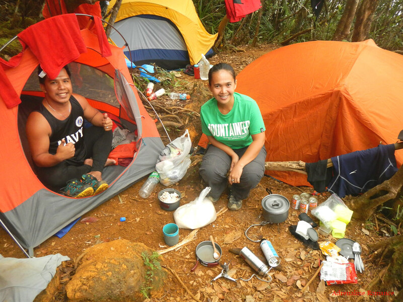
Let us introduce you to our guide Angie (the guy in blue) and porter Andrew (the guy with the green pack). They are some of the strongest and most capable guides/porters we’ve ever encountered in all our mountaineering adventures. But that should be of no surprise since they are pure May-as—indigenous people of Sibuyan Island. Having lived in these mountains all their lives, these guides and porters are almost super humans. They can carry huge loads, effortlessly leap from one rock to another, live off the land, and cross the entire Mt. Guiting-guiting range in just a day. Later, we learned that Angie can even track bees to their hives so that he can harvest the bees’ honey.
The team placement was also new to us. The porter walks in front of the team while the guide walks behind. In most other mountains, it’s the other way around. It was an unusual arrangement, but it made sense. The porter with the heavy load can go ahead to set up camp or to prepare the next stop for the team. The guide stays behind to direct the team and to have a commanding overview of the trek’s progress.

Be careful! Many plants like these are wicked, and they can cut your skin. The leaves’ edges are sharp and saw-like.
At around 8AM, we reached Camp 1 at 657 MASL where we had a well-deserved rest after a constant ascent. We shared our GORP (Good Old Raisins and Peanuts, but we included chocolate bits and jellies to the mix) trail snacks to Angie and Andrew and began to share stories. Both shy guys opened up as they realized we were treating them as equal team members, not as service providers.
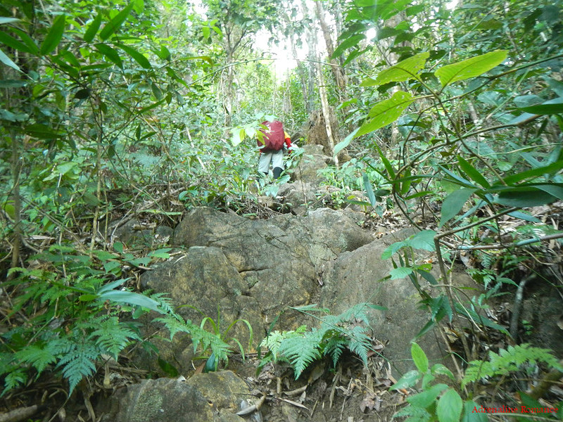
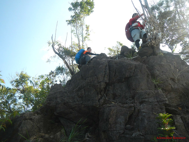
We left Camp 1 and continued the ascent after getting our heartbeat and breathing back in sync. Not far from the camp, the trail abruptly changed. Rather than loose soil which we usually trek on in other mountains, we came across huge boulders. And by huge, we meant boulders ranging from the size of an average man to a single-floor bungalow! There was no other way than to climb these humongous rocks.
Seventy percent of the trail, from this point to faraway Mayo’s Peak, is dotted with mountain-borne boulders. No, we weren’t just trekking. This is pure and awesome rock scrambling!
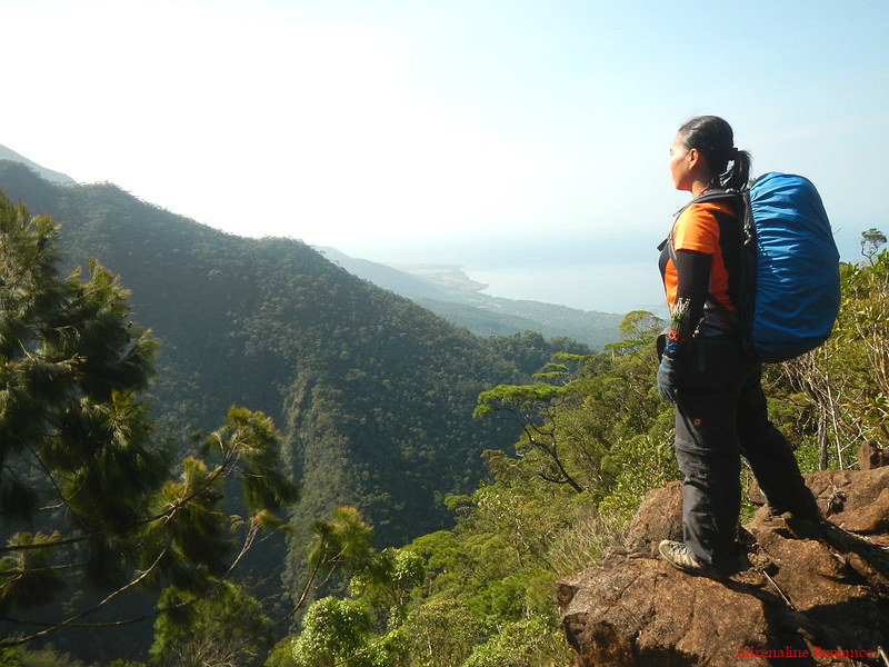
It’s a beautiful world! Sweetie paused for awhile to admire the stunning scenery below us. In many instances, we had to fight it out in order to witness these wonders.
Living a good life is similar. You need to persevere; take the challenge head-on; and overcome your fears, doubts and worries. That’s the only way to enjoy life’s promises.
Because Sibuyan Island is isolated since its geographical birth, it is very rich in biodiversity. Much of the forest area in the island, covering an area of 140 square kilometers, is original. Forests in the plains however are second-generation and have grown successfully through reforestation.
To protect this treasure, the Philippine government declared an area of 157 square kilometers at the center of the island as a protected area called the Mt. Guiting-guiting Natural Park. The park features canopied forests amidst scenic landscapes.
This does not include the mangrove forests and the heathlands that surround the park and Mt. Guiting-guiting.
Huge rocks dot the slopes of the mountain. The somewhat reddish color suggests that these rocks are rich in mineral and iron deposits.
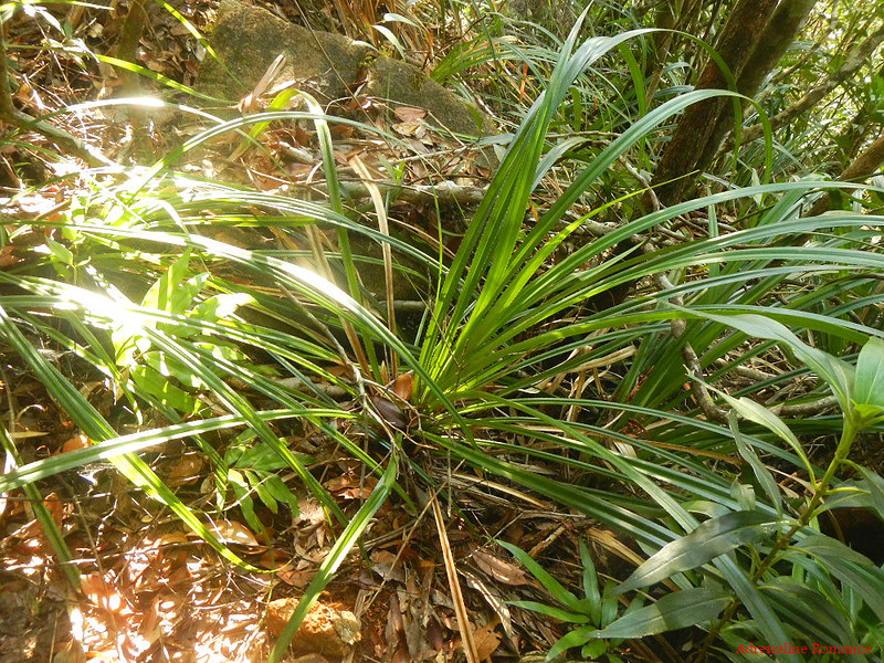
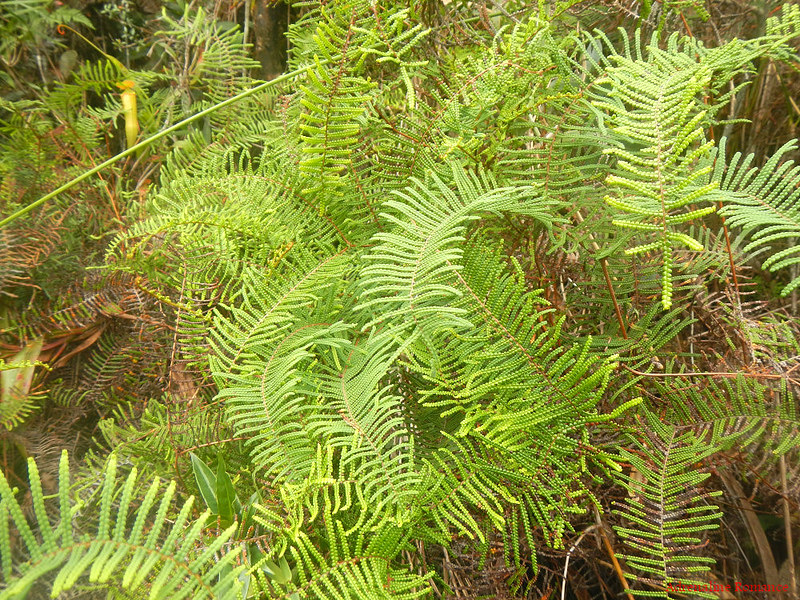
Wild ferns are everywhere! Many of these ferns are so large and lush.
The struggle was very real…and absolutely fun! We had to use our hands and feet to climb near-vertical sections of the trail.
(Photo credit: Halourd)
There are elements of real danger all along the trail. For example, although this “deck” offers a picturesque view of San Fernando, we had to be careful because a misstep to the right can send us falling off the ridge. Vegetation covers the edge of the cliff.

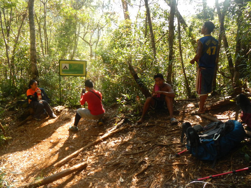
At around 11AM, we arrived at Camp 2 deep inside the forest, and it’s time to replenish our energy. We prepared a hot lunch of corned beef, sausages, and thick crab-and-corn soup. Of course, along with lunch comes interesting stories, from legends of the mountain to funny accounts of the guide’s experiences in guiding other climbers.
After a hearty lunch and a pleasant round of conversations, we started the next and last leg of our first day’s ascent. The trail took us deep inside the mountain’s montane forests, which starts at an elevation of 700 meters.
Many of the forest trees are covered with various types of moss. The moss provides a great habitat for insects and worms. Furthermore, because they retain water like sponges, you can suck water from them in survival situations.
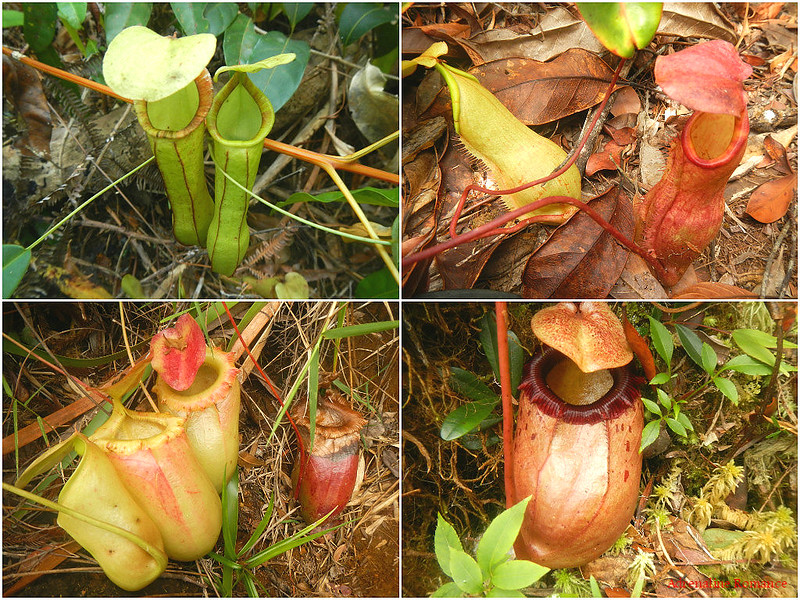
Along the trail, we found a huge variety of carnivorous pitcher plants. Specifically, these are Nepthes Sibuyanensis, a specie endemic in Sibuyan Island. Visual and nasal lures attract insects towards the slippery lip of the pitcher plant. Once the insect lands on the lip, it slips into the inside of the pitcher plant. The interior wall contains waxy scales, inward and downward-pointing hair, and aldehyde crystals that prevent the prey from crawling back out. Inside is a vat of liquid that slowly drowns and gradually dissolves the insect. The plant then absorbs the nutrients from the dead prey.
Pitcher plants usually grow in locations wherein the soil quality is too acidic or lacking in nutrients for more fragile plants to survive. So rather than solely depending on photosynthesis, pitcher plants supplement their nutritional requirements through their insect prey.
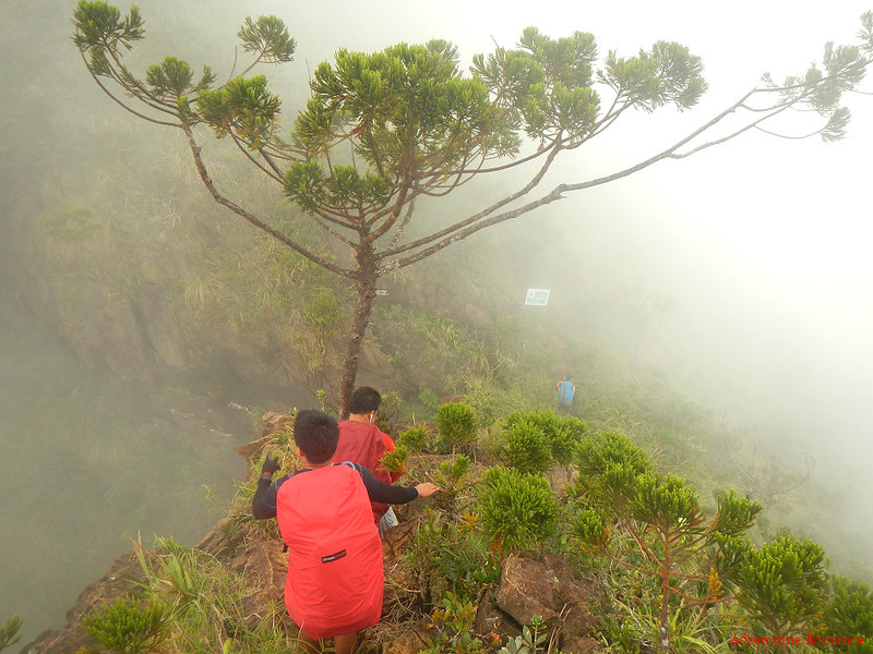
As we reached a fern-covered ridge, a thick bank of fog rolled in. Despite the fact that we left the canopied forest behind, the foliage became thicker. But what was really strange was that everyone, even the guides, felt a powerful sense of humility and reverence. It was as if we were entering a sacred and ancient place that is filled with spirits of Mother Nature.

The thick fog bank made the air cool and refreshing. But it also made the trail more dangerous. Check out the left side of the photo below; the fog hid a very steep cliff
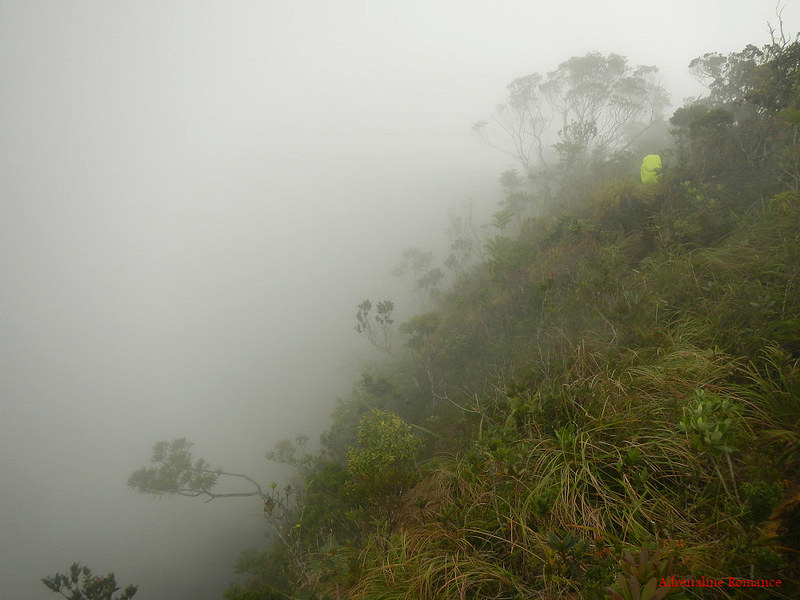
At around 2PM, we reached a small flat area called Helipad. As its name implies, it’s supposed to be a landing area for choppers. But the pad is too small and rough for a helicopter to land on. Being at the shoulder of a mountain, the view around us must be breathtaking if not for this fog.
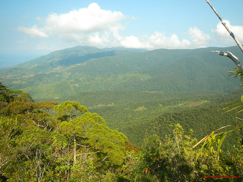
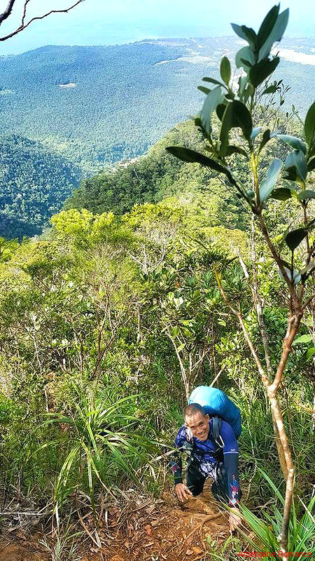
After 15 minutes and consuming our first bag of trail mix, we proceeded to Camp 3. Now, look at the photo below to see just how verdant and lush this mountain is. Biologists of the National Museum estimated that there are 1,551 trees in one hectare in Mt. Guiting-guiting. That’s a whole lot of trees, don’t you think?

Be careful, Sweetie! She stood at the lip of a cliff that seems to have no bottom. Seeing her at the edge made me truly jittery. And yet, this is truly part of the trail.
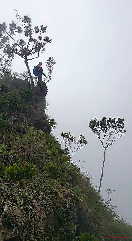
The photo below gives you a better view of the knife-edge trail that we were walking on. On one side is a sheer drop and on the other is a steep slope. Choose! Hehehe!
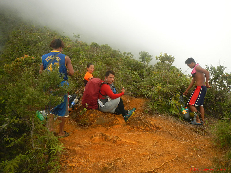
Close to 3PM, we finally saw the sign that indicates that Camp 3 is just around the corner. Finally, we can have a well-deserved rest after 10 hours of climbing. It was about time too because I felt tell-tale signs of leg cramps.
We had one final push up this 70-degree part of the trail that is characterized by loose soil and falling rocks.
Hidden in a small clearing just off the trail is Camp 3. The good thing is that the lofty trees protected us from strong high-altitude winds, which became more ferocious later in the night. However, their massive network of roots protrude from the forest ground, making it a less-than-ideal place to pitch tents. Sweetie, Halourd, and I had to spend some time to position our tents on the most level piece of ground we can find. Hammocks, on the other hand, would be perfect here.
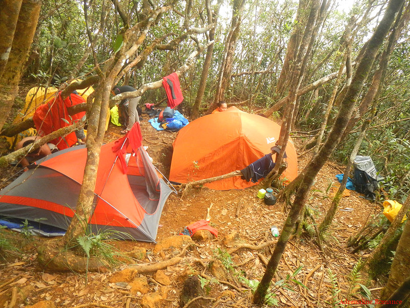
A massive cliff behind Camp 3 shielded us from the brunt of the wind, which got stronger and colder as the afternoon wore on.

Angie told us that we should be able to leave camp by 3AM the next morning so we could catch the sunrise at the summit. But because we want our climb to be slow, pleasant, and unhurried, we didn’t take any chances. We told Angie that we should be out by 2AM, which meant that we need to wake up at 1AM.
They agreed to the schedule and began to gather all the water we can carry from a hidden water source. This will be our last water source until we exit the mountain sometime tomorrow evening.
Thus, we prepared an early dinner and next day’s breakfast, changed into our sleep clothes, and drifted into a relatively relaxing slumber.
After all the sacrifices and preparations—after all the doubts, uncertainties, and near misfortunes (and one immense unexpected fortune) that have befell on us in the past few days, we were finally on the way of achieving a grand dream. But deep inside in our hearts, the first day was a proud yet humbling experience. We were filled with gratitude to whatever unfathomable forces that worked with us to make this dream climb a reality.
Despite the danger and the exhaustion, we have made it safely to Mt. Guiting-Guiting’s immense summit slope. But will we make it to its glorious peak? check out for Part 2 of this dream adventure.
Update (as of November 3, 2016)
Effective November 19, 2016, Cebu Pacific will have daily flights from Cebu to Roxas City.
Update (as of August 3, 2016)
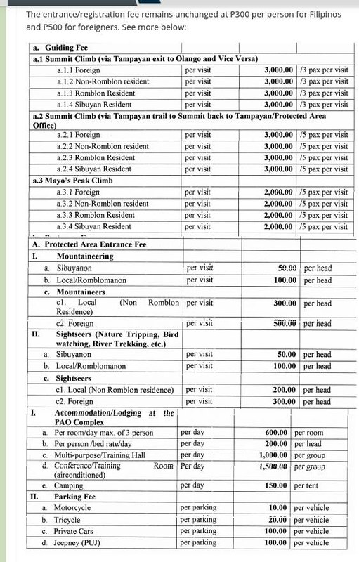
The Mt. Guiting-Guiting National Park (MGGNP) office of the DENR will implement new fee changes effective 1 January 2017. Please be informed of these upcoming fees.
For itineraries and useful tips, check out Part 2.
Getting to Sibuyan Island
The standard way is to ride a bus from Manila to Batangas. From the port in Batangas, there is a ferry that goes directly to Magdiwang, Sibuyan Island. However, this option is only logistically and financially effective if you are originating from Luzon.
Thus, for climbers and mountaineers from Visayas and Mindanao, we have an alternative way via Roxas City in the province of Capiz, Panay Island. To get to Roxas City, please check this link and scroll down to the section with the heading “Getting to Roxas City.” The good news is that effective November 19, 2016, Cebu Pacific now has daily flights from Cebu to Roxas City!
From Culasi port in Roxas City, ride a pump boat to San Fernando, Sibuyan Island. The voyage across the Sibuyan Sea roughly takes 6 hours.
Regarding the climb itself, we opted to do a traverse from Sitio Olango in San Fernando to Tampayan, Magdiwang due to logistical reasons. The traditional route is the other way around.
Pump boat Schedules*
Roxas City to Sibuyan Island
- Tuesday, 7AM – M/B Joram, M/B Kalinga, M/B RM
- Friday, 9AM – M/B Joram
Sibuyan Island to Roxas City
- Wednesday, 8AM – M/B Kalinga
- Thursday, 8AM – M/B RM
- Friday, 9AM – M/B Joram
* Although these are the regular schedules, pump boat operators for this route sometimes cancel their regular schedules for varied reasons (e.g. few passengers, boat maintenance, PCG permit failures, decision to go to nearby Mindoro to pick up cargo, etc.). Strange as it may seem, locals actually send text messages to the captains of the ferries for trip confirmation. We got these numbers so you can contact the vessel’s person in charge.
We strongly recommend you text or call the skippers of these boats to confirm your trip.
- M/B Joram – 0948-527-1963
- M/B RM – 0947-271-5394
Contact Details
For guideship services for the Mt. Guiting-guiting traverse route, get in touch with Sir Remy Rebiso at 0921-732-2462 or 0906-635-6901. He will take care of your DENR permit, arrange transportation, and side trips in Sibuyan Island.
Important Fees/Budget**
Transportation-related Fees
-
-
- P 350 per person – pump boat ferry fare from Culasi Port, Roxas City to San Fernando Port, Sibuyan Island (same rate applies on the return trip)
- P 200 per person – tricycle fare from San Fernando Port to Sir Remy’s place (same rate applies on the return trip)
- P 400 per porter/guide team – tricycle fare from DENR station in Magdiwang to Sir Remy’s place.
- P 200 per person – tricycle fare from DENR station in Magdiwang to Sir Remy’s place
-
Climb-related Fees
-
-
-
- P 300 per person – DENR permit fee
- P 2,400 per guide – guide fee good for 3 days (ratio = 3 climbers: 1 guide. Maximum 15 climbers per team)
- P 1,800 per porter – porter fee good for 3 days (ratio= 3 climbers: 1 porter)
-
-
** Rates are subject to change without prior notice. Note that we didn’t include the budget for food, side trips, accommodations, and more as you may have different arrangements with us.

nice! Hope to climb G2 too 🙂 soon 🙂
Hi Paradukdok,
Please do so. Our climb up Mt. Guiting-guiting was the best and most challenging one we had.
[…] READ MORE […]
Mas extreme ang 6 hours boat ride sa open sea. Weew. See you next time guys. Sayang..
Hehe! The open sea voyage was part of the G2 extreme adventure. Sayang talaga na we weren’t able to climb together. But don’t worry, there’s always a next time.
By the way, thank you very much, sir, for organizing the climb and leaving us with supplies. 🙂
Is it possible for a 5 days IT in this climb sir if you’re come from davao city? hope to climb this mountain soon. One of my dream mountain. 🙂
Hi Sir,
The climb itself can be done in 2 or 3 days (we recommend the latter for a more relaxed climb). It’s the logistics of going to and getting out of Sibuyan Island that eats a large chunk of your schedule.
Try to see if there’s a flight or a boat trip from Davao that goes to Ilo-ilo, Kalibo, or Roxas City. Then scroll down to the “Getting to Sibuyan Island” heading on this post. You can also click the link there if you want to find details about getting to Roxas City, which is the starting point of the trip.
Once you get details of a Davao-to-Roxas trip, you can estimate the number of days needed for the entire adventure.
We will post the itinerary for this climb in Part 2 of this adventure. 🙂
Okay sir, got it! What my friends told me on how to get in G2 was: Davao-Manila-Batangas-Romblon-Sibuyan Island which is for me, a very tedious and more time consuming trip. Thank you for giving me another route on getting to G2. hehehe! What would be the best season to climb G2 for you sir? Is there a recommended season or period to climb this mountain?
Hi Sir,
We agree with you. Getting to Sibuyan Island via Batangas is logistically and financially efficient only if you are residing in Luzon. But for us, Visayans and Mindanaonons, the Roxas City entry is the most cost-effective and time-efficient way.
The only thing you need to do is to check out how you can get to Roxas City from Davao. Once you figure out the route, it will be easy to plan out your schedule. You may also want to see if you can enter Sibuyan Island via Masbate.
Summer is the best season to climb G2. Climbing it during rainy weather is dangerous.
Got it! thanks for updating me about G2. This blog helps me a lot not just on the itinerary but also on giving me tips on the preparation and how difficult G2 is. hehe! will wait for your part 2 of this blog sir. 🙂
Oh Oh!!! another amazing stories with amazing couple and friends…Congrats! looking forward to see your prat 2 🙂
Thank you! Please do watch out for Part 2 for stunning landscape photos as well as the itinerary and tips for this climb.
Back when I was active with the UP Mountaineers, climbing the G2 was in my bucket list. They made it sound so hard! I guess because when we climbed, having a porter carry our things was unthinkable haha I’m no longer an active member now, but I still want to climb it. Beautiful story!
Hi Aleah,
Oh, we didn’t know you were from UP Mountaineers. 🙂 That’s really cool!
Climbing G2 is quite challenging and difficult, but you can do it since you already have considerable mountaineering experience.
In G2, hiring a porter is mandatory. Water discipline is virtually impossible; the ascent is so long and so steep that you’ll be gulping water mindlessly. And if you’re caught in fogless/cloudless days in the super exposed traverse, you’ll be basked in the sun for hours.
In fact, our porter carried bottles upon bottles of water! That excludes our trail water.
But do climb G2. Despite its difficulties and dangers, it is the best climbing experience we ever had. 🙂
Hi Aleah! We have an annual memorial climb every summer at Mt. Guiting-Guiting. Just recently, this last week of May 2018 we had an official climb at Mt. Guiting-Guiting, and guess what, kasama ko batchmate mo si Jhon Jeffrey Reynaldo(Jay, if you still remember him, you’re UPM batch 2003, right?). Sama ka next year!
By the way, am also a UPM member, I am Sieg Tuberon(Sieg T’ron-FB name).
Uy! Hello, Sir Sieg T’ron! Thank you for visiting our humble space in the Net. 🙂
Kaya kaha ni nako? huhu Nindota jud ninyo’g mga adventures. Makasuya ♥♥♥
Hi Gly,
Of course, kaya kaayo ni nimo. But the treacherous trail, steep ascent, rock scrambling requirement, lack of water sources, etc. when climbing this mountain requires you to train and have a few practice climbs before ascending G2.
Don’t worry, you will definitely get there. 🙂
Reading this makes me question my ability to steady my legs mid-climb and finish the ascent hahahaha but at the same time your story is really very encouraging especially for us who wishes to summit this beautiful mountain despite the odds.
Thank you for sharing. Sana next year. Sana.
Hi Petrified Dreamer,
Don’t worry. With proper preparation, you can do this. Check out part 2; we placed tips and useful information about preparations and the climb itself.
Nothing is impossible. 🙂
Thank you for sharing your adventure! Malaking tulong ito for my preparation to climb Mt G2 this sept. After learning from a Polish friend whom i met in Mt Kinabalu, that Mt G2 was one of the most beautiful places in the Philippines i started to gather lots of info about the mountain. Saglit basahin ko na ung Part 2!
Hi Rommel,
You’re welcome, and thank you to for taking time to read our humble blog. We bid you the best of luck and happy trails when you climb G2. Please free to use the information in our G2 blog posts for your guidance.
Hopefully, someday, somewhere, we’ll meet on the trail and say cheers at the top of the summit. 🙂
Excellent work! This is one of the best Mt G2 guide because its very detailed with the pictures and i love how you express every bit of the adventure. I manage to get in touch with tatay remy rebiso and he said, he’ll be happy to meet me and be my guide for mt g2 traverse but we are doing the opposite way.
Hi Rommel,
It’s great that you were able to meet with Sir Remy. Ah, you’re doing the standard route—Mayo’s Peak to the Summit to Sir Remy’s place. Nice!
Just make sure you allocate one porter to carry your water. We’re not sure about the water situation there; it might be less of a problem if it’s rainy season. Still, it’s best to be prepared. Based on our experience, the lack of water sources is the biggest challenge there.
I agree that water source is the biggest challenge, it is important to keep our body hydrated during intense activity. i also prepare to have 5ltrs of drinking water para sigurado baka walang tubig yung ibang water source. excited na talaga ako hehe. nagulat din si tatay remy na uuwi lang ako sa pinas para umakyat sa mt guiting guiting from mla airport diretso na to romblon at sabi nya Nabios daw sakyan ko dahil direct to sibuyan island na.
Hehe! That’s nice. Well, enjoy your G2 climb, and tel us about it after your adventure. 🙂
[…] because we’ve been here earlier; that was during our side trip after we successfully climbed Mt. Guiting-guiting earlier this […]
Hi – looks great!
I’m coming from the UK to do this climb. Is it possible to find a guide when I arrive on the island, or do I need to organise it in advance? Thanks
Hi Freddie,
We are not sure if it is possible to simply get a guide when you get there. But considering that the mountain is strictly monitored by the DENR, we strongly recommend that you book your climb with the guide first.
Contact details of Sir Remy is in this blog post. Also, don’t forget to check the Updates section above.
Hope this helps. Thank you! 🙂
[…] we slept early before sunset the day before, we were up (rejuvenated, we might add) by 1AM. We quickly packed up, picked up after ourselves, […]
I’m curious if there’s a safer way to get to your destination. A direct flight maybe? Our 2 hour boat ride to the Gigante islands was gruelling and nerve racking. I can’t imagine a 6-hr boat ride in open seas to be worth anything.
Hi Belle,
Unfortunately, there is no direct flight to Sibuyan Island, rightfully so because the place is so virgin. We don’t think airports are allowed to be built there. It actually has an official protected status considering that is is our version of the Gallapagos.
The standard way before we presented the alternative itinerary in this blog was to ride a bus from Manila to Batangas. From Batangas, there is a ferry that travels overnight to Sibuyan Island. That ferry is quite big, so we guess it’s safer.
The information presented here is for Visayas and Mindano-based people like us who want to climb G2 or visit the island. This is the most cost-effective and effort-efficient way for us. It would take us a lot of money, time, and effort if we have to go to Manila. 🙂
Amazing! I would love to climb G2 one day. For now, mag practice sa kogg climb kay lisod2 ra ba jd ning bukira. 🙂
Hi Hanna,
Yes, this mountain really demands a lot from climbers. But with practice, you can do it. 🙂
Hi!
Is there really a ferry from Batangas Port to Sibuyan Island? I have no idea. I only knew of Batangas-Romblon then Romblon-Sibuyan. Thanks!
Hi Lovely,
Yes, and it’s a big ship. That’s the most direct route for Luzon-based climbers.
Anong oras po yung alis ng barko from Batangas?
At may question pa po ako. I’ve seen in another blog that you can leave your backpack at Mayo’s peak so that when you ascend the summit itself, you only need to bring water and yourself. 😀 Is this also possible?
Salamat kaayo!
Hi Lovely,
We don’t have any information about the schedule of the Batangas to Sibuyan route. It’s better if you ask Manila-based climbers; that’s their standard route.
You can probably leave your backpack in Mayo’s peak, but you will have to come back for it after you reach the summit. That is, if you plan to backtrack. If your itinerary involves a traverse, then you’ll have to bring your backpack with you.
In addition, the trek to the summit from Mayo’s peak will take around 4 to 6 hours depending on your pace. Are you really willing to leave your backpack at the summit for several hours? It’s your risk, but personally, we wouldn’t.
For us, the biggest challenge of a Mt. G2 climb is the availability of water; there are only very few water sources. In fact, we played it safe and had our porter carry several liters of water in addition to our personal trail water. So, the “you only need to bring water and yourself” approach is quite dangerous. In climbing treacherous mountains such as G2, you really have to be extra prepared.
Remember that we did the traverse, which means we have to carry our backpacks all the way.
Oh. Copy. Nag traverse pala. Sorry na lost ako, binasa ko uli yung blog niyo.
Anyways, salamat!
No problem at all. 🙂
Sir, my friends and I are planning to go to Sibuyan Island via Roxas City next week. How safe is the boat? Is 6 hours the fastest the boat can get? And are there nearby resorts/accomodations once we got onto San Fernando port?
Hi Ed,
Thanks for communicating with us. By boat, it will take 5 to 6 hours. About safety, well, let’s just say, you won’t like it after you see the vessel.
However, these people have been plying these waters for decades, so let’s just assume that they really know what they’re doing. And locals ride with regularly with these boats.
By inference, these boats should be reasonably safe. But DON’T ride smaller, colorum pumpboats; they are not granted for safety by the Coast Guard.
San Fernando is a town, so we believe there are accommodations there. We believe there are resorts there as well since some friends of ours spent some time there. But we think they would be rudimentary ones with beautiful beaches. So don’t expect resorts with air conditioned facilities, hotel staff, pools, etc.
One of the best hikes in the Philippines.