Check out the start of our Mt. Talinis adventure in Part 1.
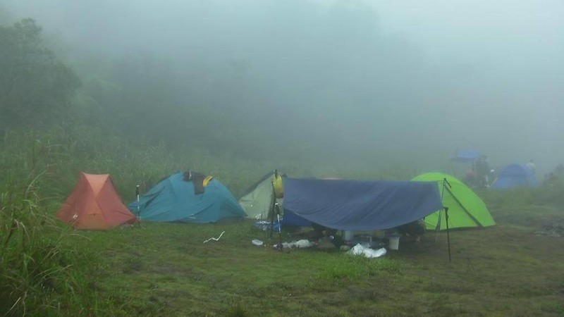
We had a great sleep, thanks to the cool weather (12 degrees Celsius). The next day, we woke up to a cold, wet, gray morning as a gentle drizzle showered the landscape. The mist that descended on Lake Nailig made everything ethereal and magical as brilliant colors muted.
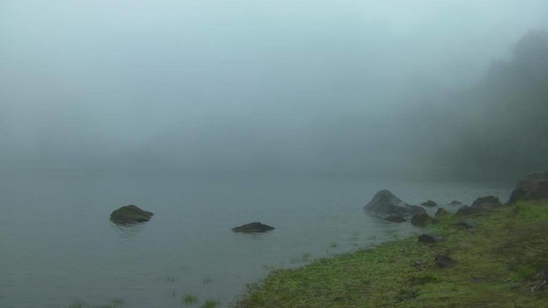
Our campsite was enveloped by mists.
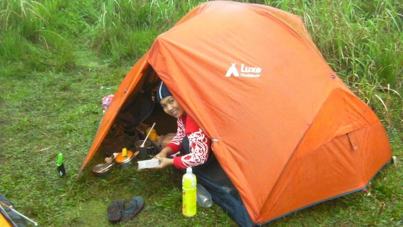
Sweetie and I woke up at 5:30 AM and decided not to go to the summit (for time efficiency, actually) and cooked our breakfast instead, skinless chorizo and scrambled eggs. Several others proceeded to prepare for their summit bid.

Let’s eat! Sweetie gave me that bonnet. In cold mountains like Mt. Talinis, you need to wear a bonnet or pull your hood up (if your jacket has one). A bonnet or hood helps retain your body heat. Remember that you lose 70 percent of your body heat through your head.

Cleaning up after breakfast. That’s my trusty Luxe Habitat tent. Thanks to my sponsor for this reliable, strong, waterproof tent. This tent easily survived a storm in Mt. Napulak.
While Sweetie and I prepared to break camp, the Talahib mountaineers went up the summit (around 30 minutes from the campsite).

After the guys who summited came back and ate breakfast, we started to break camp and pack up.

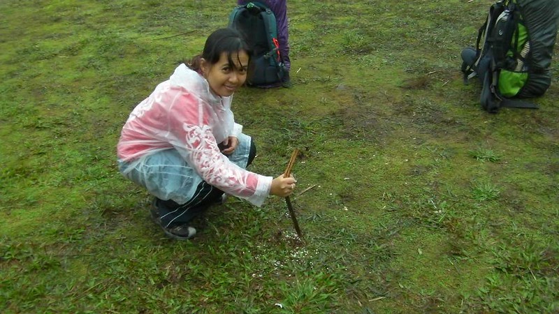
Sweetie following the rules of LNT. Those are rice crumbs. She’s burying them under the ground to discourage mountain fauna from invading the campsite. Leaving food in the mountain, even if it is biodegradable, can alter the natural feeding habits of mountain animals.
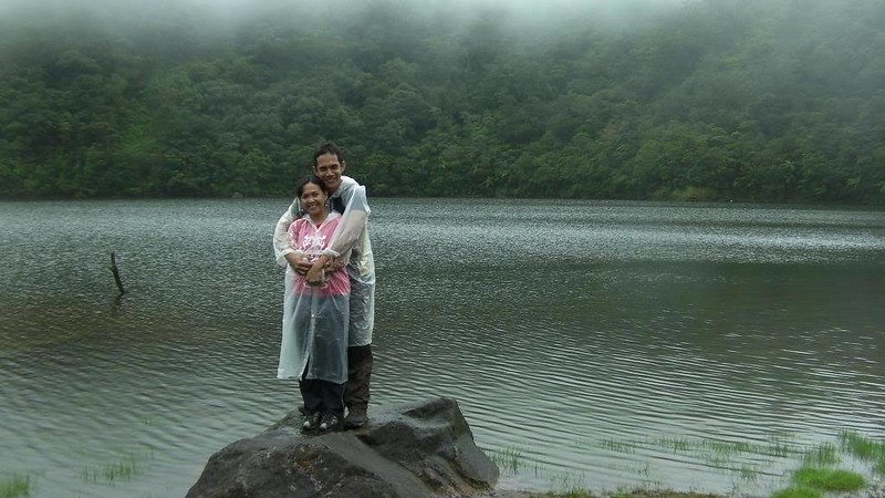
Later in the morning, the fog lifted up and offered us a very clear view of Lake Nailig. The water is very clean, and you can actually use it for cooking.

We posed according to Sir Ruel’s cinematic direction. Hehehe! Next year, when we may climb here again, Sweetie and I are planning to bring our inflatable kayak so we can check out the other side of the lake.
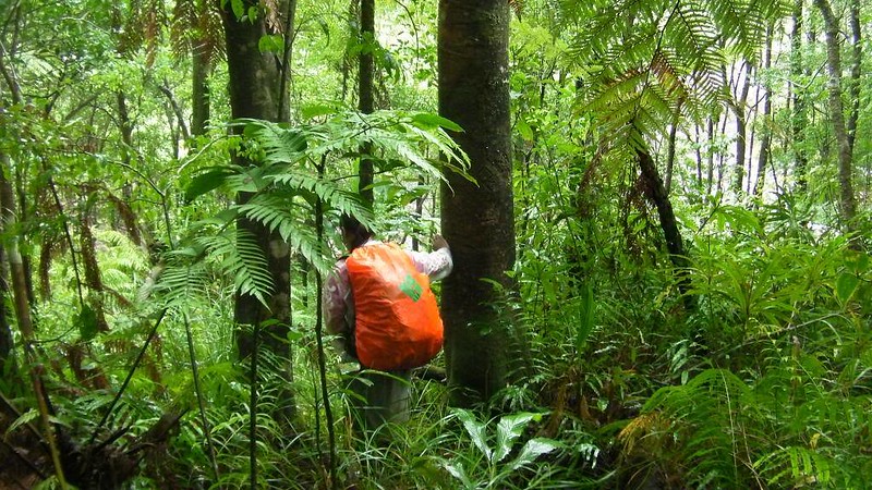
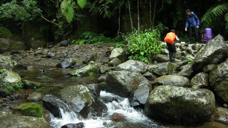
After we packed up, we began to trek towards Apolong, our exit point which is an 8 to 10-hour trek from Lake Nailig. For energy, Sweetie took some chocolate bars. We have around 10 of those bars in addition to our nuts, raisins, and chocolate trail mix.

A few hours on our traverse, we came up to an extremely steep, muddy, and slippery section of the trail. Even with my pair of Merrell shoes and trekking pole, I was unable to stop myself from slipping. As we came to a more comfortable part of the trail, we were amused to find out that EVERYONE slipped and skidded down the trail. Look at all that mud on my raincoat!
Next time, I’ll wear something dark so that the evidence of a slip would be concealed. Hehehe!

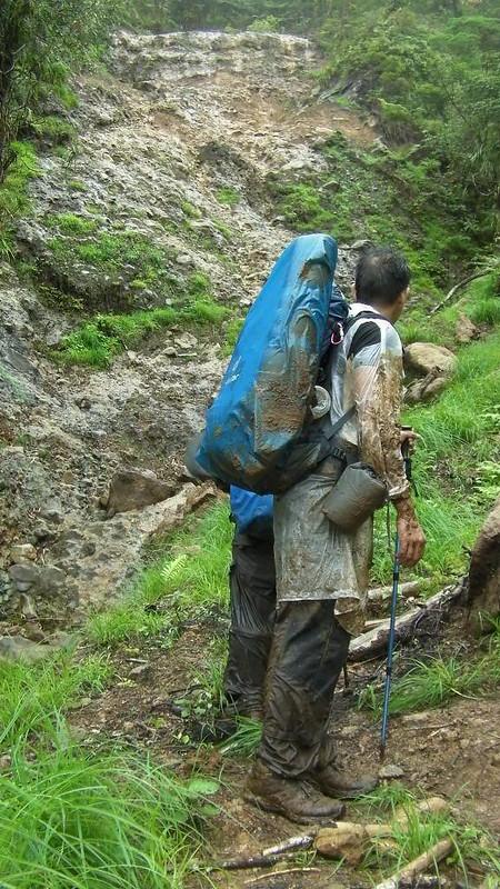
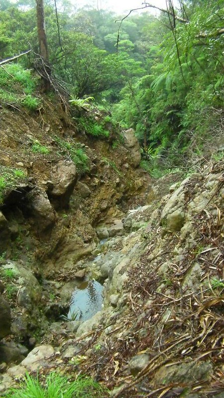
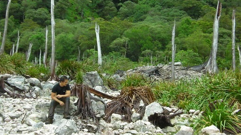
A huge, huge landslide caused by Typhoon Sendong. Sir Kevin recalled that huge swaths of trees were taken along with it. Our trail involved crossing this treacherous landslide.
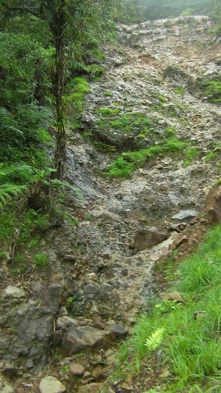
A creek and a canyon just beneath the landslide.
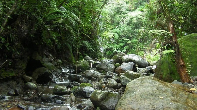
After crossing the landslide, the trail gets a bit easier. After an hour or so, you suddenly smell the stink of rotten eggs.
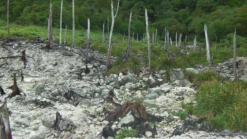
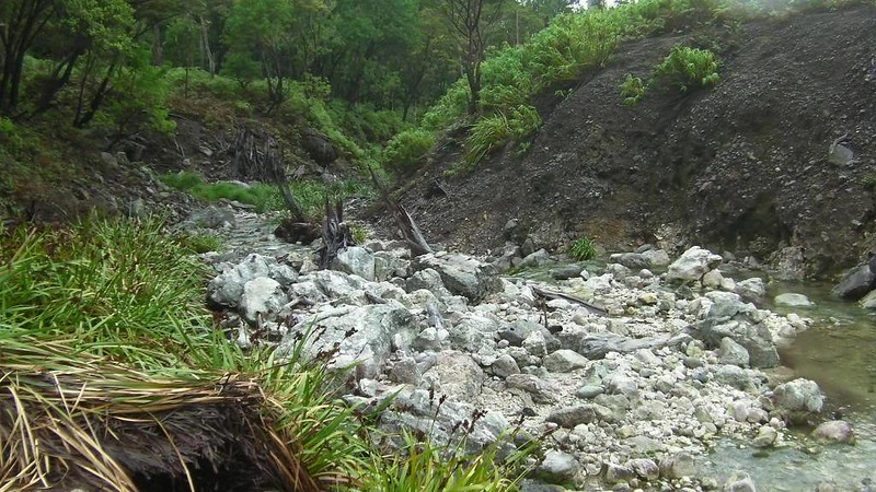
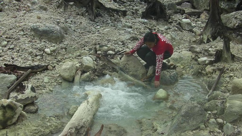
Half an hour later, we arrived right smack at the middle of the Kaipuhan Sulfur River, an immense solfatara system.

That’s the Kaipuhan Sulfur River, which is full of solfataras. Noxious sulfurous gases emerge from this place, suffocating all living things after being exposed for a long time. Those trees are dead, burned by sulfur dioxide.
The river runs deep into the lowlands.
Dead trees line up the Kaipuhan Solfotaras in stark contrast with the healthy living trees that surround the river.
A close-up of a dead, sulfur-burned tree

That’s a solfatara, otherwise known as a fumarole. It’s an opening in the earth’s crust that emits steam and gases. This is one of the sources of gas around the area. Since the opening is under the water, the gas causes the water to bubble. My sweetie here was trying to feel if the bubbling water is hot. Is it hot? Well, we’ll leave it up to you to find out. 🙂
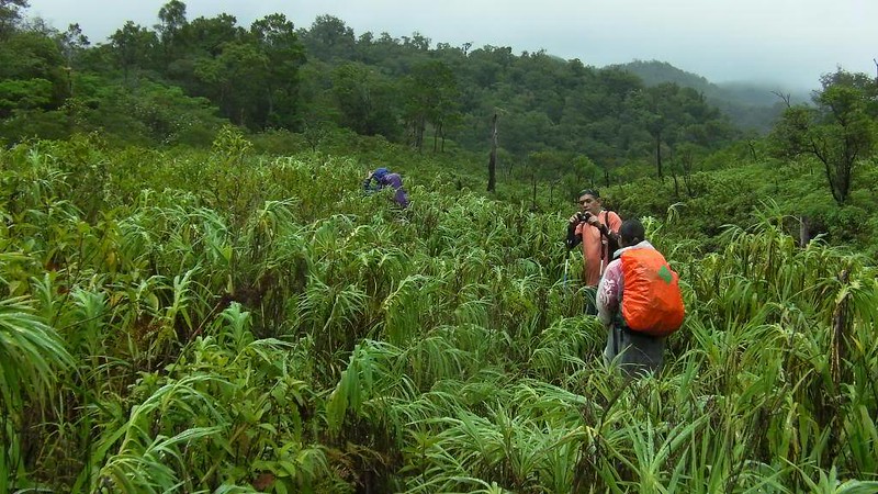
On our way to Rancho, for the first time in days, the sun came up, albeit briefly. You can see deep fern-like plants. While walking here, we thought it was some kind of farmland. Nope, these were really wild plants.
We finally arrived at the Rancho, one of Cuernos De Negros Mountaineers’ campsites and meeting points. We met two Cuernos mountaineers when we arrived at the place. We ate our lunch here.
Lofty mountains covered with forests. The Talinis range is one of the last few first-generation forest areas left in the Philippines.

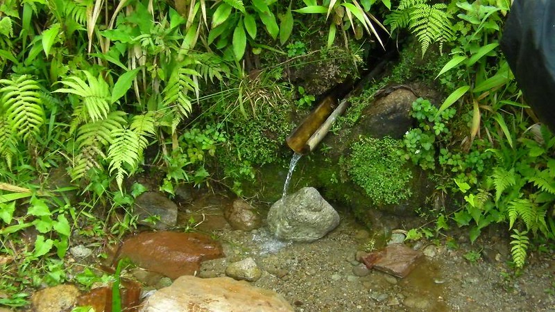
After eating a quick but filling lunch, we continued on our way to Apolong. Before going any farther, we filled up our water bottles with fresh, clear water from this spring. The water is so cold that it’s similar to water that has been chilled inside the refrigerator.
We left Rancho at around 1:00pm. Sir Kevin decided that we visit the magnificent Twin Falls considering our pace and the extra time we have left in our compressed itinerary. At around 3pm, we arrived at this beautiful river. You have to be really careful here because visiting the waterfalls involves scrambling over slippery, moss-covered, wet river boulders.
Boulder strewn river heading to Twin Falls. Be careful! They’re wet and slippery.
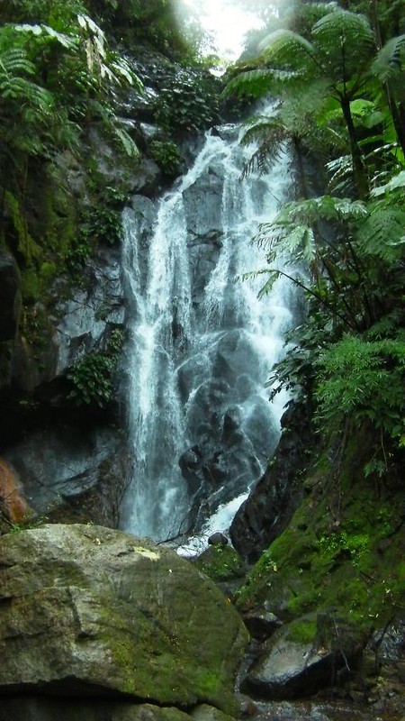
At the end of the river, we saw this magnificent waterfalls, the Twin Falls.
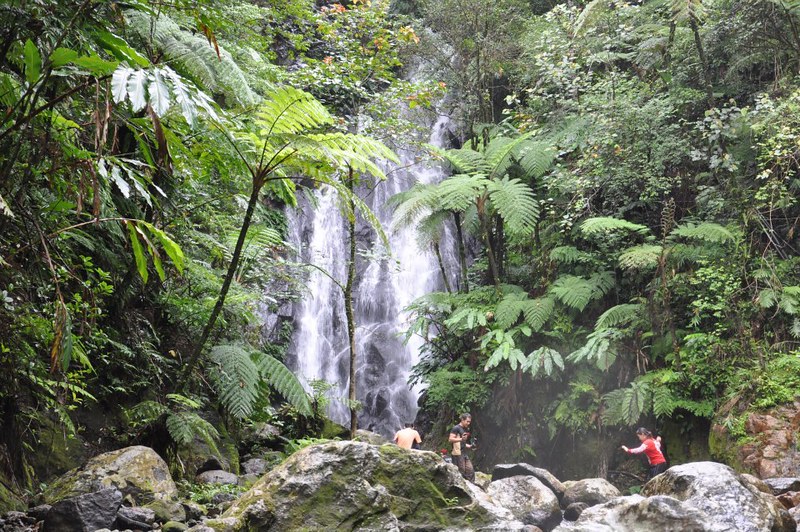
The awesome Twin Falls. That is taller and more powerful than our own Budlaan Falls in Cebu.
The pool beneath the waterfalls. Locals do bathe here from time to time, but that is quite infrequent due to the remoteness of the waterfalls. Yes, you can swim here…if you can stand the cold. Hehe!
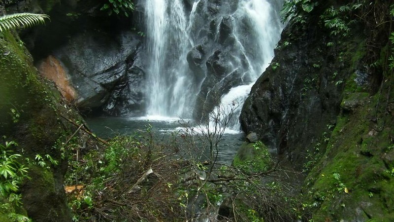
This is the waterfall’s “twin,” located at the side of the main waterfall.

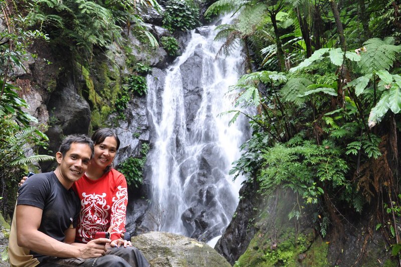
Adrenaline Romance sweethearts enjoying the cool, refreshing spray of the waterfall.
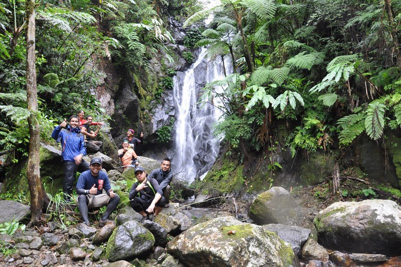
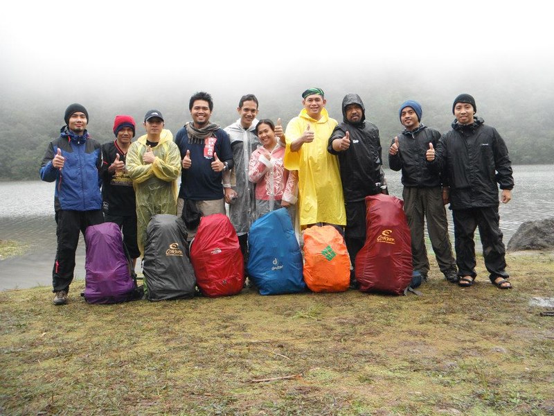
How about a group shot before leaving?
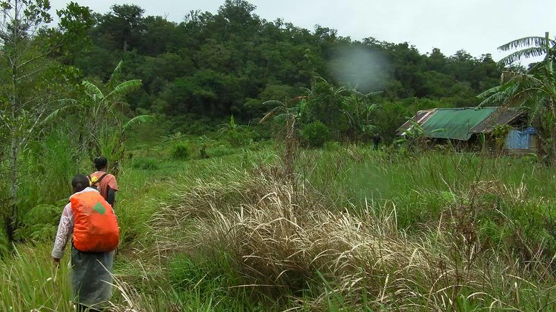
We left the Twin Falls after 30 minutes. A short while later, we came to this house, the first sign of civilization for over two days we’ve been in this mountain. The homeowners keep a logbook to monitor groups who have exited the mountain.

Confirming our exit by logging out. There’s ZETS, the first mountaineering group I’ve joined!

That’s the beautiful Banica River with flowing fresh water. It’s a primary water source of the lowlands.

The long trail back to Apolong. This is a muddy, rock-and-root strewn trail but relatively easy to traverse. It takes 4 to 5 hours to walk down this trail even with a fast pace.
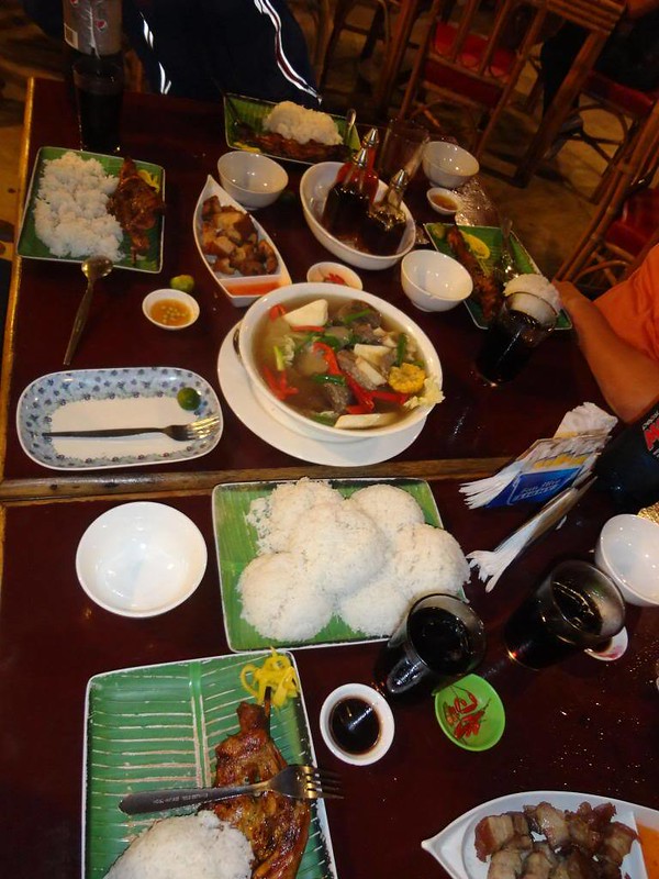
We arrived at Apolong, at the entrance of Casaroro Falls around 7 PM and parted ways with the Iloilo climbers in Dumaguete. We celebrated our successful climb with Sir Kevin and Jay Warren of Cuernos De Negros Mountaineers and the Cebu contingents: Sir Ruel, Sir Ronald, Sweetie, and yours truly with a sumptuous dinner at Dumaguete’s Atong Kamalig.

Sumptuous! We were very hungry indeed!
Home sweet home!

‘Till the next climb and adventure! A fun time was had by all.
Our Mt. Talinis expedition was really spectacular. There was an impressive plethora of sights to see: the serene Lake Yagumyun, the eerie and ancient maribuhok forests, the grand Lake Nailig, the tree-laded summit, the Kaipuhan solfataras, the Twin Falls, and Casaroro Falls (highest waterfalls in Negors). Except for Casaroro Falls, we were able to see the wonders of these sights.
In addition, Mt. Talinis is one of the cleanest mountains we’ve visited. Thanks to the efforts of Cuernos De Negros Mountaineers, the Siliman-based mountaineering group whose strict monitoring and enforcement of the LNT principle made the mountain pristine.
We would also like to thank our guides Kevin Rocamora and Jay Warren Ferolino for making our climb safe, sound, and extremely enjoyable.
Some photos courtesy of Sirs Ronald Ramiso, Vincent Tambanillo, and Bernie Intrepedo.
Update (2/6/2017): We are not sure if Sir Kevin is still offering guideship services. If you can’t get in touch with him, the local mountaineering group Cuernos de Negros Mountaineers can help you. Please get in touch with them by visiting or sending inquiries in the Cuernos de Negros Facebook page.
Itinerary
Day 1
2:00 AM – ETA Dumaguete, sleep in ship
5:00 AM – Wake up, prepare for departure
6:00 AM – meet up with guide and prepare for jeepney ride to Bediao
7:30 AM – ETA jump-off. Last water source before reaching Lake Yagumyum
8:00 AM – Start trek
12:00 PM – ETA Lake Yagumgyum. Lunch.
1:00 PM – Resume trek going to Lake Nailig
5:00 PM – ETA Lake Nailig, set up camp
6:00 PM – Prepare dinner
7:00 PM – Dinner and Socials
10:00 PM – Lights Off
Day 2
4:30 AM – wake up call
5:00 AM – Talinis summit assault (Optional)
5:30 AM – ETA Summit
6:00 AM – Head back to Lake Nailig
6:30 AM – ETA Lake Nailig campsite, cook breakfast, prepare packed lunch
7:30 AM – break camp
8:15 AM – ETD Lake Nailig Campsite, start trek to Apolong
11:30 AM – ETA Kaipuhan Solfatara River
12:00 PM – ETD Kaipuah Solfatara River, head to Rancho
1:00 PM – ETA Rancho, lunch
1:30 PM – ETD Rancho, trek to Twin Falls
3:00 PM – ETA Twin Falls
3:30 PM – Resume Trek to Apolong
7:00 PM – ETA Apolong
7:45 PM – ETA Dumaguete, side trip at the Dumaguete Boulevard
12:00 MN – ETD Dumaguete Port for arrival to Cebu
Rates
- Guide – 500-700 per day
- Porter – 500 per day
- Hired Jeep (Dumaguete to Bediao) – 150 per head, minimum of 10 pax
- Hired Jeep (Apolong to Dumaguete) – 150 per head, minimum of 10 pax
- Standard Jeep Fare (Dumaguete to Dauin) – 18 per pax
- Standard Habal-habal fare (Dauin to Bediao) – 150 per pax
- Standard Habal-habal Fare (Apolong to Valencia) – 25 per pax
- Standard Jeep Fare (Valencia to Dumaguete) – 12.50 per pax (last trip 5pm)
- Standard Tricycle Fare (Valencia to Dumaguete) – 30-50pesos per head
- Casaroro Entrance Fee – 10
Tips
1. For guideship services, contact Kevin Rocamaroa at 0915-1098759. Guide fee is P500 per day. You can also hire a porter at P500 per day.
2. It is better, safer, and more convenient for you to let the guide arrange for the transportation. Best transportation is a hired jeepney which can take you straight from Dumaguete to Bediao, and can fetch you from Apolong straight back to Dumaguete.
3. If you want a more relaxed climb and time to have a side trip to Casaroro Falls and Dumaguete City, it is recommended that you follow a standard 3-day itinerary. Ours was compressed, and we weren’t able to stop by Casaroro Falls.
4. You have to have a good sleep to muster the energy you need for the climb. That is exactly why we took the ship rather than the bus; we can sleep on the ship while it sails to Dumaguete.
5. Bring tough shoes because the trail is full of roots, mud, and rock that can wreak havoc to unprotected feet.
6. Bring sufficient waterproofing because the mountain is really misty and wet.
7. Bring warm clothes. The Lake Nailig campsite is very cold.

i’m from manila & 3 of my friends and i will be climbing mt. talinis on april 10-12. still undecided whether to take the bediao or the apolong trail. which would you recommend? are there jeeps from dumaguete to dauin as early as 5am?
Hi Glen,
Thanks for visiting our blog.
We entered Mt. Talinis via Bediao Trail in Dauin and exited the mountain via Apolong Trail which ends in Valencia. It really doesn’t matter which trail you wish to use.
However, if you start through Apolong trail, expect a really long but easy, steady assault on a clearly marked trail. You may have to camp at Rancho for the night before continuing up Lake Nailig. The Bediao trail is shorter but more difficult.
I’m not sure if there are jeeps that ply there during early morning. In fact, our guide, Kevin, arranged a jeep for us; we were able to reach the PNOC jump-off around 8 AM. But normally, no jeep would go to the PNOC jump-off unless you hire the entire vehicle. You would have to go to PNOC on a habal-habal. The same jeepney was arranged to wait for us at the exit point in Valencia the next day.
For your convenience, we HIGHLY RECOMMEND you contact Kevin Rocamaroa (0908-9282484 for Smart, 0922-7003973 for Sun) as your guide. In addition, he can actually arrange the vehicle to take you to your jump-off points and wait for you at your exit points.
Thanks and good luck on your Mt. Talinis climb.
Gian and Sheila
hello gian and sheila. thanks for sharing this great adventure..i will be in dumaguete june 2-8, 2013 and am planning to climb talinis…there might be someone out there or a group who is climbing also around those dates or who wants to climb with me? makikisabay sana ako. thanks! 🙂
Hi Judy, thanks for the compliment.
We’ll try to find some fellow mountaineers in our place who can go with you. In the meantime, you can contact Sir Kevin; his contact details are in this blog. He is truly a very good guide.
Of course, you can also befriend him in FB.
Taga Dumaguete City lang ako, pero hindi pa ako nka punta sa highlands ng valencia. hehehe.
Hi John Lester,
Really? You should visit Mt. Talinis. It’s one of the best treasures in your place. 🙂
Thanks for sharing this very useful info. Plan to go this sembreak. Honestly, i have never tried climbing a mountan since birth heheh. What are the thingsi need to prepare ahead? Like the kind of shoes,bag,tent,raincoat, i mean Everything a mountain climber must have! Thanks
Hi Chejabez,
Thank you for dropping by our blog. It’s good that you have picked up an interest in mountaineering. Mountaineering and engaging in outdoor adventures are truly life-changing passions.
If you want to try out mountaineering, we strongly suggest going with a mountaineering group before buying outdoor gear. Check our Lunatrek 12 entry and scroll down to the “Tips” section; fun climbs and activities like these allow you to experience what it’s like to climb a mountain.
Also, you can join Cuernos de Negros, a mountaineering group there in your place and participate in one of their climbs. Our amazing guide during our Mt. Talinis trek is a member.
How I missed the place…Its been 2 decades past..Lake Nailig and Lake Yagumyum…My WHITE WOLF MOUNTAINEERS Family always been there and we stayed 1 week to 2 weeks..We have no guide and I myself the lead pack…WOW!!!..
Reminisce the past. Thanks for posting all the picz and trails….We Salute You..
Hi Sir Peter,
Thank you too for visiting our website. Mt. Talinis is definitely one of the best mountains we’ve ever climbed. We love how Cuernos de Negros, the LGU, and other entities involved kept the mountain pristine.
We plan to go back there but on a different trail. Or perhaps, we’ll discover and experience (and write a blog post) about other adventure spots in Dumaguete.
hi peter – visited dumaguete recently. best regards to you, ria and the kids.
Hi Gian and Sheila,
Thank you for the great post. I’m interested in completing this hike but only have one day. How much / which part of the trail would you recommend for just a day hike?
Hi Maddy,
Thank you for the compliment about the post.
With regards to your question, we’re not sure if a day hike can be done if you follow the same route we did on this particular adventure. On a relaxed pace (and if a side trip to Casaroro Falls is included), it would normally take 3 days to complete the adventure. We doubled our pace, but it still took us 2 days to complete the Bediao-Apolong traverse.
We suggest you contact the Cuernos de Negros Mountaineers—you can search their group in Facebook—for more information. The climbers there are more well-versed about Mt. Talinis that we are.
We will have to update our Tips section for this post since Sir Kevin is quite busy at work, and he won’t be able to guide guests for quite some time.
Hi Gian and Sheila. Thanks for your reply. I’ll look into the FB group to see if I can get more information. If you have the contact of any other guides and could post them that would be great. Thank you.
Hi Maddy,
We will do that. Thank you!
Hi,
Are there no local guides available for Mt Talinis within the vicinity or communities near Bediao?
Thanks!
Jaybie
XD
Hi Jaybie,
Please get in touch with the Cuernos de Negros organization. You can search for their page/group by typing “Cuernos de Negros” in FB. Since they’re from there, they would know best on how to get guides in Bediao.
Hope this helps. Thanks!
Hello, your blog is great!
I would like to ask the safest budget range per pax in this adventure. My group is planning to climb Mt. Talinis Next Month.
TIA!
Hello Kano,
Thank you for visiting our blog. Regarding your question, please scroll down to the bottom of the blog post; you can see a label that says “Involved expenditures (subject to change).” We listed the pertinent prices there.
Hope this helps.
Good day sir. I tried contacting sir Kevin but he havent responded yet. May iba ka pa bang kilala na pwdeng maging guide? Or can we just go straight to Dauin and inquire for a guide? Thanks!
Hi Keith,
We should have updated the blog earlier; Sir Kevin changed his number. You can get in touch with him at 0915-1098759.
Hope this helps. Thanks!
Ok sir thank you. Nagkausap na kami.
Hi Keith,
Nice nice! Thank you too for visiting our blog. 🙂 We updated the blog and his contact details, thanks to you.
Hello,
I’m planning to climb this on Dec. I’m assuming you had to bring all your gear – sleeping bags/tents/cookware etc? Did you hire a porter to carry them? Also, pareho pa rin po kaya ang rates ng guides/porters?
Thank you,
gnetski
Hi Gnetski,
Yes, we brought all our gear with us. Only one of us hired a porter because he had some knee problems a week before the climb.
But you can definitely hire a porter; we actually recommend it so that you’d have a more relaxed and less tiring climb.
Since this climb happened several years ago, the rates may have changed. But chances are, the increase may be just slight.
Hope this helps. Thanks! 🙂
Thank you so much for the reply. Follow up question – would you know if we can rent the tents/sleeping bags/pads/cookware in the area? I will be traveling with family kasi and my siblings might hike with me but I’m the only one with gear. I can’t afford to buy them all the gear required. hehe. Also, any other nature destination tips? We will be in the area for about 2 wks. For now we have Siquijor, Apo Island, Oslob, & Badian as destinations.
Hi Gnetski,
We’re not really sure if there are camping equipment for rent; honestly, we haven’t tried that. You can check our contact though. His number is in the blog.
For your second question, we haven’t been to the other neighboring nature attractions in the area. But we know two of them 1) Lake Balinsasayaw and 2) Casaroro Falls.
Perhaps Sir Kevin can also help you with your side trips.
Hope this helps. Thanks!
sir ang problema, asa ta magbawas ug maligo?
Hi Sir,
You mean you want to take a bath in the lake? Or the Twin Falls? Yes, you can.
At the end of the trek, you can stop by at Casaroro Falls for a refreshing shower. 🙂
Need po ba ng climbing permit? thanks
Hi Arianne,
No, a permit is not needed. However, you need a guide to climb the mountain.
[…] produce bubbles. There is a similar fumarole like this, albeit bigger, that we encountered in the Kaipuhan Sulfur Riverduring our climb in Mt. […]
Hi Sir pwede po kaya mag-overnight sa geothermal site sa bediao ? almost 3pm kasi kami darating sa dumaguete airport.
Hi Ricky,
Hmmm…we’re not sure. We haven’t tried that, but most probably they won’t allow it because it’s a power plant And facilities like power plants are high-security areas. But you can get in touch with Cuernos de Negros Mountaineers (link in this blog post); they would know better.
[…] Mt. Talinis: The Last Frontier of Negros Oriental (Part 2) | Adrenaline. – 7:45 PM – ETA Dumaguete, side trip at the Dumaguete Boulevard. climb and time to have a side trip to Casaroro Falls and Dumaguete City,. […]